
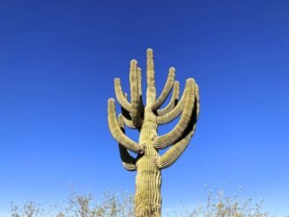
Lost Dog Wash Trail to Taliesin Overlook
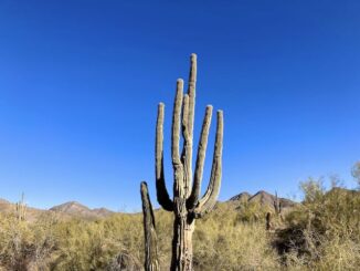
Lost Dog Wash Trail to Taliesin Overlook is 2.1 miles, 400 ft. accumulated elevation gain (AEG), outbound. Only 60 AEG on the return trip. Alternately, Ringtail […]
Lost Dog Wash Trail to Taliesin Overlook is 2.1 miles, 400 ft. accumulated elevation gain (AEG), outbound. Only 60 AEG on the return trip. Alternately, Ringtail […]
Reach 11 Recreation Area is located in north Phoenix. From Cave Creek Rd., Reach 11 stretches seven miles east to Scottsdale Rd., and a less than a […]
It was a wintry — by Phoenix standards — 51° when I started my traditional Christmas Eve day hike up Shaw Butte. The Christmas Palo Verde […]
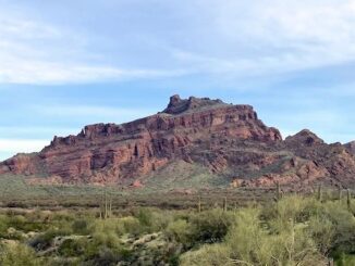
Wife flying in at 8:15 p.m. Left home at 4:45. Hit West Buttes Parking Lot at 5:30. Had to pee: Still no toilet, or even outhouse. […]
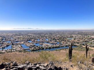
The Phoenix Sonoran Preserve is in far north Phoenix. There’s two units, South and North, separated by Sonoran Desert Drive and Cave Buttes Recreation Area. […]

I hadn’t put my shoes on dirt in three weeks, and hadn’t done a decent hike since Coachwhip Trail and Arrowhead Point Trail in Thunderbird […]
After my annual Halloween hike in Maryland, I start my winter hiking program back home in Phoenix. I actually have the next six months of […]
It’s been a couple of years since I last hiked in Buckeye’s Skyline Regional Park, at the south end of the White Tank Mountains. But, unlike […]
I’ve never been to the Hawes Trail System before. You just don’t hear aboout people hiking it much. It’s popular with mountain bikers. Maybe they […]
Copyright © 2026 Preston V. McMurry III | WordPress Theme by MH Themes