

I’ve long wanted to hike the entirety of Deer Creek, in Aravaipa Canyon. Thirteen months ago, I even took a stab at it, but had to bail due to weather. (You do NOT want to be caught in an Aravaipa flash flood.) I figured this year I would give Spring another month to settle in. Only the night before my wife & I left drove down to Thatcher I realized I had failed to secure a BLM wilderness permit. Crap.
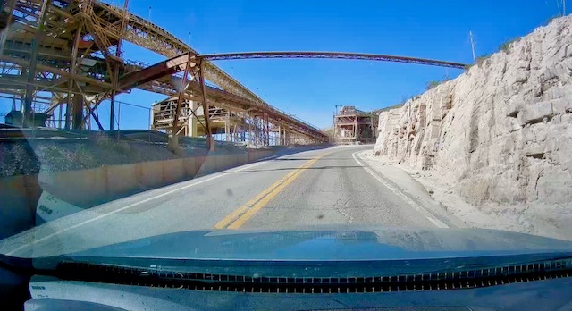
I didn’t want to lose our hotel reservation, so I quickly cast about for something else to do down there. Mount Graham has plenty of trails, but they are either long, have too much elevation gain, both, or are too short. Then I remembered HL Canyon Trail #11, which loops around Mitchell Peak, 10 miles north of Morenci Mine — the largest in North America. And it’s a part of Arizona I’ve never been to. 🎯
HL Canyon Trail #11 is 7½ miles, 1,700 ft. AEG (accumulated elevation gain). I figured it would take me four hours to hike the loop around Mitchell Peak. The trailheads are about 7,200 ft. elevation. I planned to hike counter-clockwise, so I would be on Mitchell Peak’s sun-facing slope in cool morning temps, and on it’s sun-blocking northern slope in the warmer afternoon. I was expecting shade. I did not find it. 😒
After checking out the view at HL Saddle, I started hiking at 10:25 a.m. I climbed up the jeep trail across the highway, then turned south, paralleling US-191. My nose immediately began generating epic amounts of allergy-induced boogers. I had to blow my nose at least every minute. That did not bode well for a four hour hike. Thankfully, the faucet turned off when I arrived at Sardine Saddle.
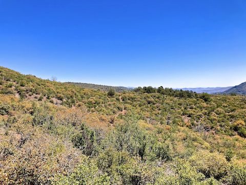
From Sardine Saddle, HL Canyon Trail #11 descends 800 ft. in just under a mile. Though I never fell, I slipped a bunch of times. It was rocky. And not nearly as shady as I had hoped. Sunny and 75℉ is a lot warmer than it sounds. I’d rather have 90℉ and overcast.
I did not find Sardine Saddle Spring, but two branches of Sardine Creek had a trickle of water. (Despite there being no snow on Mitchell Peak.)
I arrived at the HL Canyon Trail #11 low point — 6300 ft. el. — just before noon. It had taken me 90 minutes to hike the 2½ miles to the Walnut Spring Cutoff. Considering how warm it was getting, and how far I had to go, I decided to bail. No need to repeat my my Willow Springs Canyon experience. 🚁
It took me 1h 15m — including three five minute breaks — to hike 1½ miles back up to Sardine Saddle. Thankfully, I was able to text ahead, so my wife could meet me there. Maybe the northern half of HL Canyon Trail #11 is better: I did not care much for the part I did. 🫤
Since I finished hiking early, rather than late (or not at all), my wife & I took our time driving back to Thatcher. First, after driving through Morenci Mine, we diverted through the town of Morenci, as I had half a mind to stop for pizza & beer. (We have fond memories of Old Time Pizza in Kearny, the mining town between Ray Mine and the smelter in Hayden.) But it was just after 2 p.m. Thus we rolled on.
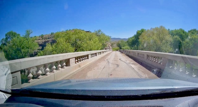
Driving south from Clifton on US-191 I saw a sign for Black Hills Back Country Byway, which I was warned is a “primitive road” that one should “use at your own risk”. So, I decided to at least take a look at it. Particularly down to the Owl Creek Campground and the Old Safford Bridge across the Gila River, then up to Menges Ranch (MP 21-16) the road couldn’t have been nicer dirt.
Black Hills Back Country Byway climbs into the Peloncillo Mountains. There are a number of overlooks, picnic areas, interpretive sites, and historical markers. My favorite was Copper Canyon Overlook (MP 13.2), which had a lot of information about Morenci Mine. The Black Hills Rockhound Area, off Cueto Ranch Rd. (MP 3.2), is popular with mineral hunters, particularly for fire agate. ♦️
Black Hills Back Country Byway gets very twisty, so mind your speed and look ahead. On a Tuesday afternoon, I saw no one. The only slightly rocky part was below the Greenlee County / Graham County line, roughly MP 7-4. Though dirt road conditions can change, today Black Hills Back Country Byway was car-drivable; no high clearance necessary. (Side roads are strictly 4×4.) I really liked the 21 mile drive!
Trailhead Directions: Sardine Saddle Picnic Area is at milepost 181.5 on the east side of US-191. HL Saddle Picnic Area is a mile north, at milepost 182.5, on the west side of the highway. (US-191 mileposts count up, south-to-north.) Either trailhead is a ninety minute drive northeast from Thatcher, or two hour drive south of Springerville.
Black Hills Back Country Byway GPS File: Black_Hills_Back_Country_Byway
HL Canyon Trail #11 GPS File: HL_Canyon_Trail_11
Distance: 4.22 mi.
AEG: 1,085 ft.
Time: 2h 11m