

I was going to hike another segment of the Maricopa Trail today, but my wife was visiting family in Florida, and hiking from Anthem to the Bob Bentley Trailhead would require a shuttle driver. (Or a 16+ mile out & back on terrain it would not be worth repeating.)
Meanwhile, I plan on finally tackling Picacho Peak during this spring flower season. As Picacho is a 1,200 ft. climb in just under a mile (a very steep 25% grade), and my knee has been feeling better, I figured I ought to do at least some climb training. Maricopa Peak is what I chose. ⛰
Maricopa Peak is a locals hike in South Mountain Park, where it is the high point in the Ma Ha Tauk Range, the smaller of the park’s two parallel ranges. Slightly higher Mount Suppoa (aka TV Tower Peak) — the park’s highpoint — is in the other range.
On my previous Maricopa Peak summit, six years ago, I hiked Alta Trail east from 35th Ave. This time, Central Ave. was open — if you don’t count the construction zone all the way from downtown — so my trailhead was the intersection of San Juan Rd. and Summit Rd., in the middle of South Mountain Park.
I briefly considered hiking a loop to Maricopa Peak from the T-Bone Trailhead on 19th Ave., but that would have added two miles and 400 AEG (accumulated elevation gain) to my day. Given my late start — nearly 10:00 a.m. — I’m glad I changed plans. As it was, I didn’t finish until almost 4:00 p.m., when it was an unseasonably warm 84℉. 😅
Today’s route to the summit of Maricopa Peak starts by heading west from Summit Rd. on Bajada Trail. The trail crosses two small washes, before entering a third. Bajada Trail follows the wash bottom for 200 yds. to a trail split. The green B sign left stays on Bajada Trail: Instead turn right on the purple A (Alta Trail) sign.
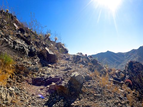
After turning off Bajada Trail, Alta Trail climbs some stone stairs to a small trailhead on San Juan Rd. (Which is only open the first weekend of each month.) After crossing San Juan Rd., Alta Trail rises a leisurely 100 ft. in a ⅓ of a mile, before the real climb begins in earnest.
Alta Trail climbs 700 ft. in a hair over a mile to the top of the Ma Ha Tauk ridgeline. There’s a ton of switchbacks along the way. About halfway up, there is a stone bench, which I somehow didn’t see until I was on my way back down. 😎
At the top of the climb, there is a t-intersection: Alta Trail continues to the left. To the right is a trail that is on OpenTopo, but not on the official South Mountain Park map: Variously named Warrior Trail and Hau’Pal (Red Tail Hawk) Trail, it descends to the T-Bone Trailhead on 19th Ave. I went left.
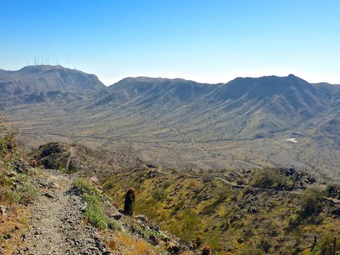
From the Warrior Trail intersection, Alta Trail descends 200 ft. in the next mile, as it snakes along the ridgeline’s military crest (the elevation contour just below the very top of a hill). Being mostly on the northside of the ridgeline, Alta Trail still had decent shade, even late morning. On my return trip, two hours later, the shade was gone but for one small spot.
Alta Trail then climbs 250 ft. in the next ½ mile to the spur which marks the trail’s highpoint, which is marked by another rusty metal post with a bar-coded, mobile-scannable, purple A sign. Following the sign will take you west, down to the San Juan Trailhead. Instead, turn left (east). ↖️
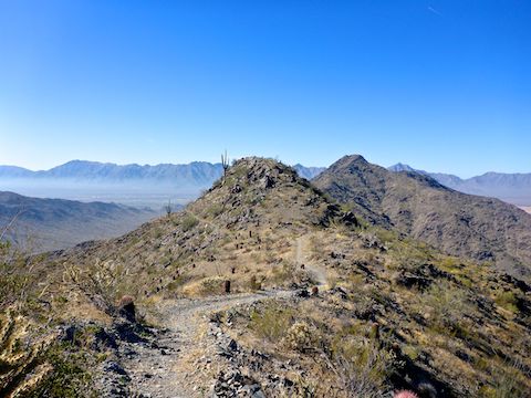
The ¼ mile long Maricopa Peak summit trail may at first appear obvious, but you may lose it: Keep heading east, towards the obvious high point. Take care with your footing going over the various rocky outcroppings. The summit will appear as two rocky knobs: The right knob may appear higher, but the left one is the summit.
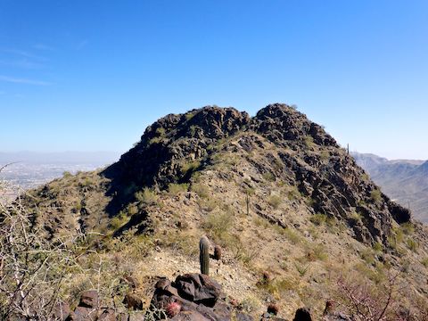
There is a small, shady, flat between the two knobs. I left my hiking poles there, so I would have my hands free for the short, but tricky, scramble to the summit. I did not have a great deal of confidence negotiating the graffiti rock, but I went right, edging face-first along a ledge, maintaining three points of contact. (Except when my shirt go caught on a rock, and I had to very carefully unhook it, so I could continue.) Slipping would have resulted in a long tumble down the mountain.
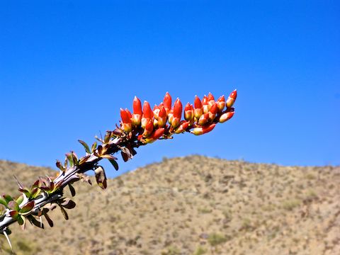
There’s no shade on the Maricopa Peak summit, unless you count a small palo verde. (See top.) But I took what I could get while I ate lunch. The smog over Phoenix was so bad, I could not see Camelback Mountain. 🤢
Even though I took a summit photo of my hiking beer, I did not drink it until I was back on Alta Trail, as I wanted all my faculties while descending the summit knob: I went around the opposite side of the dark graffiti rock, butt scootching along that ledge.
I took two breaks on the way back down Alta Trail: The first in the one bit of shade remaining on the ridgeline, to swap liquids, the second in the one bit of mid-afternoon shade on the switchbacks (hour long business call I had to take). 📱
Directions: Wherever you come from in the Valley, head south on Central Ave., through South Phoenix, into South Mountain Park. Mind your speed: The road is twisty, narrow, and you share it with bicycles. Go through the two unmanned park gates (no fee), past the quarter midget track, to the intersection of San Juan Rd. and Summit Rd. Park in the middle of the triangle.
Park Map: South_Mountain_Park_Trail_Map (pdf)
GPS File: Maricopa_Peak
Distance: 8.10 mi.
AEG: 1,833 ft.
Time: 3h 50m
Hiking Video
Hiking Maricopa Peak from Preston McMurry on Vimeo.