

Every winter, I do hikes in lower elevations, where there is no snow. Most of those are what I call a “locals hike“: Phoenix area hikes that are not as long, with less AEG, not requiring a GPS, and which avoid bushwhacking. To avoid burning out an area, I rotate through the Valley of the Sun’s various mountain preserves and regional parks. This week, it was South Mountain’s turn.
I had hoped to leave home before 6:00 a.m., beating rush hour, then eating breakfast at the Chandler Blvd. Waffle House, while I waited for sunrise. But I couldn’t get out of the house, so I waited until after rush hour. Despite appearances on my Kingsnake’s Dashcam videos, I do try to avoid stress. ☮️
It’s been two years since I hiked the west end of the park, when I did the last of my ten Loop 202 South Mountain Freeway survey hikes. Today’s plan was to hike Pyramid Trail, Lost Ranch Mine Trail, Gila Trail and Bursera Trail counter-clockwise. The loop is 5.8 miles, 1,150 ft. accumulated elevation gain (AEG).
Other options include:
- Lost Ranch Ruins: This side trip adds 0.7 miles, 160 AEG, to the hike.
- Short Loop: The saddle on Gila Trail has a shortcut to the top of Bursera Trail that reduces the loop to 3.6 miles, 450 AEG.
- Bursera Peak Summit: Might as well, since this adds no distance and maybe 50 AEG to the loop.
- Bursera Peak Out & Back: This is a popular quickie at only 3.3 miles, 775 AEG, round trip.
I did the big loop, plus Lost Ranch Ruins and Bursera Peak for 6.5 miles, 1,350 AEG. As usual, my stats below are greater due to exploring along the way.
Pyramid Trail starts at the Pyramid Trailhead, on Chandler Blvd. at 19th Ave. The only trailhead amenities are a map board and parking spaces. No water, restroom, or picnic tables. At 10:00 a.m. on a weekday, the ~40 spaces were maybe ⅓ occupied. For the ¾ mile I hiked Pyramid Trail, it was wide, gravelly, and rolling.
Lost Ranch Mine Trail starts at Pyramid Trail. It was pretty darn rocky: Okay for hiking, but I wouldn’t want to endure the jarring of mountain biking it. Gila Trail intersects Lost Ranch Mine Trail in a wash, after which Lost Ranch Mine Trail climbs to the eponymous ruins. I couldn’t find anything about Lost Ranch’s history, but it was a big place, with a concrete foundation, local stone walls, and multiple fireplaces. 🏚
After checking out Lost Ranch, I doubled back to the wash, then picked up Gila Trail.
Gila Trail continues up the wash for 250 yds., before leaving it, climbing 360 ft. in ¾ mile to a saddle. It was somewhat rocky, but with a smoothed out path through the rocks. At the saddle, there is a yellow “area closed” sign. Opposite the sign, is a use trail up. That is the shortcut to Bursera Trail.
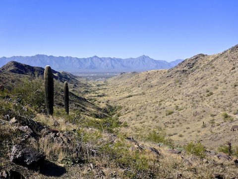
Gila Trail continues down, to the west. It was initially steep and rocky. After the first of two deep washes, the trail surface cleared and levelled out. I saw a mine adit up the first wash, but my mine exploring was brief. Bursera Trail is visible climbing the south side of the canyon.
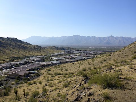
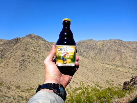
I continued on Gila Trail for ⅓ mile past the Bursera Trail intersection to a knoll above the luxury community recently built next to Loop 202 South Mountain Freeway. Homes have sold there for up to $1.1 million; half that closer to the freeway. After enjoying half my gas station murderwich, I doubled back to Bursera Trail.
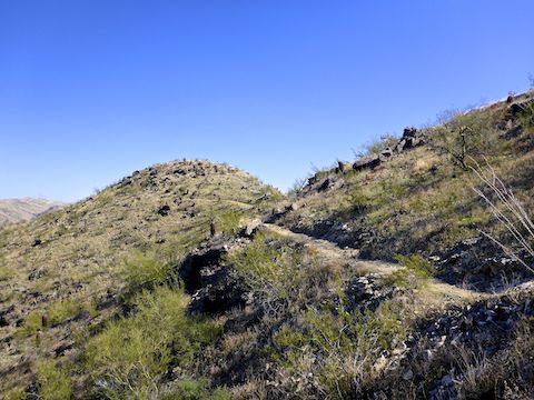
Bursera Trail is smooth single track, dotted with small sections of explosed bedrock. From Gila Trail, it climbs 360 ft. in ¾ mile to a south facing saddle. Same distance & angle as Gila Trail, but it seemed steeper. Bursera Canyon Trail descends south; instead turn left. Bursera Trail continues climbing, 180 ft. in ⅓ mile to this loop’s high point: The upper end of the shortcut.
Just before the shortcut, there is a faint trail on the right that goes to the summit of Bursera Peak. (Note: The actual summit is ⅓ mile west of where satellite view claims it is.) The summit is not very high off Bursera Trail, but it does have good views and space for a picnic. 🧺
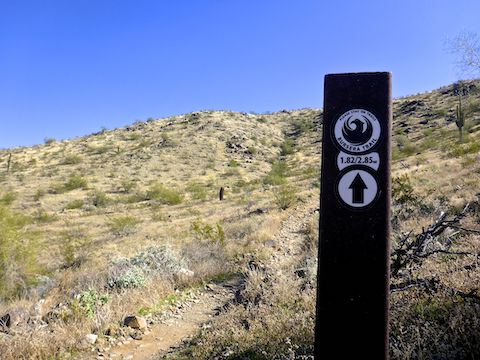
The other trails on this loop had signposts at the intersections, but Bursera Trail has plenty of intermediate signposts. Most had a simple black-on-white sticker, not a purple “B”, elevation profile or QR code like they were supposed to be putting on Maricopa County trail markers a few years ago.
From the summit, other than stopping to attempt a repair on my pack’s zipper, I slalomed past a steady stream of people heading up, making it down to Pyramid Trailhead in about 30 minutes.
Directions: From the Loop 202 South Mountain Freeway, take exit 62 onto 17th Ave. In 0.7 miles, turn left on Chandler Blvd. In 0.3 miles, at the edge of the housing area, turn right. (Ignore the “dead end” sign.) Immediately turn left into the Pyramid Trailhead. There is no entry fee.
Park Map: South_Mountain_Park_Trail_Map (pdf)
GPS File: Pyramid_Gila_Bursera_Lost_Ranch_Loop
Distance: 7.79 mi.
AEG: 1,497 ft.
Time: 3h 11m
Hike Video
Hiking South Mountain, Phoenix from Preston McMurry on Vimeo.