
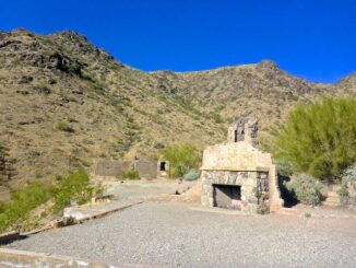
South Mountain: Pyramid Loop
Every winter, I do hikes in lower elevations, where there is no snow. Most of those are what I call a “locals hike“: Phoenix area hikes […]
Every winter, I do hikes in lower elevations, where there is no snow. Most of those are what I call a “locals hike“: Phoenix area hikes […]

McDowell Mountain Regional Park is a 21,099 acre Maricopa County park north of Fountain Hills and east of the McDowell Mountains. MMRP is immediately adjacent to […]
Estrella Mountain Regional Park is 19,840 acres of easy Sonoran Desert hiking. Officially, the most difficult trail is rated “moderate-difficult”, but Maricopa County tends to […]

Winter is officially upon us. It is -8℉ in Flagstaff as I type. Thankfully, “only” 36℉ in Phoenix. So, this is the time of year […]
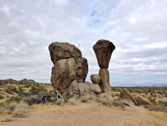
Marcus Landslide was “discovered” in 2002 by two ASU geography post-grads. Surely, many people had looked at the rocks before, but the students were the […]
Counter-clockwise from Bronco Trailhead, this is the 4th and 5th segment of the Maricopa Trail. At the beginning of 2021, I set out to hike […]

Another Halloween in Hagerstown, Maryland, in the books. Son & family went as the crew from Scooby Doo. Ruh-roh, Shaggy, is that a Mystery Van!? […]
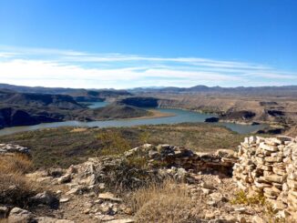
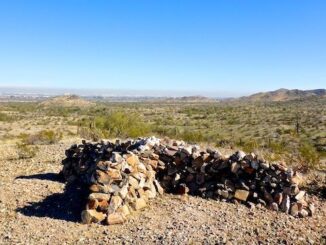
Indian Mesa Ruins is another one of those hikes I’ve had on my to-do list for years. Not sure why I’ve never gotten around to […]
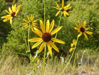
My third Arizona flowers video adds another three dozen or so species I’ve photographed on my travels across the elevated forests, canyons and mountains of […]

I have not ridden my mountain bike since my ride along the Arizona Canal — aka the “Homeless Highway” — March 2, 2014, nearly eight […]
Copyright © 2026 Preston V. McMurry III | WordPress Theme by MH Themes