

McDowell Mountain Regional Park is a 21,099 acre Maricopa County park north of Fountain Hills, nestled between the McDowell Mountains to the west and the Fort McDowell Yavapai Reservation to the east. Together with the adjacent 30,500 acre McDowell Sonoran Preserve, over 51,000 combined acres is a pretty darn big park! 🤗
The last time I was in McDowell Mountain Regional Park was almost two years ago, to mountain bike the Pemberton Trail.
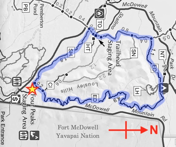
Starting at the Four Peaks Trailhead / Horse Staging Area, today’s plan was to hike all of Shallmo Wash Trail, a wee bit of Pemberton Trail and all of Escondido Trail. The same loop can be done from the Pemberton Trailhead or Lousley Trailhead, but I wanted to avoid the extra 5-10 minute drive (each way).
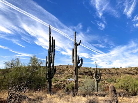
I started hiking just after 8:00 a.m., when the late autumn sun was still relatively low in the sky. The clouds were wispy, laced with contrails. The temperature was 58℉, and breezy, so I wore my hoodie. 🥶
Shallmo Wash Trail climbs a leisurely 180 ft. Unlike the sandy wash which it parallels, the trail is hard. More like cement than dirt. Firm & fast singletrack. I took my best pictures of the day along Shallmo Wash Trail: Clouds, low-angle sun shots, and saguaro cactus. I finished Shallmo Wash Trail in just over an hour (total time, not moving time).
Pemberton Trail was wider. If not doubletrack, at least wide enough for mountain bikers to safely pass each other. The surface along the Lousley Hills segment is smooth, and mostly firm, but slippery sand in spots. Not bad at all.
I don’t recall seeing a single saguaro along Pemberton Trail. I did see about a half dozen mountain bikers. Hoping to add something interesting to my hiking video, I stopped at a small wood bridge waiting for an MTB to roll by for a finger quotes “action” shot. Twenty minutes I waited. No bueno. Of course. 🙄
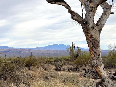
The only subjects worth photographing — McDowell Peak, Thompson Peak, East End, Marcus Landslide — were too distant for my iPhone to do justice.
The sky had become totally overcast, so even though the temperature had ostensibly increased, I kept my hoodie on. Just after 10:00 a.m., I turned onto Escondido Trail.
Escondido Trail starts heading east along the north edge of the Lousley Hills. The Pemberton Trail intersection is the high point of the loop, so the next two miles are downhill. The descent is the inverse of the climb on Shallmo Wash Trail. A couple of MTBs preceeded me, but I didn’t see another one the remainder of my hike.
After a mile, Lousley Hill Trail crosses Escondido Trail. The only hikers I saw all day were in this area. Lousley Hill Trail is a steep 300 ft. in ⅓ mile. The whole small loop would add 1¼ miles to this hike. I skipped it.
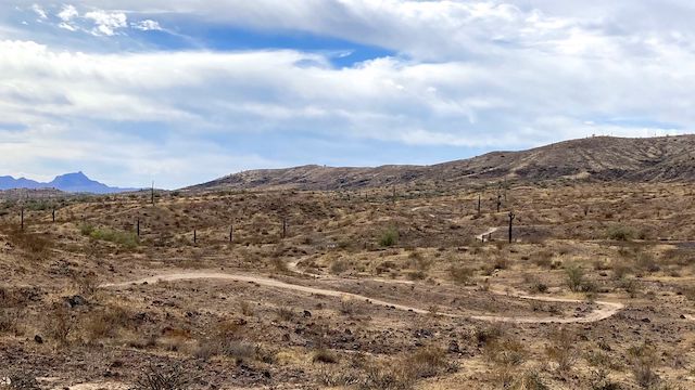
At the bottom of the descent, Escondido Trail turns south. It becomes rolling and very twisty as the MTB-optimized route is squeezed between the Lousley Hills and McDowell Mountain Rd. If you need a bail, Escondido Trail is never more than ⅓ mile from the heavily-trafficked road, and sometimes as close as 200 yds. Most of this hike’s elevation is in this section, in the form of many 50-80 ft. / 4-5% slope climbs.
It would probably be a blast to ride Escondido Trail, but hiking it got to be drudgery without something, anything, to photograph. Maybe in April, when the desert flowers bloom, it might be better. Oh well: Miles is miles.
Directions: From Phoenix, drive east on Shea Blvd. Just over the top of the hill into Fountain Hills, turn left onto Fountain Hills Blvd. Stay on the road 3.9 miles through Fountain Hills. Beware the 15 mph school zone on the edge of town. Just past the school, the same road becomes McDowell Mountain Rd. In 3.6 miles, turn left on McDowell Mountain Park Dr. Entrance fee is $7. Just past the entrance, where the brown sign says “Horse Staging Area”, turn right onto the decent dirt road. Parking begins in 0.25 miles, but the Shallmo Wash Trail and Escondido Trail are on the far side of the lot.
Park Map: McDowell_Mountain_Regional_Park_Trail_Map
GPS File: MMRP_Shallmo_Wash_Pemberton_Escondido
Distance: 9.97 miles
AEG: 793 ft.
Time: 3h 15m
Rumble Video
Vimeo Video
Hiking McDowell Mountain Regional Park from Preston McMurry on Vimeo.