

My plan this week was to bike Railroad Grade Trail #601 from Apache Railroad Trailhead on AZ-260, south 19 miles to Railroad Cove Trailhead at Big Lake. In Phoenix, I ride my 17-mile Mega Church Loop in 1h 40m, which is ~10 mph. So, on pavement, I could ride 19 miles in two hours — three including stops for photos. With a nine-hour round trip drive from Phoenix, it would be a long & tiring day. 🥱
Instead, I sold the idea to my lovely shuttle driver / wife as a romantic 3-day getaway to Greer: First day, drive up to the White Mountains, route recon down AZ-273 to Big Lake, do a leg-stretching hike, then check in to our lodge in Greer. Second day, bike Railroad Grade Trail #601. Third day, drive home.
The leg-stretching hike I chose was Mount Baldy Crossover Trail #96, which connects East Baldy Trail #95 to West Baldy Trail #94, near Lee Valley Lake. The trails also connect just below the Mount Baldy summit, which is off limits, on the Fort Apache Indian Reservation.
I hiked Mount Baldy Crossover Trail #96 south-to-north. From the East Baldy Trail #95 trailhead, I hiked west on a wide gravel trail that looked like what I was expecting the next day on Railroad Grade Trail #601. In 300 yds., Mount Baldy Crossover Trail #96 is on the right. Despite the obvious sign, I missed it, and had to double back.
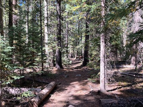
In a little over three miles, Mount Baldy Crossover Trail #96 makes three short, but steep, climbs: 180 ft. at 8%, 100 ft. at 10% and 160 ft. at 12%. If you are not acclimated to the elevation, you will feel it on the climbs. The hills are heavily forested with mixed ponderosa pine, spruce, Douglas fir and aspen. The highest elevation lake in Arizona, 35 acre Lee Valley Lake may be visible through the trees. 🌲
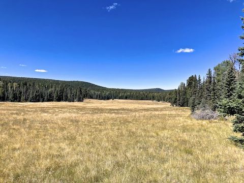
In between the three hills are grassy cienegas. The first is nearly a half mile wide, and drains into Lee Valley Lake. (As does the second cienega.) The other cienegas are much smaller. Any creeks are easy to cross dry.
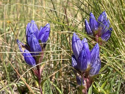
This late in the year, at ~9,500 ft. elevation, high country flowers were sparse. Dandelions were most common. I also spotted a couple of Wheeler’s thistle, one paintbrush, harebell, pleated gentian, a few small western yarrow and some aster & fleabane. (There were small, but dense, fleabane clusters near the West Baldy Trail #94 trailhead.)
Descending Mount Baldy Crossover Trail #96 to West Fork Little Colorado River was steep enough to have switchbacks. Once, I slipped and almost fell. My hiking-jitsu must be strong, as I was not using my hiking poles. Indeed, I carried no gear at all: Just my crappy Garmin 62S and a bottle of water.
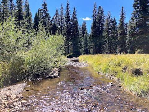
Mount Baldy Crossover Trail #96 ends just across West Fork Little Colorado River. I turned right, following West Baldy Trail #94 a mile to the trailhead on AZ-273, just above Sheep Crossing. 🐑
After finishing my hike, my wife & I drove back up AZ-273, then east on AZ-260. I stopped at Apache Railroad Trailhead to scout out the beginning of tomorrow’s bike ride. I could see the slightly elevated grade, but Railroad Grade Trail #601 was very narrow singletrack. (As was the far end, down at Big Lake.) I could do 19 miles of true rail trail — like Prescott’s Peavine Trail — no problem. But singletrack? I made contingency plans to maybe only bike the first eight miles to Sheep Crossing.
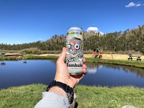
After checking in at our lodge, I sat down by the pond to relax and catch up on twitter. I had two bar Verizon LTE, but nothing in the cabin. The lodge’s wifi was protected, and $20 / night. Even after paying for it, my iPhone SE couldn’t even detect the wifi. Worse, I had lost my glasses somewhere outside. I was not happy. 😫
We had a good dinner, off site at Molly Butler Lodge, sitting on the balcony, watching an elk herd below. Normally, I don’t fiddle with my iPhone while eating — it’s together time — but Molly Butler had open wifi with a strong signal.
Back at the lodge, I barely slept. The next morning I was tired, and still frustrated, and not looking forward to struggling on non-rail trail. Also, it was freezing cold. So I called EndEx and we bailed back to Phoenix. Maybe next year … 🤷🏻♂️
Directions: From Phoenix, head north on AZ-87, the Beeline Highway, into Payson. Drive east on AZ-260 for 123.5 miles, through Heber-Overgaard, Show Low, Pinetop-Lakeside and the White Mountain Apache Reservation. Just past milepost 377, turn right on Arizona Highway 273. In 8.5 miles, the West Baldy Trail #94 trailhead will be on the right. Continuing down AZ-273, in another 3 miles, the East Baldy Trail #95 trailhead is also on the right.
GPS File: Mount_Baldy_Crossover_Trail_96
Distance: 4.98 mi.
AEG: 558 ft.
Time: 1h 47m
West Fork Little Colorado River
West Fork Little Colorado River from Preston McMurry on Vimeo.