

I’ve been hitting the Mogollon Rim pretty hard this year, but I need to up my game if I will ever reach my goal of hiking all the its named canyons. This week’s objective was Gentry Canyon.
Gentry Canyon is located between Knoll Lake, O’Haco Lookout, FR 115 and FR 56 on its west flank, and Gentry Ridge on it’s east flank. Gentry Canyon extends at least nine miles to Willow Creek, at the north end of Gentry Ridge near Alcatraz Point. (Willow Creek continues another 21 miles north to Clear Creek; I am not sure what the name of the canyon is which Willow Creek passes through.) 🤔
Bailing from Gentry Canyon between Gentry Spring and Open Draw ranges from incredibly easy to a good blow, but it is never dangerous. A forest road is never more than 200 yds. away and 150 ft. up. Heck, FR 91M is only 50 yds. away, and 20 ft. up, from the Gentry Spring spring box!
So, you can make your Gentry Canyon loop as short as you like. That said, here’s some options:
- Gentry Spring Loop: All on jeep trails. Anybody could do it! 2.5 miles, 200 AEG (accumulated elevation gain).
- Bessemer Crossing Loop: Up Gentry Canyon to FR 40 at Bessemer Crossing, then loop back on jeep trails. 8.1 miles, 470 AEG.
- The Whole Shot: Up Gentry Canyon, past Bessemer Crossing, to the junction with Open Draw. Climb out, then loop back on jeep trails. 11.0 miles, 630 AEG.
- Visit Double Cabin Spring: Just west of Bessemer Crossing. Add one mile and 60 AEG to option #2 or #3.
I hiked options 3 and 4. If you are wondering why my mileage and AEG are greater, it is because of all the wandering back & forth I do, checking routes, looking for the best photo ops, etc. 📸
I started hiking from the same trailhead on FR 91 as the Open Draw and Turkey Creek hikes. I could have headed straight across FR 91, towards the low ground, but instead headed north along the forest road a ¼ mile. I turned left on the far side of an unnamed tank, onto a unnumbered jeep trail that descended through an aspen grove to the floor of Gentry Canyon.
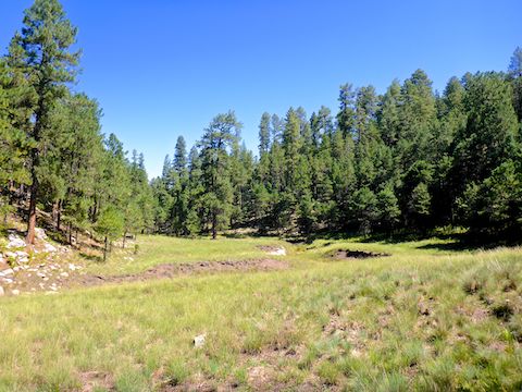
At a ½ mile, the jeep trail breaks out into the open, travelling along the west side of a ½ mile long prairie / wetland. Gentry Spring, at the north end of the prairie, had a small pool of muddy water; no flow. A tree was fenced off for a reason I could not determine; it was kinda scraggly. There were vehicle tracks across the prairie. 🤭
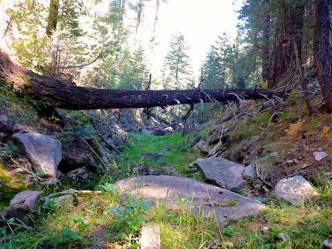
North of Gentry Spring, I turned off the jeep trail, following the canyon bottom north. Gentry Canyon immediately became tighter — rockier, with deadfall and vegetation — but never too bad. After ¾ of a mile of minor canyon crawling, the canyon bottom opened up into wide, grassy, shelves for the next 2½ miles (past Bessemer Crossing).
Travelling along Gentry Canyon, a small black bear ran across the grassy shelf 150 yds. ahead of me. It was my first bear sighting since Moscow Peak in 2015. I didn’t see mama, but I had my head on a swivel for the next ten minutes! 🐻
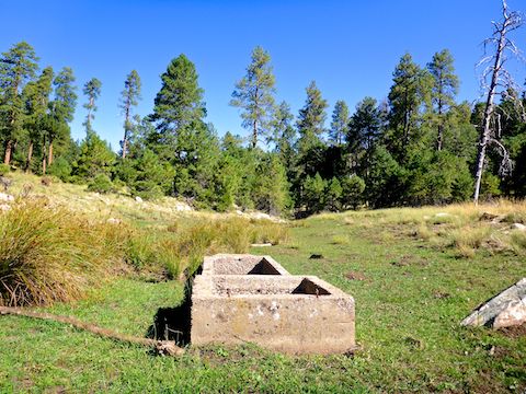
After 3.8 miles of hiking, I reached Bessemer Crossing. I turned left (west) up FR 40. Double Cabin — which I assume is two cabins — is not where the single topo stone building symbol ■ says it is. All I found there was an old fence post, with some scraggly barbwire. The remains of the large log cabin are, in fact, quite obvious and directly across from Double Cabin Spring. I assume what remains of the “other” cabin is a nearby broken cement foundation. The spring is fenced off with relatively fresh barbwire, so I don’t know if it is flowing. The spring box was dry & dusty.
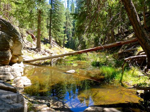
A ½ mile north of Bessemer Crossing, Gentry Canyon tightens up for the final mile to Open Draw. There are shallow, clear, pools with barely perceptible flow, but travel is still not bad.
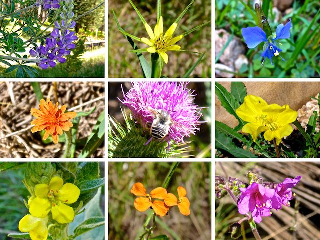
Top Row: hills lupine, yellow salsify, western dayflower.
Middle Row: orange agoseris, Wheeler’s thistle, Hooker’s Evening Primrose.
Bottom Row: mullein, western wallflower, linearleaf four-o’clock.
Plus Richardson’s geranium, dandelion, coneflower and fleabane.
I ate lunch just short of Open Draw, then headed 150 ft. up the elk trail to FR 40G, which follows the contour line for 1¼ miles southwest to FR 40, just above Bessemer Crossing.
South of FR 40, the jeep trail continues, renumbered as FR 40A. After ¾ of a mile, the jeep trail splits: The obvious trail is left, but that is FR 40A1. Note the “1”: It matters. I was a ½ mile up FR 40A1, before I realized my mistake. I could have continued up to FR 91, then back to the trailhead, but that was not my plan, so I doubled back. Instead, split right. 🧭
2⅓ miles south of Bessemer Crossing, FR 40A becomes FR 91M, which continues a ½ back to the Gentry Canyon spring box. The previous 4¼ miles of jeep trail were shady, smooth, almost flat, and showed no signs of recent vehicle traffic.
From the Gentry Canyon spring box, I turned east up a rocky jeep trail to the big camping area, then followed FR 91 a little over a mile back to the trailhead.
My favorite part of hiking at the east end of the Mogollon Rim is making a post-hike stop at the Woods Canyon Lake bait shop for ice cream (strawberry shortcake) and ice cold hiking beer (Sam Adam’s Octoberfest Märzen). 🍦🍺🤗
Directions: Head north on AZ-87, the Beeline Highway, into Payson. Turn right on AZ-260. In 29 miles, after cresting the Mogollon Rim, take the first left onto FR 300 / Rim Rd. In 3.2 miles, at the Woods Canyon Lake intersection, Rim Rd. turns to car-drivable dirt. 9.4 miles from AZ-260 is a t-intersection. Turn left. (Right is FR 34 to Winslow.) In 7.1 miles, turn right onto FR 115, aka Limestone Rd. In 1.2 miles, turn right onto FR 91. In a ¼ mile, park in the clearing on the right.
GPS File: Gentry_Canyon_Mogollon_Rim
Distance: 14.11 miles
AEG: 835 ft.
Time: 5h 23m
Hiking Video
Hiking Gentry Canyon on Mogollon Rim from Preston McMurry on Vimeo.