
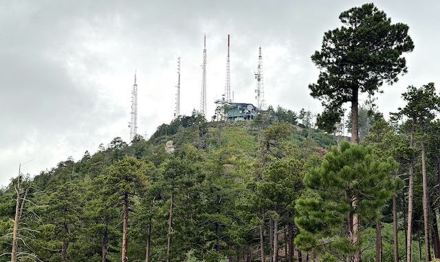
My birthday week is usually our annual July expedition to the Santa Catalina Mountains. We go down a day early, and leave the day after, to avoid fighting rush hour across Tucson from I-10, and arriving home way late. That allows us to take the scenic “back roads” through Superior, Ray, Hayden, Mammoth, and Oracle. Most importantly with a lunch time stop at Old Time Pizza in Kearny.

Today’s plan was to hike from San Pedro Vista (MP 18.3), along Incinerator Ridge Trail #18A past Barnum Rock to Incinerator Ridge Trailhead, then Kellogg Mountain Trail #45 and Mount Bigelow Trail to the antenna farm. (You can drive a car to the summit of Mount Bigelow via FR 34, opposite Whitetail Campground @ MP 20.7.) I hoped to complete a roundtrip in three hours (four incuding photos).
The best San Pedro Vista view is uphill 30 ft. from the downhill end of the lot. (That’s where I shot my video intro.) It took me a couple of minutes to figure out that Incinerator Ridge Trail #18A starts at the uphill end of the lot, on the road side of the wall. The trail starts steep and rocky. I instantly began sucking wind. Thankfully, the trail moderated a bit as it switchbacked up to the Barnum Rock saddle.
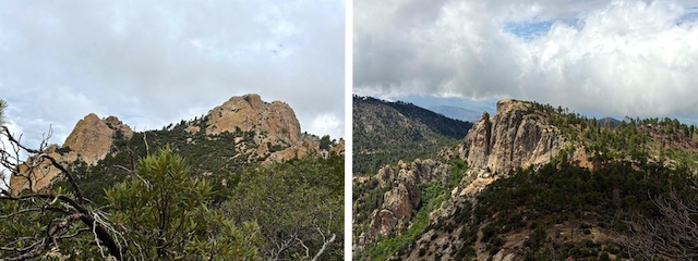
Barnum Rock is supposedly closed February 1 – August 31, due to peregrine falcon nesting, but there is no notice to that effect on the Coronado National Forest alerts page, and I saw no signs at San Pedro Vista, nor along the trail. Barnum Rock has climbing routes rated 5.5 up to at least 5.9. Allegedly, you can walk right up. I didn’t see anything obvious, or easy, so I skipped both Barnum Rock summits.
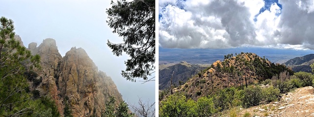
I still hoped to “summit” Leopold Point and Kellogg Mountain. Each adds about 0.3 mi., 120 AEG (feet of accumulated elevation gain) to your day. Some Incinerator Ridge hiking options include:
- Leopold Point from Incinerator Ridge Trailhead, out & back: 1.3 mi., 375 AEG
- Leopold Point from San Pedro Vista, out & back: 2.6 mi., 770 AEG
- Mount Bigelow from Bigelow Trailhead, out & back: 2.0 mi., 580 AEG
- Mount Bigelow from Incinerator Ridge Trailhead, out & back: 1.9 mi., 520 AEG
- Mount Bigelow from San Pedro Vista: out & back, 5.2 mi., 1430 AEG
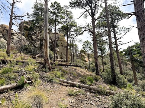
If you do nothing else in the Incinerator Ridge – Mount Bigelow area, make sure you visit Leopold Point! You can pretty much walk up Leopold Point, with never more than maybe an occasional hand hold. The payoff is an open summit with 5-star views east to the San Pedro River Valley, Galiuro Mountains (25 mi.), Pinaleno Mountains (50 mi.) and, on a clear day, the Gila National Forest (110 mi.)!
Today was my second outing with my new Kodak PixPro WPZ2 pocket camera. After a disappointing debut in Alder Canyon, I initially forgot I had it, used it sparingly, and ultimately did not even bother downloading the photos. I’m still struggling with focus, and lens switching, on my almost as new iPhone 17 Pro, but I think the Kodak WPZ2 has joined my Ricoh WG-6 in the dust bin of crappy camera history.
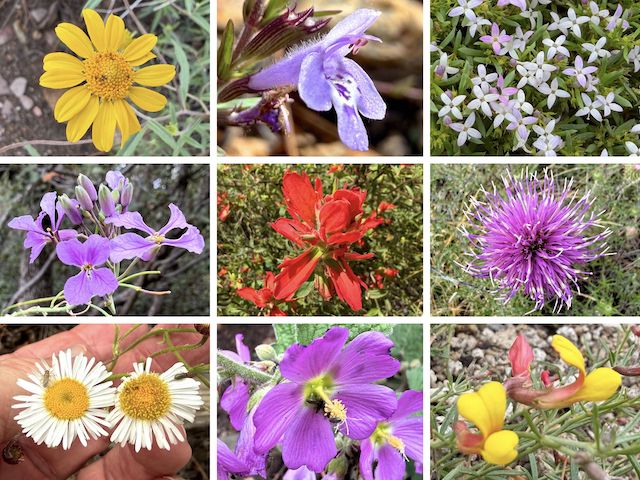
Top Row: showy goldeneye, aromatic false pennyroyal, pygmy bluet.
Middle Row: slimleaf plainsmustard, Rincon Mountain indian paintbrush, Wheeler’s thistle.
Bottom Row: spreading fleabane, thicket globemallow, red and yellow pea (via fuzzy iPhone 17 Pro).
Besides the pictured high country flowers, I also saw pineywoods geranium (Geranium caespitosum), mullein (erbascum thapsus), and western yarrow (Achillea millefolium). The most common flower — not unexpectedly for Mount Lemmon — was scarlet penstemon (Penstemon barbatus). The best flowers started a quarter mile west of Leopold Point; east of it was almost devoid of color.
I saw some hikers, and a couple of birders, by the Knagge Trail #18 junction. At Incinerator Ridge Trailhead, a guy was having cook out. (Fire restrictions were lifted a few days ago, due to the monsoon, and rain was expected today.) Continuing on Kellogg Mountain Trail #45, it switchbacked up 160 ft. in a quarter mile. I had considered bushwhacking to Kellogg’s summit, but it is a bouldery 45% slope. 👋
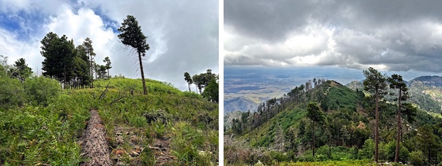
Starting at 9:40 a.m., I arrived at the Kellogg Mountain Trail #45 / Butterfly Trail #16 / Mount Bigelow Trail junction at 12:06 p.m. Kellogg Mountain has an open summit, with better views than Mount Bigelow, but I could not find the use trail up. I did not feel like beating brush. Not even for 120 ft. I prefer to bushwhack down slope. Skipped it. I can always come back.
Halfway up Mount Bigelow Trail, at a large boulder, it splits. The trail on the topo map goes right. I didn’t see anything there, so I went left along the obvious path. I made FR 34 / Mount Bigelow Rd. in 10 minutes. There’s some serious facilities on the summit. The generators? / fans? were loud. After eating a truly horrific 7-Eleven taquito, it was 12:30. I didn’t think I could make it back in time to San Pedro Vista.
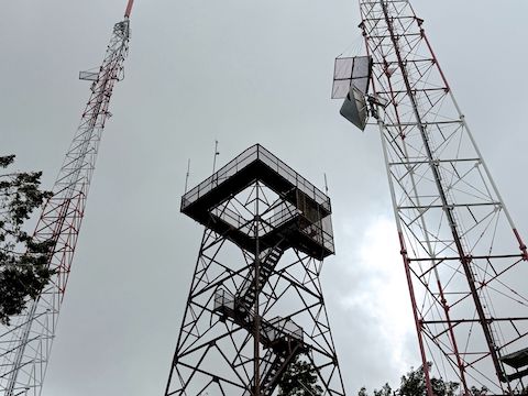
With 1-2 bar Verizon, I texted my wife a change of plans: Pick me up at Bigelow Trailhead. I made it down the Mount Bigelow Trail topo route, to Mount Bigelow Trailhead, by 1:05 p.m. Good thing too: It started raining five minutes later. I did not want to deal with that two weeks in a row! 😆
Directions: From I-10 in Tucson, take Exit 256. Head east on Grant Rd. for 8.5 miles. Turn left onto Tanque Verde Rd. In 3.3 miles, turn left onto the Catalina Highway. In 22.0 very twisty miles (speed limit 35 mph), San Pedro Vista is on the right. Bigelow Trailhead is exactly two more miles.
GPS File: San_Pedro_Vista_to_Mount_Bigelow
Distance: 4.74 miles
AEG: 1,454 ft.
Time: 2h 29m
Rumble Video
Vimeo Video
Hiking San Pedro Vista to Mount Bigelow from Preston McMurry on Vimeo.
