

Wow, what a crappy week I’ve had since I hiked Turkey Creek and Gentry Ridge. I wish I was still hiking the Mogollon Rim. 🚶♂️
But you are here to read about a hike, not sob over Dear Abby. Onwards!
It had been two months since I hiked Beaver Canyon, which is just the other side of Turkey Beaver Ridge — yes, that is its name — from Turkey Creek. My original plan that day was to do a loop of both Beaver Canyon and Turkey Creek, but instead I looped back on a ridge top forest road. This time I planned right out of the box to hike FR 91 back along Gentry Ridge.
The only question was whether I would bail at some point along Turkey Creek, or go all the way to McGuire Crossing, which would be a 12 mile loop. In the end, despite finding several apparently easy canyon exits, I went all the way.
Turkey Creek certainly was no Crackerbox Canyon!
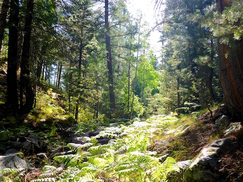
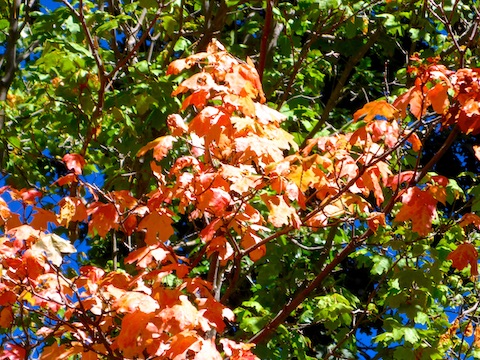
The hike starts out the back of the trailhead, past a fire ring, and down a decommissioned jeep trail. The ferns along the jeep trail were a beautiful blend of summer green and winter orange. If you consider that ‘fall color‘, it was the only fall color I saw the whole day. (With one isolated exception.) 🍁
In a few hundred yards, the jeep trail reached the bottom of Turkey Creek. I turned left, heading north, downstream. The first ½ mile had a bit of trippy undergrowth, but nothing major.
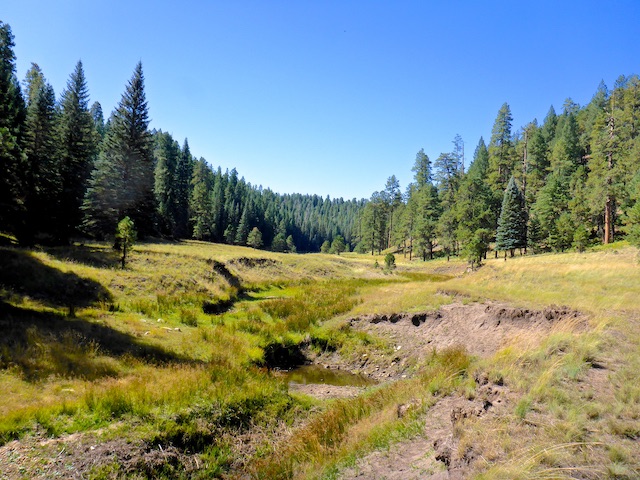
The next four miles in Turkey Creek alternate between hiking flat, shaded, creekside shelves and slighty sloped grassy hillsides.
There were tons of yellow cornflower along Turkey Creek, but very few still had petals. Most had gone fallow for the fall. There were very few other flowers in the canyon bottom and none on Gentry Ridge.
As you see in the above photo, Turkey Creek’s slope is neither steep nor high. Despite the mellow creekside travel, I spotted several good bail points, 3.4 and 3.8 miles into the hike. Both offer obstacle-free, even less strenuous, access to FR 91. Both bail points are marked on the attached GPS route, below. 🧭
If you dropped into Turkey Creek from Turkey Beaver Ridge, there appears to be another good bail point at 4.5 miles, where a use trail heads up slope to FR 92E, which eventually connects back to Rim Rd. at Horsehoe Lake / Horton Trailhead. Any trail is better than none, no matter how easy the terrain.
Speaking of use trails, or animal trails, there were very few in Turkey Creek. Certainly nothing like the freeway in Beaver Canyon.
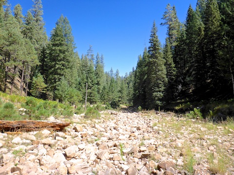
North of the use trail to FR 92E, Turkey Creek loses its easy bank travel. Though the creek bottom never gets tangled in underbrush or deadfall, it is very rocky, slow, going the next 1.5 miles to McGuire Crossing.
Before I trudged up the rocky part of Turkey Creek, I stopped for a break. Today’s mom-packed snack note: “Life holds so much to be happy about — so much to be happy about always. Most people ask for happiness on condition. Happiness can be felt only if you don’t set conditions. (Artur Rubinstein)” Mom signed it with a smiley face. No emojis.
5.3 miles downstream, Beaver Canyon empties into Turkey Creek. At least at the intersection, Beaver Canyon is jumbled with deadfall. Not sure about the area between Turkey Crossing — the furthest I’ve been in Beaver Canyon — and Turkey Creek. Conditions can quickly change in Mogollon Rim canyons! 🏞
Oh! I forgot to mention that Turkey Creek was totally dry, with the exception of the middle section, roughly between 2.4 and 3.7 miles downstream. Mostly small, isolated pools, though there was decent water in the “tripod moment” prairie. No flow.
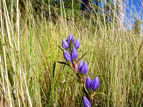
I spotted that beautiful Cardinal Catchfly in the header just before McGuire Crossing. It was definitely the floral highlight of my day!
It was hard to tell the difference between Turkey Creek and FR 91 at McGuire Crossing, so rocky was the forest road. I would not feel comfortable driving it in my SUV. High clearance recommended.
After eating lunch just above McGuire Crossing, I began following FR 91 south along the crest of Gentry Ridge. As far as ridge top Mogollon Rim forest roads go, it was relatively flat. Only minor changes in elevation. After a couple of miles, the rocks gave way to a road surface that was often quite sandy. That was an issue because the wind which was howling all day, and was at its peak mid-afternoon on the elevated ridge top. I haven’t had sand blow in my eyes like that since Desert Storm.
There was plenty of shade along Gentry Ridge. Whereas Turkey Creek was almost all pine, the ridge top had lots of aspen, plenty of oak, and a scattering of other deciduous species.
There was quite a bit of traffic along FR 91, south of FR 40, which descends to Campo Bonito and Open Draw (both on my list of future Mogollon Rim hikes). I saw Arizona Game & Fish twice, and there were probably twenty vehicle camps scattered along Gentry Ridge.
Considering the mileage, I was feeling pretty good when I finished my hike. On the way out along Rim Road, my wife & I stopped at my favorite place in Arizona, Woods Canyon Lake, for ice cream and ice cold beer. 🍦🍺👍
Directions: Head north on AZ-87, the Beeline Highway, into Payson. Turn right on AZ-260. In 29 miles, after cresting the Mogollon Rim, take the first left onto FR 300 / Rim Rd. In 3.2 miles, at the Woods Canyon Lake intersection, Rim Rd. turns to car-drivable dirt. 9.4 miles from AZ-260 is a t-intersection. Turn left. (Right is FR 34 to Winslow.) In 7.1 miles, turn right onto FR 115, aka Limestone Rd. In 1.2 miles, turn right onto FR 91. In a ¼ mile, park in the clearing on the right.
GPS File: Turkey_Creek_Gentry_Ridge_Loop
Distance: 12.18 miles
AEG: 845 ft.
Time: 4h 54m
Hiking Video
Hiking Turkey Creek on Mogollon Rim from Preston McMurry on Vimeo.