

Mid-week, Phoenix was in the midst of an unseasonable, but welcome, cold snap. Well, “cold” by Phoenix standards: Overnight lows were in the mid-60s! 🥶
Since the daytime high in Phoenix would only be 90℉ or so, I looked around for a hike that was lower than the Mogollon Rim‘s ~7,600 ft. elevation. The rule of thumb I learned in the Army was that temperature decreases one degree per 300 ft. For instance, as I type this the morning after my hike, it is 73℉ in Phoenix, but only 54℉ in Cherry, which is 4,000 ft. higher.
Cherry is at the east end of Arizona’s Black Hills, in the Prescott National Forest, and I’ve been wanting to check out the area for several years. The hike I decided to do was Medlar Springs Trail #9706, and at least take a peak up Ash Creek Trail #9705. (That is different than Ash Creek Trail #307 in the Pinaleno Mountains; Arizona has many places with the same name.)
In researching Medlar Springs Trail #9706, I chanced upon a map of the Prescott National Forest’s 2017 plan for the Black Canyon Trail. All the trails in the Black Hills, both motorized and foot / hoof were included. Trail #9706 seemed to indicate it was being decommissioned. Satellite view showed minimal trail, other than where Trail #9706 was co-located with forest roads skirting a ranch. Further, HikeArizona only showed one triplog for Trail #9706 and two or three for Ash Creek Trail #9705 — none more recent than 2014.
I was not expecting much.
And I found it.
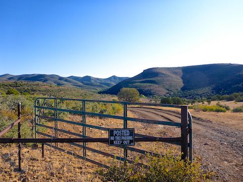
Driving in, I stopped short of the trailhead at a “No Trespassing!” sign. In the west, a property may be owned by a rancher, but a much larger portion of a ranch’s property is leased from the federal — e.g. Forest Service / Bureau of Land Management — or state government. The government land may legally fenced by the rancher, and he has the grazing rights to it. However, it is still government land and may usually be legally accessed for recreational purposes, such as hiking. Sometimes the barbed wire fence may have a gate; if not, you either have to low crawl it or risk your future generations stepping over it.
I knew I was on Prescott National Forest land and was probably okay to at least hike down FR 531 to the Medlar Springs Trail #9706 trailhead, but I opted for discretion, working my way around the fence. Twenty minutes and ¾ of a mile later, I was where I wanted to start … Which still wasn’t the official trailhead, which is just feet from the ranch house. Close enough. I don’t like guns being pointed at me. 🚫🔫
I followed a horse trail north across a meadow, but when I realized it had begun bending west, I started bushwhacking east. I low crawled a barbed wire fence, then worked my way around a spur into the dry bed of Ash Creek.
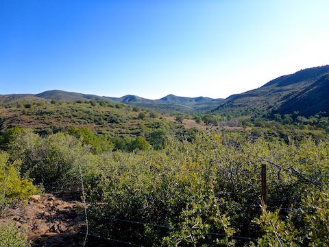
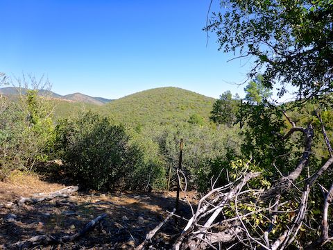
There was some nice pines and shade along Ash Creek, but I still was not actually on Medlar Springs Trail #9706, which is supposed to be jeep trail as far as Ash Creek Well. After low crawling another barbed wire fence, I was where I was supposed to be all along. The well is at the 1.5 mile mark, but it took me 2.5 miles to get there.
Ash Creek Well serves as the trailhead for Ash Creek Trail #9705, and the trail appears to continue that way, but, ducking under another barbed wire fence, I instead turned northeast towards Medlar Springs. 🧭
Medlar Springs Trail #9706 only appeared in short bits the mile between Ash Creek Well and the spring. Otherwise, it was more bushwhacking, or rocky creek bottom travel. (Though not too rocky.)
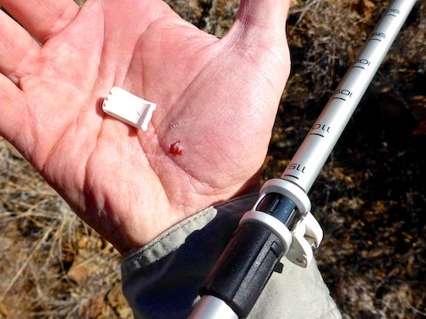
Besides the usual array of scratches and scrapes, I twice banged my head hard on heavy branches and cracked my shin hard enough it is still sore 48 hours later. The one that pissed me off though was the tension tab on my Leki hiking poles snapping off, gouging my hand. I’m sick of tension settings on hiking poles that collapse the pole (usually at very inopportune moments). My old Black Diamond poles did that as well, until I duct-taped the fuckers into permanent position. I need to find pinned hiking poles.
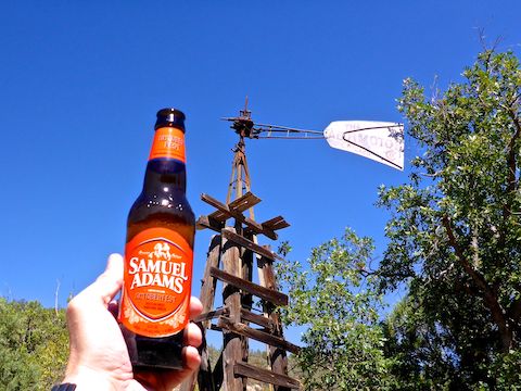
Officially, Medlar Springs Trail #9706 is 2.4 miles long. By my route, it was 3.3 miles, and with no pay off at the end: It was bone dry, with little shade and minimal view. Rather than dally, I took a few quick photos and bailed back to Ash Creek Well for my break. 🍺
Properly refreshed, and with no desire to double down by continuing up Ash Creek Trail #9705, I was back at my Acura AWD RDX in an hour, then home by 2:00 p.m.
Most of the trails I hike have something for everyone. As I alluded to above, this has nothing for anyone.
Unless you like cattle corpses, not recommended.
Directions: From Phoenix, take I-17 north. Just before the curves descending to the Verde Valley, exit west onto AZ-169. In 10.3 miles, in the midst of a scattered ranch community, turn right onto dirt Old Cherry Rd. In 1.7 miles, turn left onto FR 531. Pay attention: It’s easy to miss. In 3.4 miles, park at the turn around in front of the “No Trespassing” sign. The drive is easily SUV-able; cars not recommended.
GPS File: Medlar_Spring_Trail_9706
Distance: 7.54 mi.
AEG: 913 ft.
Time: 3h 27m
Hiking Video
Hiking Medlar Springs Trail #9706 from Preston McMurry on Vimeo.