

After hiking up Mount Peeley, I took last week off. No reason, just being lazy.
I passed through Flagstaff as recently as last October, on my way to see the fall colors in the Inner Basin of the San Francisco Peaks, but we took I-40 out to Flagstaff’s east side, rather than driving through town. Seems like a lot has changed since we last drove through the west side, 18 months ago: There’s all kinds of construction along Milton Rd., and other buildings abandoned and fenced off. Downtown, there’s a new hotel across from Wheeler Park. Flagstaff is, unfortunately, becomming more city-like with each passing year. 😕
Today’s plan was to park at the bottom of Schultz Pass Rd. / FR 420, then hike a loop of Rocky Ridge Trail #153, bits of Lower Oldham Trail #1 and Brookbank Trail #2 across the Dry Lake Hills, FR 789 (aka “Little Gnarly”) to the Sunset Trailhead, then Schultz Creek Trail #152 back to where I started.
Despite the Coconino National Forest announcing Schultz Pass Rd. being closed May 6-8, the gate a half mile past Mount Elden Lookout Rd. was open, so we parked at the trailhead there, rather than back where the two roads split. I figure I had a solid hike in front of me, so if I could save 20 minutes, I would. Like I said, lazy. 😇
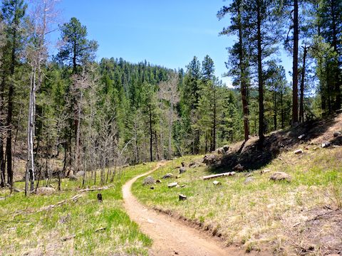
Rocky Ridge Trail #153 climbs 200 ft. in the first mile, before levelling off for the next mile to where the Arizona Trail turns south. There’s a few small boulders sticking out here & there, but the trail is in great shape.
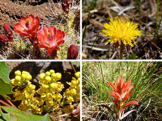
I saw precisely one blooming claret cup cactus and one indian paintbrush along Rocky Ridge Trail #153. I didn’t see another flower until the prairie in the middle of the Dry Lake Hills. There were a number of slash piles in the first two miles, including the biggest one I’ve ever seen: I swear it was 20 ft. high and 50 ft. wide! (A slash pile is where the debris from forest thinning is accumulated for a subsequent planned burn.)
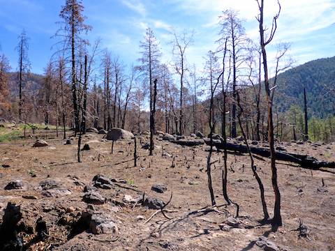
There was plenty of shade the first two miles of Rocky Ridge Trail #153; not so the third & final mile, as it lies within the Museum Fire‘s burn area: The section along Mount Elden Lookout Rd. was a moonscape: One large tree was hollowed out by the fire, and many smaller ones were burnt down to 6″ stubs. 🔥
At the intersection of Rocky Ridge Trail #153 and Oldham Trail #1, there was a Forest Service sign announcing “Trail closed to all traffic including foot traffic.” Bummer. I headed up Mount Elden Lookout Rd. instead.
In a ¼ mile, at the bottom of Brookbank Trail #2, there was another Forest Service closure sign. I could have headed back the way I came with a low drive time ROI, or snuck past the sign when nobody was looking. But then it occured to me that I swear the Museum Fire closures had recently been rescinded! Luckily I had cell signal, and was able to scroll back through the Coconino National Forest‘s twitter feed, and there it was on April 28: Closure lifted. Sweet!
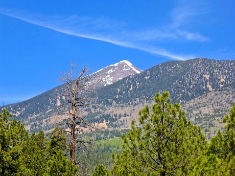
The only climb of the day was 600 ft. in the first mile up Brookbank Trail #2. Despite heavy fire damage, the dead needles in the upper reaches of the pine trees provided pretty good shade as the trail headed up canyon. Looking back, as one should always do when hiking, there were great views south across Flagstaff to the white eggshell of NAU’s Skydome, and beyond even to Oak Creek Canyon. I could not pick out my old ghetto apartment on Verde St.
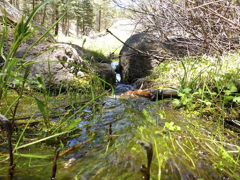
At the top of the climb, Brookbank Trail #2 splits right, continuing another two miles to Sunset Trail #23. Instead, I split left towards the prairie in the middle of the Dry Lake Hills. The prairie is only a couple of hundred yards ahead, and thankfully unburned. Rather than head straight across the prairie, I veered right along a use trail, which took me to north end of the cattle tank which is the prairie’s highlight. My position avoided taking pictures into the sun, instead giving me a quartering light, making the water & trees pop. 📸
From the tank, I hopped onto FR 789, aka “Little Gnarly”, which is wide, smooth, hard pack dirt. Easily car-drivable if it wasn’t gated off down near Sunset Trailhead. Little Gnarly had many large log decks, which are unstable, dangerous, piles of harvested logs which have been staged for transport.
After ¾ of a mile on Little Gnarly, FR 789 splits: Left is a ⅓ of a mile to Schultz Creek Trail #152; right a ½ mile to Sunset Trailhead, where Trail #152 actually begins. I’m a completist, so I went right. There were some people trailer camping at Sunset Trailhead, but there are no toilet facilities other than trees. And a sign warning about bears, because we all know bears what bears do in the woods. 💩
From Sunset Trailhead, I started down Schultz Creek Trail #152. Like previous trails, it had a great surface. Unlike the other trails, Trail #152 also had tons of mountain bikes. Thankfully, they were all considerate and friendly. Schultz Creek was moist the first ½ mile below Sunset Trailhead, then decent flow for the next mile. I ate lunch and enjoyed a hiking beer — Brouwerij Bosteels Tripel Karmeliet, a Belgian abbey beer rated 99 out of 100 — in a shady spot next to Schultz Creek.
After lunch, I hauled the last couple of miles back to where I started. I was expecting Schultz Creek Trail #152 to be shadier, but it had plenty of sun too, and my wife commented on the burn I’d acquired. 🍦
Great day and the best part was we were back home in Phoenix by 4:30 p.m.!
Schultz Pass Directions: From Phoenix, head north on I-17 into Flagstaff, as it becomes Milton Rd. After passing under the railroad tracks, turn left at the first light onto Humphreys St. In 0.6 miles, turn left on US-180. In 2.6 miles, turn right on Schultz Pass Rd. In a ½ mile, Schultz Pass Rd. splits left, Mount Elden Lookout Rd. right. There are two trailheads: The first inside split, the second another ½ mile up Schultz Pass Rd., just past the cattle guard / gate. If the gate is open, park there, otherwise back at the split.
GPS File: Dry_Lake_Hills_Loop
Distance: 11.09 mi.
AEG: 1,355 ft.
Time: 4h 02m
Hiking Video
Hiking Dry Lake Hills & Schultz Creek, Flagstaff from Preston McMurry on Vimeo.