

The last time I was in the Old Beeline Highway area was just over eight years ago, when I hiked Little Saddle Mountain Trail #244. This time, instead of following the pavement south down the Old Beeline Highway, I turned north on dirt FR 201. Though narrow & twisty, FR 201 was in much better shape than FR 172 to Woodbury Trailhead last May. It took me 40 minutes to make the 10.3 mile drive. Part of the reason I chose to hike Mount Peeley, was so I could do one of the two or three off roading videos I do every year. Ironically, both FR 172 and FR 201 are in the Tonto National Forest, even though they are 45 miles apart. 🏜
Mount Peeley is a short hike, only five miles round trip, but with a lot of bang for your buck: 1,400 ft. accumulated elevation gain (AEG) and great 360° views from the summit. Think of Mount Peeley as a more scenic, much less crowded, Camelback Mountain. And with a bit of a drive.
Make sure you do your business before you leave home: The restrooms, at the reservation station on AZ-87 in Fort McDowell, are closed due to the coronavirus panic. The next restrooms aren’t until Payson … assuming they are open. The state rest stop at AZ-87 and AZ-188, across from the Deer Creek trailhead, has been closed for years. And there is nothing at the Mount Peeley Trailhead other than bushes — which, judging by the toilet paper, has been recently used. 💩
There was a large black pickup at the Peeley Trailhead when we arrived. I assumed the driver was hiking down Deer Creek Trail #45 to Davey Gowan’s camp, or even his grave site. (Out & back to Davey Gowan’s grave is a 11.4 mile, 2,400 AEG hike; round trip to just his camp, only 2.2 miles, 850 AEG.)
It was 61° at the Peeley Trailhead, but felt warmer. The high at Mount Peeley was expected to be 81°, but it was 87° when I returned at 1:30 p.m. I was thought there would be shade at the trailhead, but no such luck. After checking out the trail map / information board — including reading the GPSJoe Domin missing poster — I started hiking just after 9:00 a.m.
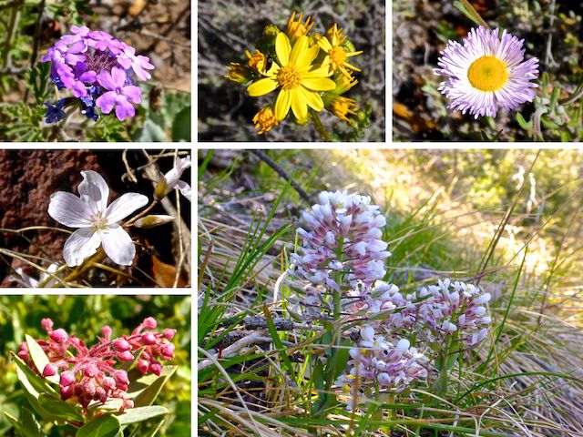
The first ½ mile has a mild grade, climbing 150 ft. to the Mazatzal Divide Trail #23 intersection. There were some very healthy patches of spreading fleabane, Gooding’s verbena and whatever that yellow flower is up there. 🤔
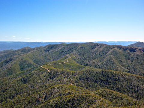
At that intersection, Cornucopia Trail #86 turns south, heading down canyon another three miles to FR 25A and the Cornucopia Mine. To continue to Mount Peeley, head up through the switchbacks on Mazatzal Divide Trail #23, which climbs 600 ft. in the next unshaded mile. I kept my pace slow & steady.
At the top of the climb, Mazatzal Divide Trail #23, turns west along the north slope of Mount Peeley. The next ½ mile has a moderate grade, climbing 150 ft. through the spotty shade remaining from the 2004 Willow Fire and 2012 Sunflower Fire. The only slightly rocky part of the first two miles was a couple of feet of step-up in this section. Otherwise the trail was in great shape.
Just past the Mazatzal Wilderness sign, there is a moderate-sized cairn, currently marked with an Arizona Trail sticker. Mazatzal Divide Trail #23, now colocated with the Arizona Trail, continues west. Instead, turn left, off trail.
I say “off trail”, but there is an obvious use trail dragged through the duff, and cairns every 50-200 ft. If you lose site of the use trail, or the next cairn, keep heading up the spur which you’ve been following up Mount Peeley’s northwest slope. (A spur is a terrain feature which is down in three directions, up in one.) There were a few easily avoided patches of manzanita, but no grab & stabs or dangerous traverses along the use trail. Other than being very steep, climbing 500 ft. in a ½ mile, the use trail was no problem at all. 👍
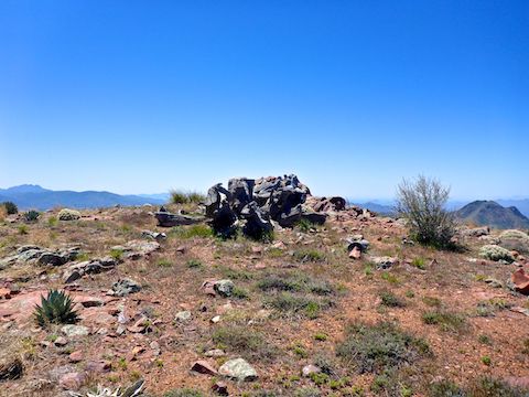
There is little shade on the use trail, and none on Mount Peeley’s summit.
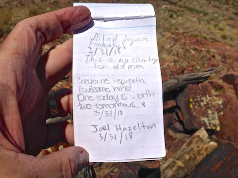
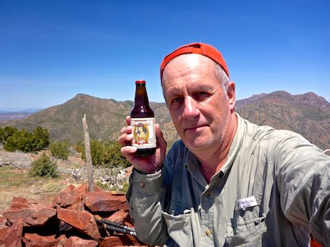
I spent over an hour on Mount Peeley’s summit, exploring, enjoying the views, taking photos and reading the summit logs. To the north, Mazatzal Peak was just visible behind two unnamed mountains. West, I could identify Horshoe Reservoir and Davenport Peak. South were Sheep Mountain (where GPSJoe disappeared), Saddle Mountain, Flatiron and, just barely visible, Weavers Needle. Southeast was Four Peaks and east, just eight miles away, Mount Ord. 🤗
I could also see the Peeley Trailhead, the black pickup being replaced by two SUVs. I waved my red hat at my wife, who I’d told to look for me, but she later said she hadn’t seen me.
It took me 40 minutes to hike off trail to the summit, but only 15 minutes to make it back down to Mazatzal Divide Trail #23. Overall, an hour all the way back to the Peeley Trailhead, jogging about a quarter of the way.
Directions: From Phoenix, exit Loop 101 at Shea. Go east on Shea to the Beeline Highway (AZ-87). Go north on the Beeline Highway for 34 miles to the Mount Ord exit / intersection. Turn west onto paved FR 627. In 1.2 miles, turn right onto dirt FR 201. Continue on FR 201 for another 9.7 miles to the end, at Mount Peeley trailhead. FR 201 is narrow & twisty; take it slow. Being Being dirt, the surface may vary, but FR 201 is currently SUV drivable. Avoid in wet weather.
GPS File: Mount_Peeley
Distance: 6.10 miles
AEG: 1,492 ft.
Time: 3h 04m
Driving FR 201 to Peeley Trailhead
Hiking Video
Hiking Mount Peeley, Mazatzal Mountains from Preston McMurry on Vimeo.