
.")
It was a frigid — by Phoenix standards — morning. Low temp was about 34℉. So, I delayed leaving home until 10:00 a.m., and even then wore a windbreaker and brought a wooly hat. I’d already had enough coffee. 🥶
The West Wing Mountain trail system can be accessed from Peoria’s Paloma Park, but most folks use the Sunrise Mountain Trailhead on Westwing Parkway. (The road is one word, “Westwing”.) Sunrise Mountain has its own trail system, south of the trailhead. While looking north, West Wing Mountain is the mile long ridgeline on the far side of the neighborhood.
Good thing I didn’t drink any coffee on the way, as the Sunrise Mountain Trailhead pisser was clogged and overflowing, while the crapper did not flush. At least on the guy’s side. I guess I could have pulled the Xer-card and tried the girl’s side.
From Sunrise Mountain Trailhead, walk west along the wide dirt path for 200 yds. to the four-way stop sign you drove through a few minutes ago. Cross catty corner, heading north along the High Desert Dr. sidewalk. At the first side road, on the left, is a metal “West Wing Mountain” sign, frequently ignored doggie doo bag dispenser, and trash can. Take that dirt singletrack trail.
The trail follows a right-of-way between private communities for ⅓ mile to another also ignored doggie doo bag dispenser, gabage can, and red Golden Cliffs Trail sign, with emergency marker WW-05. Golden Cliffs Trail, which I mostly followed, is blue diamond rated, and 3.04 miles. The blue diamond is solid — not a solid blue square, blue diamond outline, or solid black diamond — so I’m not sure what the difficulty is. 🤷🏻♂️
Call it moderately difficult. Mostly because of the four short climbs. As I hiked West Wing Mountain, 300 ft. (12%), 300 ft. (16%), 180 ft. (11%) and 100 ft. (19%, with a scramble). The middle two with only a short respite. Plus a short section of the Canyon Overlook Trail descent requiring handholds.
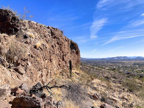
Though they have smooth sections, the West Wing Mountain trails are very rocky: exposed stone with a broken surface, scattered “baseballs”, and side boulders intruding on the path, forcing you off line. (Particularly on West Overlook Trail.) The footing is generally stable, though.
During my hike I saw a dog walker and a group of ladies on the lower parts of Golden Cliffs Trail. No horses or mountain bikes. There were no signs barring MTBs, but it would be a very difficult ride, both aerobically and technically. I’d actually like to see someone try! Canyon Overlook Trail and Western Overlook Trail are out of the question. ✋
Though not optimized for mountain bikes, West Wing Mountain trails have tons of switchbacks. Sometimes every ten feet!
I chugged the half mile up Golden Cliffs Trail to the saddle in only 12 minutes. That saddle ties the West Wing Mountain Trails together. I turned right, to hike the loop counter-clockwise, along the midslope cliff band on the mountain’s southern face. The trail descends 200 ft. Before reaching New River Dam, the trail turns north, briefly intersecting Speckled Rattler Trail and Dam Overlook Trail at 1⅔ miles.
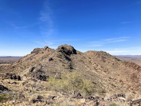
Golden Cliffs Trail then turns west, switchbacking up to Hill 1818. It may not look like a hill when the trail passes right over the top of it, but “1818” is how it is marked on the topo. Hill 1818 has nice views to the east and south, despite the lack of prominence. The trail descends, straightens out a bit, climbs to a saddle, and passes by the base of Hill 1930’s summit at 2⅔ miles. It’s only 40 ft. up. ⛰
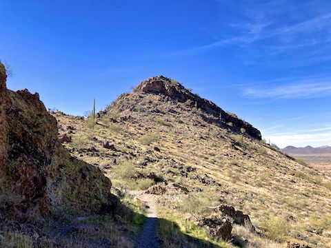
After also hitting adjacent Hill 1918, I turned on to Canyon Overlook Trail. Marked by a yellow sticker, it is rated difficult, mainly for a 100 yd. long section near the top. My old ass had to use handholds while cautiously stepping down. At the bottom was the smoothest trail of the day. The north slope was in deep, chilly shadow. I saw small sheets of graupel ice.
Back at the saddle interchange, after just under three miles, I saw a couple packing lawn chairs up Golden Cliffs Trail to Hill 1930. Never seen that before. I headed across the saddle, onto Western Overlook Trail, which is marked with a green label, and is rated difficult.
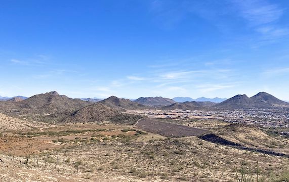
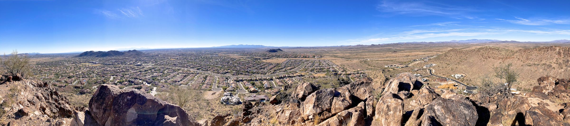
Western Overlook Trail is typical rocky goodness for about 100 yds. Then it nearly disappears in scree. Finally, it scrambles 30 ft. up a small chute before finding the trail that traverses it’s high line. A 270° viewing arc from Ludden Mountain, clockwise past Sunrise Mountain, the White Tank Mountains, Calderwood Butte, Paloma Park and even the TSMC chip fab on Carefree Highway. (panorama photo)
I ate my snack, but forgot to drink my hiking beer. From Sunrise Mountain Trailhead, Western Overlook (Hill 1846) would be a quick lunchtime hike, 2¼ miles round trip, with 460 ft. AEG (accumulated elevation gain). Like I told a couple on the way back down, a lot of bang for your buck! 👍
Directions: Really depends on where you live in the Valley. Personally, from I-17, I took exit 218, west onto Happy Valley Pkwy. In just under 7 miles, after crossing New River, turn right on 83rd Ave. In 2 miles, Sunrise Mountain Trailhead is on the left, but you can’t turn directly into it. Instead, turn left on Black Rock Blvd., then left into the parking lot, then curl right, around the church / shops to the trailhead.
Park Map: Peoria_Paloma_Preserve_Trail_Map (pdf)
GPS File: West_Wing_Mountain
Distance: 4.32 mi.
AEG: 1,085 ft.
Time: 2h 05m
Rumble Video
Vimeo Video
Hiking West Wing Mountain, Peoria, Arizona from Preston McMurry on Vimeo.