

The Phoenix metro area — aka the “Valley of the Sun” — is so large it is hard to grasp how big it really is: From Buckeye east to Gold Canyon, it is 66 miles; from Anthem south to Sun Lakes, it is 50 miles. That’s bigger than the New York City metro area from Edison, NJ, east to Bayshore, Long Island, and Staten Island north to Tarrytown, NY.
So, to drive from my home in Sunnyslope, in central Phoenix, to Queen Creek, on the outskirts of the metro area, takes a fair amount of time. At 5:30 a.m. on a Thursday morning, against rush hour, about 70 minutes. Shockingly, without encountering any Phoenix Asshole Drivers. 👍
After breakfast at the Denny’s in Queen Creek, I set about trying to find San Tan Mountain Regional Park. It didn’t show on my in-car GPS, so I had to navigate using my handheld hiking GPS.
It took me awhile, but I was on the trail by 8:25 a.m.
Though it is in Pinal County, the trails in San Mountain Regional Park are similar to the trails in any of the other desert parks in in the Phoenix area, such as Estrella Mountain Regional Park or Skyline Regional Park: Mostly wide, mostly smooth, with minimal elevation change.
There are nine trails in the San Tan Mountain Regional Park, rated from easy to “difficult”. I hiked a loop consisting of all 0.7 easy miles of the Littleleaf Trail, 0.4 miles of the “difficult” Goldmine Trail, and all 6.4 “moderate-difficult” miles of the San Tan Trail. In reality, the loop is no more difficult than hiking Charles M. Chistiansen Trail #100, only shorter. I didn’t even bring my hiking poles.
I did, however, carry my hiking pack. With low temps and 100% cloud cover, I didn’t need more than a bottle or two of water, but for training purposes I humped all the crap in my pack anyway. 💪
My first stop was the Afghanistan-Iraq War Memorial opposite the front gate. The Memorial lists the name, service, rank and date each Arizonan that died. I think Lori Piestewa was third.
After paying my respects at the Afghanistan-Iraq War Memorial, I started up the Littleleaf Trail.
Littleaf Trail: Though short, the 0.7 mile Littleleaf Trail was the rockiest part of my hike. It is only 89 ft. accumulated elevation gain (AEG) “uphill”. At both ends, Littleleaf connects to the Goldmine Trail, making for an easy 1.4 mile mini-loop. I could have just taken Goldmine, but I’m saving most of it for a future Locals’ Hike. (The term I use for metro area hikes that are not as long, with less AEG, not requiring a GPS, which avoid bushwhacking.)
Goldmine Trail: I was only on it for 0.4 miles. I think it took longer to type this paragraph than hike that wee bit. 😉
San Tan Trail: Done counterclockwise, as I did, the 6.4 mile San Tan Trail is 430 AEG; clockwise, it is 560 AEG. It didn’t have nearly as many horse 🍏’s as I remember from last time I hiked it, in 2010. The only “climb” is 200 ft. in the 0.6 miles from Rock Peak to a saddle. (I saw one guy pushing his mountain bike up it.)
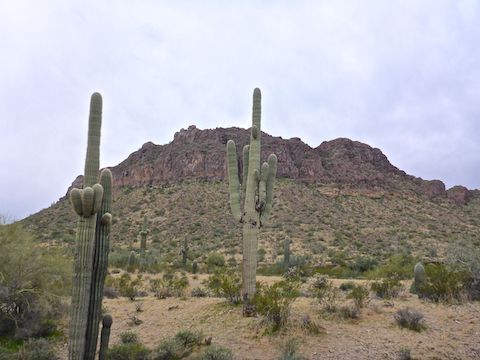
Other than that one little climb, San Tan Trail just rolls up & down small washes. It is at its best south of the Moonlight Trail intersection, where San Tan approaches the Malpais Hills cliff band, 2.4 miles to the Rock Wash Trail intersection on the northeast slope of Rock Peak. I thought I spotted one doable route up the otherwise sheer face of the Malpais Hills.
You can shave 1.5 miles off your San Trail Trail loop by cutting across the Hedgehog Trail (rated “moderate”). But I’ll hit that up on a future hike with the Malpais Trail from the Rock Peak Wash Trailhead. Maybe in 2021, as I am off to other desert parks for my remaining locals’ hikes this Spring.
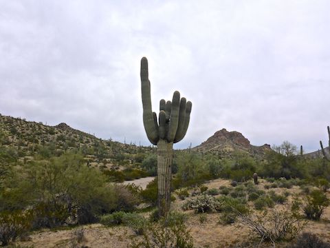
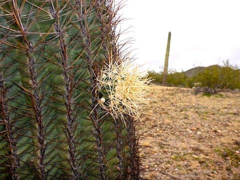
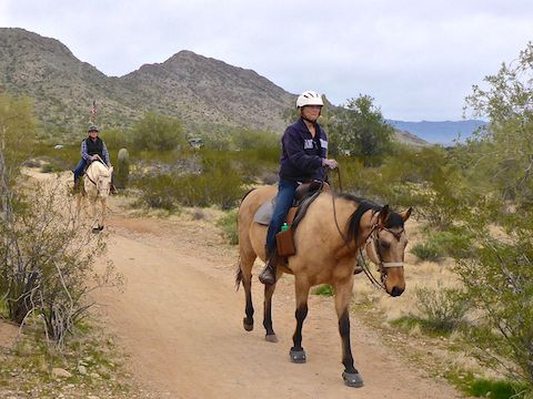
A few final notes: Mountain bikers outnumbered hikers, and with the rolling terrain, can move quite fast. Keep your head on a swivel. Also, there’s a fair number of barrel cactus and relatively young saguaro, but no grab & stabs threaten unwary hikers.
Like I say in my hiking videos, we’ll see you next week, and you have a good one!
Directions: The Valley of the Sun is a massive metropolis, so how you get to San Tan Mountain Regional Park, really depends on where you live. Generally speaking, from the Loop 202, head south on Ellsworth Rd. Or from I-10, head east on Riggs Rd. to Ellsworth Rd. In another mile, just past Empire Blvd., Ellsworth curves to the left and becomes Hunt Highway. In just over a mile, turn right onto Thompson Rd. In 2.0 miles, turn right onto Phillips Rd. The park gate is in another mile. Admission is currently $7 per vehicle.
Park Map: San Tan Mountain Regional Park (pdf)
GPS File: San_Tan_Trail_Littleleaf_Trail
Distance: 7.94 mi.
AEG: 608 ft.
Time: 2h 44m
Hike Video
Hiking San Tan Mountain Regional Park from Preston McMurry on Vimeo.