Promontory Butte – Mogollon Rim

Apache-Sitgreaves National Forest

Immature ponderosa pine cone.

My intent was to more or less follow the rim of Promontory Butte, all the way around. I figured it would be about 9 miles, 10 with wandering. However, the little side canyons I intended to mostly cut across, turned out to be a deeper and steeper than the topo implied. I could have crossed them, but instead followed their edges until it wouldn’t be quite so deep & steep, resulting in my doubling my expected mileage & time. One side canyon took me back to FR 76. I decided since I would be on FR 76 for a little bit anyway, I would just head back to where I parked, and drive my wife up to Promontory Point so she could enjoy the view as well.

Promontory Fire Lookout. I know it's been a few years, but I hate to see these things abandoned.
Promontory Fire Lookout. I know it’s been a few years, but I hate to see these things abandoned.
Goldenbanner, not sure if mountain (Thermopsis montana) or spreadfruit (Thermopsis divaricarpa).
Crossing the upper end of a side canyon. This got old quick.
New Mexico locust (Robinia neomexicana)
Looking down See Canyon. I should hike Trail #184 up to the Mogollon Rim sometime ...
Looking down See Canyon. I should hike Trail #184 up to the Mogollon Rim sometime …
Lemmon's Star (Triteleia lemmoniae), also known as Oak Creek Triteleia and Oak Creek triplet lily. Apparently rare, but I saw some five miles away along Willow Creek, just last year.
Lemmon’s Star (Triteleia lemmoniae), also known as Oak Creek Triteleia and Oak Creek triplet lily. Apparently rare, but I saw some five miles away along Willow Creek, just last year.
Pygmy bluet (Houstonia wrightii), which I've also only seen one other time, two years ago, along Blue Ridge Trail #107.
Pygmy bluet (Houstonia wrightii), which I’ve also only seen one other time, two years ago, along Blue Ridge Trail #107.
Looking southwest along the Mogollon Rim and AZ-260. I didn't really earn this hiking beer ...
Looking southwest along the Mogollon Rim and AZ-260. I didn’t really earn this hiking beer … 😏

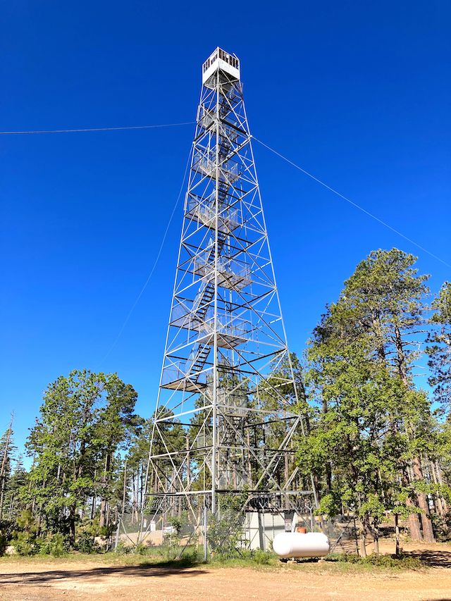
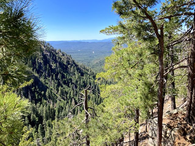
Directions: From Phoenix, head north on AZ-87, the Beeline Highway, into Payson. Turn right on AZ-260. In 29 miles, after cresting the Mogollon Rim, take the first left onto FR 300 / Rim Rd. In 3.2 miles, at the Woods Canyon Lake intersection, Rim Rd. changes to car-drivable dirt. 9.4 miles from AZ-260 is a t-intersection. Turn left. (Right is FR 34 to Winslow.) In 2.7 miles, turn left onto FR 76. The best views are in 3.7 miles, at the far south end of FR 76.

GPS File: FR76_Promontory_Butte_Mogollon_Rim

Distance: 3.48 miles

AEG: 286 ft.

Time: 1h 35m


Driving FR 76 to Promontory Point

Driving FR 76 on Promontory Butte, Mogollon Rim from Preston McMurry on Vimeo.