

Assuming the highway is not blocked due to a wildfire — more on that later — it is a 3½ hour drive from Phoenix to Pinetop-Lakeside. To maximize my drive time ROI, I tend to avoid drives longer than three hours, so I usually only hike the White Mountains once per year. In 2020, I hiked Buena Vista Trail #637; this year, Blue Ridge Trail #107.
Both trails are part of the White Mountain Trail System, which is over 160 miles of interconnected trails stretching from Pinedale, to Pinetop-Lakeside, to Vernon. (If you have a few spare minutes, it is worth a detour through Pinedale to visit Arizona’s only covered bridge.) 👍
Blue Ridge Trail #107 is a National Recreation Trail, the lowest of three tiers in the National Trails System: National Scenic Trails, National Historic Trails and National Recreation Trails. The Black Canyon Trail is also a National Recreation Trail. It sounds impressive, but there are 1,300 NRTs.
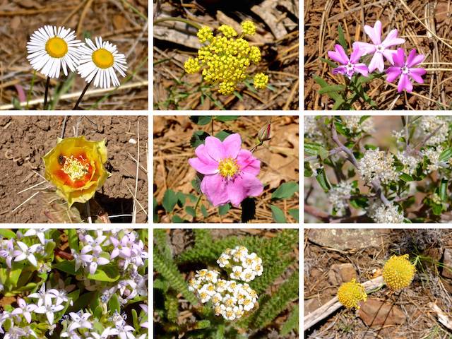
Top Row: fleabane, alpine false springparsley, showy phlox.
Middle Row: twistspine pricklypear, Arizona wild rose, ceanothus.
Bottom Row: pygmy bluet, yarrow, ???.
The basic Blue Ridge Trail #107 loop is 9.4 miles, 840 AEG (accumulated elevation gain), regardless of whether you hike clockwise or counter-clockwise, starting at Blue Ridge Trailhead #1, near the Springer Mountain Lookout, or from Blue Ridge Trailhead #2, as I did. The only difference is what you prefer first: easier hiking, or climbing Blue Ridge Mountain. Here are some other options:
- Short Lasso: In & out from the Billy Creek Trailhead adds 1.6 miles, 200 AEG, to the loop.
- Very Long Lasso: In & out from the Blue Ridge Ice Cave Trailhead adds 7.2 miles, 700 AEG, to the loop.
- Spring Mountain Lookout: A short sidetrip from Blue Ridge Trailhead #1 adds 0.7 miles, 115 AEG, to the loop.
- Figure 8: Springs Trail #633 is another loop trail, only 50 yds. from Blue Ridge Trail #107 at its closest. It adds 3.6 miles, 130 AEG, to the Trail #107 loop.
- Short Summit: Up & back to the Blue Ridge Mountain summit is only 4.1 miles, 480 AEG.
There were only two other vehicles at Blue Ridge Trailhead #2 when I started hiking at 9:40 a.m. It was breezy, but not too windy, and partly cloudy. Despite the 86,000+ acre Telegraph Fire blowing smoke from the Pinal Mountains northeast towards Pinetop-Lakeside, I saw no haze. The sky was beautiful blue. 🤗
Other than a few scattered fleabane, all the flowers I spotted were in the three miles between Blue Ridge Trailhead #2 and the Billy Creek Connector. (Or in the final half mile of the loop, from FR 9274J back to the trailhead.) The only significant flowers I remember on the other two-thirds of Blue Ridge Trail #107 were the ceanothus near Blue Ridge Trailhead #1 and the twistspine pricklypear a ¼ mile further northeast. Otherwise, fleabane were by far the most common, followed by alpine false springparsley and showy phlox.
While hiking Blue Ridge Trail #107, I saw only two mountain bikers (both polite): no horse riders, dog walkers, trail runners or other hikers. Springs Trail #633 was busier.
All single-track, Blue Ridge Trail #107 is mostly smooth and obstacle free. It crosses powerlines three times, and numerous forest roads. (FR 187 splits the loop, connecting the two trailheads.) I saw one vehicle all day.
Even near Thompson Creek and Billy Creek, the terrain is generally open forest. (Both creeks appeared bone dry.) Pines predominate on the eastern half of Blue Ridge Trail #107, with scrub oak being more common in the western half. There is enough shade to take a relaxing break, but never enough for more than a second of relief if you are moving. 😅
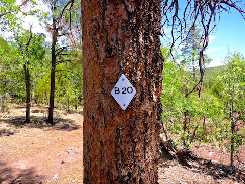
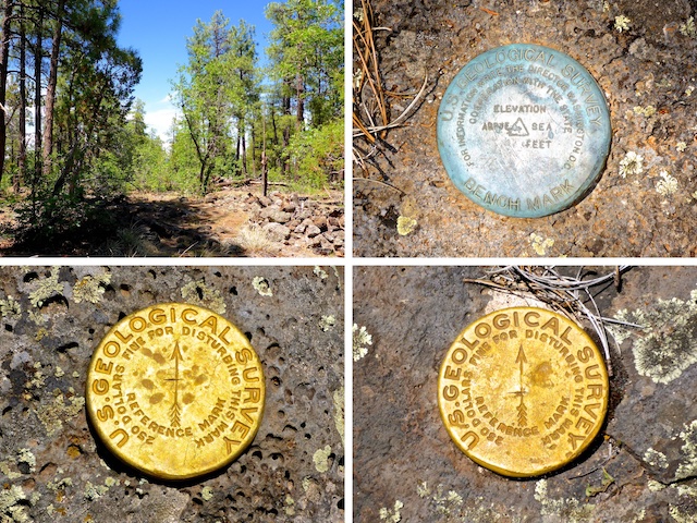
Blue Ridge Trail #107’s only climb is 550 ft. in two miles. Other than a few photos, I motored up. I don’t recall using my hiking poles all day. (Counter-clockwise, the climb is only 400 ft. in 1½ miles.) The summit of Blue Ridge Mountain is 50 yds to the north of blaze B8. I could not find a geocache. Supposedly, the summit has views, but all I saw were trees. Maybe that is why the local fire lookout is on 450 ft. lower Springer Mountain?
For once, I finished a hike quicker than expected, returning to Blue Ridge Trailhead #2 at 2:15 p.m.
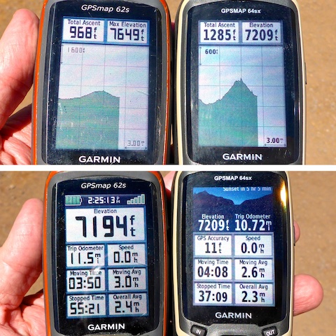
Just like last week on East Clear Creek, I carried both my crappy Garmin 62s and my new Garmin 64sx. They both seem to be fairly accurate regarding time, distance and AEG on short hikes, where I do not stop. On an “away” hike, where I am constantly stopping to take photos, things get crazy. The Garmin 64sx keeps a more accurate track — and thus more accurate (but not exact) mileage — but it keeps clocking moving time for 10+ seconds after stopping, whereas the crappy Garmin 62s stops within a second or two. The Garmin 64sx altitude is also consistently out of whack by ~50% extra AEG. And I don’t want to keep carrying them both!
On the drive home, we ran into a traffic jam in Heber-Overgaard. Turns out there was a brush fire blocking east bound AZ-260 at MP 302, just past the last Circle K in town. We crept along for 10 minutes. Then, over the course of a few more minutes, four firetrucks and a deputy sheriff headed past us, away from the fire. After that, we did not move at all for 10 minutes. Fuck me. I decided to cut my losses, turn around, and take the long route back to Phoenix via Holbrook and Flagstaff, adding over two hours to our trip. We did not get home until 8:30 p.m. 😴
Directions: Depending on where you live in the Valley, there are two general ways to get to Show Low: From the south & east Valley, take US-60 through Globe. At the Motel 6, turn left to continue on US-60. In 86 miles, in Show Low, turn right on AZ-260 / White Mountain Rd.
From other parts of the Valley, exit the Loop 101 at Shea. Go east on Shea to the Beeline Highway (AZ-87). Go north on the Beeline Highway for 61 miles to AZ-260 in Payson. Go east on AZ-260 for 87 miles to the first stop light in Show Low. Turn left on US-60. In 2.0 miles, turn right to continue on AZ-260 / White Mountain Rd.
After 13.2 miles on AZ-260 / White Mountain Rd., turn left on Buck Springs Rd. In 0.6 miles, turn left on Sky Hi Rd. / Tomahawk Rd. In 1.9 miles, turn left on FR 187. Trailhead #2 is on the right.
GPS File: Blue_Ridge_Trail_107_Loop
Distance: 10.54 mi.
AEG: 865 ft.
Time: 3h 50m
Hiking Video
Blue Ridge Trail #107, White Mountain Trail System from Preston McMurry on Vimeo.