

The head of Willow Creek is between Promontory Lookout and Carr Lake, on the Mogollon Rim. Willow Creek heads north past the Rancho Allegro site, through Bennet Butler Ranch, over Paul’s Crossing at FR 84, until seven miles later it empties into Bear Canyon at Mule Crossing on FR 89. Note: Willow Creek is not the same as Willow Springs Canyon, which is 7½ miles southeast.
Keeping with Mogollon Rim ridge-naming convention, where ridges are named after the two canyons which flank it, Bear Willow Ridge is on Willow Creek’s west flank. FR 75 and FR 34 / Wallace Rd. are on Willow Creek’s east side. Not sure what that ridge is named. 🤔
My plan was to hike FR 9443 for a mile, to bypass Bennet Butler Ranch, drop into Willow Creek at the ranch’s north gate, hike down canyon to Paul’s Crossing, then double back on decommissioned FR 9443. It didn’t look like it would be too difficult, but on the Mogollon Rim, looks can be deceiving!
The low temperature in nearby Forest Lakes was supposed to be 31℉, but by the time I started hiking at 8:30 a.m., it was up to 45℉. With a cloudless sky, and no wind until afternoon, the weather was perfect. 🤗
From Wallace Rd., FR 9443 descends 50 rocky feet to a trail split. Go right. Just past the split is a large log blocking the decommissioned forest road. I was kinda surprised the log wasn’t at Wallace Rd. Just over a mile into the hike, there was another log blocking the road, but it is sawed through, and in any case routed around. That is where I dropped 120 steep, but mostly obstacle-free, feet down to Willow Creek.
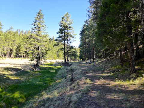
Angling right on the way down brought me to Bennet Butler Ranch’s north gate. I had intended to follow the shelf of Willow Creek, but FR 9419A was right there, so I followed it instead. The creek bottom was grassy, with many shallow pools, but no flow.
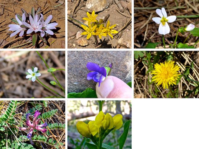
Top Row: short-sepal bitter-root, Lemmon’s star, Canada violet.
Middle Row: northern rockjasmine, northern bog violet, dandelion.
Bottom Row: ashen milkvetch, spreadfruit goldenbanner.
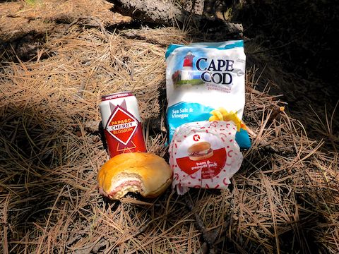
Initially, it did not appear there would be many flowers, so I took pictures of everything I found, including garbage. I ended up packing out a Gatorade label, ten beer cans, and an empty quart of motor oil. By the time I started back on FR 9443, my pockets were full of crushed beer cans. 🚮
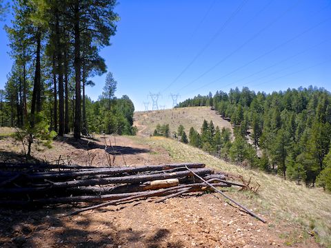
A mile down Willow Creek, the jeep trail splits: Left to stay on FR 9419A, right for a short loop (4.2 mi., 290 AEG) out of the canyon, back on FR 9443. A ¼ mile past the split, FR 9419A peters out. There are also bail points / shorter loop options at the power line (7.2 mi., 430 AEG) and a foot trail up to Ives Mesa Tank (8.5 mi., 490 AEG).
After the FR 9419A split, the next 2½ miles along Willow Creek has some rocky spots and minor deadfall, but plenty of shelves, so the canyon crawling never gets difficult. There are fewer, smaller, pools. The canyon never gets too deep, nor too steep. Certainly no cliffs.
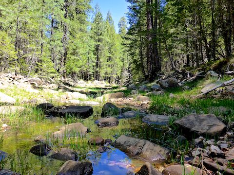
Despite the lack of flow in Willow Creek, there was plenty of evidence of relatively recent flooding, in the form of several patches of long grass bent in a downstream direction. I wonder how long it takes for grass to straighten itself after a flood?
After hiking 4¾ miles — 3¾ at the bottom of the canyon — Willow Creek reaches FR 84 / Bear Willow Rd. at Paul’s Crossing. I turned east, uphill, along Bear Willow Rd. After 300 yds., FR 9443 is on the right. Remember the road blocking logs earlier? Hoo, boy, you ain’t seen nothin’ yet … 😳
There are downfall roadblocks all along FR 9443. Some are a single large log, some are stacked smaller logs, and some are smaller logs spread out horizontally. Almost all the roadblocks are placed so that it would be difficult for a vehicle to drive around it, upslope or downhill. I bet there are twenty roadblocks. Some are less than 100 ft. apart!
There’s a large cattle tank ¾ mile south of Bear Willow Rd. Given the dry winter, I’m surprised it was full. Though not marked on the topo, my GPS map showed a spring is slightly upslope. Apparently, the spring is part of Ives Mesa Camp. I didn’t check out the spring or camp.
FR 9443 winds south four often rocky miles back to the drop in point, five to the trailhead. FR 9443 is generally mid-slope above Willow Creek: It nevers gets more then 100 yds. away, and 80 ft. upslope, of the canyon bottom. So, if you are not near one of the bail points I mentioned earlier, bailing would never be too difficult. 🪂
After I finished my hike, my wife and I stopped at Woods Canyon Lake’s bait shop, for a post-hike adult libation, a second lunch and — like I told the counter lady — the main reason I hike on the Mogollon Rim: Good Humor ice cream.
Directions: From Phoenix, head north on AZ-87, the Beeline Highway, into Payson. Turn right on AZ-260. In 29 miles, after cresting the Mogollon Rim, take the first left onto FR 300 / Rim Rd. In 3.2 miles, at the Woods Canyon Lake intersection, Rim Rd. changes to car-drivable dirt. 9.4 miles from AZ-260 is a t-intersection. Turn right onto FR 34. In a half mile, just past FR 34B, there is a small, rough, unsigned jeep trail on the left. Pull in there, and park at the fire ring. (If you continue north, you can drive FR 34 to Winslow.)
GPS File: Willow_Creek_Mogollon_Rim
Distance: 11.62 miles
AEG: 601 ft.
Time: 4h 34m
Hiking Video
Hiking Willow Creek – Mogollon Rim from Preston McMurry on Vimeo.