

My first “away bike” of the summer was in an area I’d only skirted before: Anderson Mesa. (In 2017, I hiked from Marshall Lake to Flagstaff via Fisher Point, and in 2018 I hiked Arizona Trail segment 29 to Mormon Lake.) I want to bike the Waterline Trail from Schultz Pass to Inner Basin this Fall, so I figure I need to get in some high elevation MTB rides over the next couple of months.
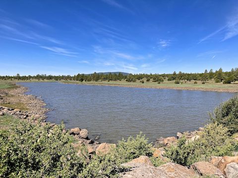
Back in 2018, and as long as I can remember — I first moved to Arizona in 1984 — Mormon Lake has been dry. Due to bountiful snow, this Spring it is full — as are the lakes just east of it on Anderson Mesa. Two weeks ago, azbackpackr, posted photos of a full Ashurst Lake. Bingo. Great idea! I would have been up there last week, but life intervened … 🕊
Hoping after two weeks there would still be some water in the Anderson Mesa lakes, my plan was to do a rough figure-8 of FR 82; FR 9485E past Coconino Lake and Breezy Lake; FR 9484F and FR 9116 past Boot Lake, Unit East Tank and Replacement Tank; past Long Lake on FR 9117A and FR 9118V; past Indian Lake; then back to Ashhurst Lake on FR 9118W and FR 740. I rolled out at 9:00 a.m.
I was expecting to ride old jeep trail along the east shore of Ashurst Lake, but I was not expecting to barely be able to detect it, nor to having to follow a foot trail along the slope of a levee. The jeep trail was marked with a yellow Forest Service “Road closed to motorized vehicles: foot and horse travel permitted” sign. Since it’s not an official wilderness, I assumed mountain bikes are allowed.
After dumping my bike in a canal this winter, I walked it across Ashurst Run, the creek which feeds Ashurst Lake. After crossing Ashurst Run, I rode on decent FR 82 for a hundred yards to where it splits left before proceeding southeast across Anderson Mesa. Instead, I split right onto FR 9118J to Coconino Lake. FR 9118J was rather rocky in spots. 🌊
Coconino Lake is a 28 acre reservoir formed by earthen Coconino Dam across Ashurst Run. A fuel-powered external pump was loudly draining Coconino Lake, feeding water into Ashurst Run on the other side of the dam. Coconino Dam has a dam screw, like Woods Canyon Lake, but I don’t think it does anything any more.
I thought there would be a jeep trail across the top of Coconino Dam, and down the spillway, but there wasn’t. I rode across the dam, then hike-a-biked down the disused spillway. In 200 yds., I reached FR 82 at a pleasant three acre pond. At the pond, FR 82 crosses a fence marked by a “wildlife protection area” sign, indicating the far side of Anderson Mesa is closed to motorized vehicles from April 15 – June 27. 🚫
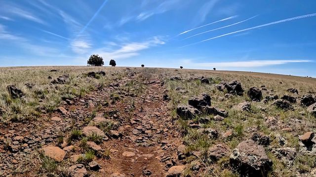
FR 82 gets rougher, but still decent, as it heads southeast towards a powerline. In ⅔ mile, I split left onto FR 9485E, which I stayed on the next 3⅓ miles to Boot Lake. FR 9485E crosses under the powerline at the same time the powerline crosses the footprint of intermittent, 103 acre, Breezy Lake. I rode across dried out tire ruts and cattle tracks, then began a gradual climb along Breezy Lake’s green east shore.
FR 9485E became rough & rocky. I spotted a vehicle’s plastic bumper cover above Breezy Lake’s tiny remaining wet spot. The roughness of the road makes the three shallow climbs much more difficult than they would be on even decent dirt. I never fell, but I freely admit to dabbing on several occasions.
On my GoPro Hero 10 Black settings — 30 fps, 1080p — I was getting about 1h 45m on a full charge. (For some reason, it shuts off at 14%.) My last several times out, I’ve only been getting around 1h 30m. Just before the chain-latched first gate, while I was actually looking at the charge, my GoPro shut down.
From the first gate, FR 9485E descends 50 ft. in ¾ mile to Boot Lake. First through juniper and pinyon; small pine nearer Boot Lake. The wire-looped second gate is just above Boot Lake. Midway between the two gates is a carbonite FR 9485E post. Given the trail conditions, it seemed like a cruel joke. 😏
The National Park Service hike difficulty formula is √(AEG * 2 * miles) = rating. For example, a 10-mile hike with 2,200 ft. of accumulated elevation gain would have a difficulty of √(2200 * 2 * 10) = 209.8. The formula does not take into account elevation where the hike starts, or reaches its maximum. Nor does it calculate weather or difficulty of the surface. My planned route was rated 104.3, but I did not relish looping around Boot Lake, or diverting to Long Lake, on likely even worse jeep trails. I decided to bail.
I walked, off and on, about half the 3⅓ miles back to the powerline. Mostly the uphill parts. The slight elevation above Anderson Mesa had nice views to the north. Besides the obvious San Francisco Peaks, I was able to pick out Kendrick Peak, Mount Elden and Sunset Crater. Not sure how full it actually was, but 280 acre Long Lake looked healthy. I thought I saw pronghorn (!), but they turned out to just be elk.
Back at the powerline, rather than continuing on to FR 82, I turned right up FR 9118W, the powerline road. The 1⅔ mile section of FR 9118W wasn’t bad at all. I never did spot FR 9118V to Long Lake, affirming my decision to bail. The descent to the corral at FR 740 was quite rocky, but I rode it all the way. Confused by the intersection, I first rode past it. FR 740 is an X, not a +, so turn sharp left & back.
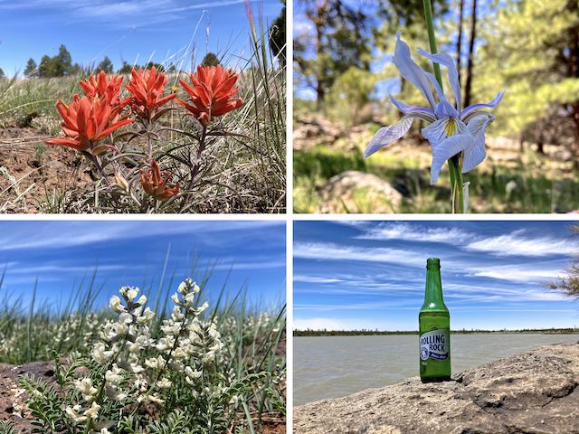
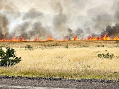
From the corral, it was only a mile on FR 740 and FR 82E to the FR 82T campground which served as my trailhead. After refreshing with a V-8 and a Rolling Rock, my wife and I headed back down to Phoenix. After climbing up I-17 from Camp Verde, my wife spotted smoke ahead. After clearing the Sunset Fire, we stopped at Culver’s to pick up dinner. Peach cobbler is the best custard flavor ever! 🤗
Directions: From Phoenix, head north on I-17. Rather than continue into Flagstaff, then backtrack on Lake Mary Rd., instead exit I-17 onto Stoneman Lake Rd. (exit 306). Drive East on Stoneman Lake Rd. / FR 213. After 14.6 miles, turn left on Lake Mary Rd. After 17.2 miles, turn right on Ashurst Lake Rd. / FR 82E. It is car-drivable dirt. In 3.9 miles, you will arrive at Ashurst Lake. Park wherever. Personally, I looped around to the east shore.
GPS File: Anderson_Mesa_Ashurst_Lake_to_Boot_Lake
Distance: 12.31 miles
AEG: 302 ft.
Time: 3h 10m
Biking Video
Mountain Biking Ashurst Lake to Boot Lake from Preston McMurry on Vimeo.