

Often accompanied by my hiking buddy Prescottstyle, I’ve hiked 53 of the Prescott Circle Trail’s 56 dirt miles. All clockwise. Not counting the currently paved 1½ miles along Williamson Valley Rd. (Driving it numerous times counts.) The missing mileage is the 2⅔ dirt miles between Willow Creek and Watson Lake. Because it’s next to Willow Lake Rd., the idea of hiking it didn’t thrill me. So, I procrastinated.
Until I figured out a way to extract some value from the segment: I planned to hike outbound on a birdwatching trail through some woods, explore a bit of the Granite Dells, hop on the actual PCT at the Willow Lake Rd. trailhead, then stroll the final roadside mile to Watson Lake. Nearly two miles of things to look at. Then return via Jan Alfano Trail — the official Prescott Circle Trail segment.
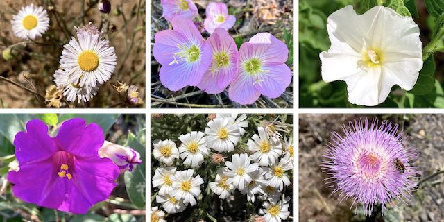
Top Row: spreading fleabane, pinkladies, field bindweed.
Bottom Row: Colorado four o’clock, heath-leaved chaetopappa, New Mexico thistle.
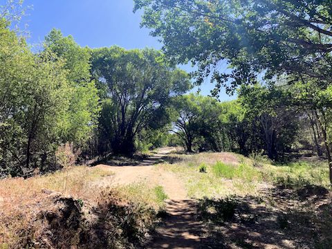
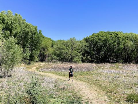
We started hiking at 9:00 a.m., but accidentally turned right out of the Willow Creek Park trailhead. It took us a quarter mile before I realized our error. Back at the trailhead, we instead went straight. After crossing 300 yds. of what I can only describe as a borrow pit for trail materials (e.g., wood chips), the nature trail enters the woods. The shady trail weaves between dried out bogs for the next half mile.
Arriving at the Granite Dells, we started picking our way up the spheroidal weathering. (Fancy science talk for rounded rock formations.) It was not a straight shot to the high point. We were almost there but, just 50 ft. short, had to turn around and try again, due to an intervening crevice where the gap was too wide to cross, and too narrow to get down & up. Certainly not without shoes grippier than my Oboz.
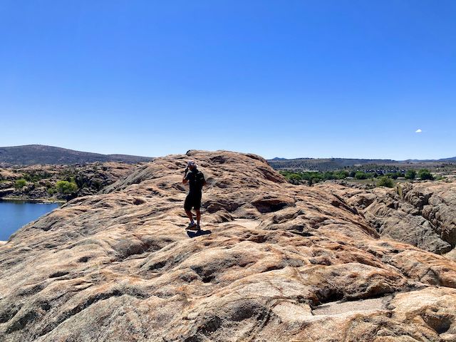
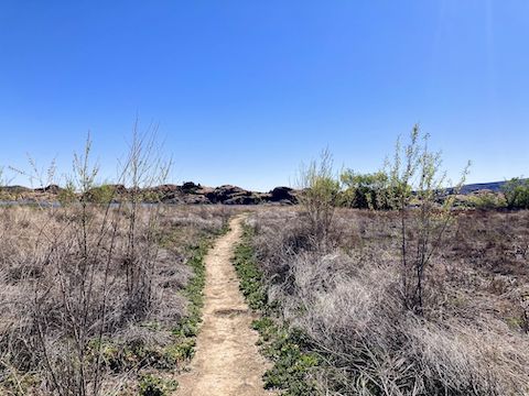
We enjoyed the panoramic views for 15 minutes, then headed down much quicker than we ascended. We followed a use trail south for 100 yds., joined the Prescott Circle Trail through a 50 yd. section of pinyon and juniper, then split left along the southern base of the Granite Dells. There followed a final shady quarter mile of use trail.
We joined the Prescott Circle Trail proper at the Willow Lake Rd. trailhead. We petted a friendly Rhodesian Ridgeback for a few minutes, then strolled the next ¾ roadside miles to the AZ-89 traffic circle. There’s a crossing button, but good luck when there’s no freaking signal! We jogged across, unsmooshed. Watson Lake Park is on the east side of AZ-89. No entrance fee for pedestrians.
After 10 minutes enjoying the Watson Lake vista (see video thumbnail below), we started back. We ran the AZ-89 gauntlet, then popped into Gilligan’s for refreshment. I chugged a Gatorade, and wolfed a burger, and got two waters to go. (I was draining my Camelbak quicker than expected). Sammies Burger Joint, next door, has the best 🍔s in Prescott, but I didn’t want to wait.
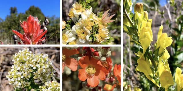
Top Row: indian paintbrush, Stansbury’s clifrose, Dalmatian toadflax.
Bottom Row: ???, Rusby’s globemallow. (More high country flowers.)
Properly rehydrated, we zipped the 2¼ actual Prescott Circuit Trail miles back to Willow Creek Park in only 48 minutes. After my wife always helpful wife collected us, it was off to La Casa Prescottstyle, for further refreshment, and sneaking of treats to Lily. (Olive was getting her teeth cleanded at the vet.) 🐶
Willow Creek Park Directions: From Pioneer Parkway, around the north side of Prescott, turn south on Willow Creek Rd. In 1.9 miles, , across from the Toyota dealer, turn left into the park. Parking is free.
Watson Lake TH Directions: From Pioneer Parkway, around the north side of Prescott, take exit 317, south onto AZ-89. In 3.0 miles, at the traffic circle, Watson Lake Park is on the left. Alternately, from Willow Creek Park, go south on Willow Creek Rd. for 0.5 miles, turn left on Willow Lake Rd., head east for 2.1 miles, and the park entrance is on the opposite side of the traffic circle. Parking is $5.
GPS File: PCT_Willow_Creek_to_Watson_Lake
Distance: 7.03 miles
AEG: 360 ft.
Time: 2h 55m
Rumble Video
Vimeo Video
Prescott Circle Trail: Willow Creek to Watson Lake from Preston McMurry on Vimeo.