
 from Dana Point, past Laguna Beach, Two Rock Point, Emerald Point, Abalone Point, Crystal Cove, Catalina Island (distant), Reef Point, Palos Verdes (distant), and Pelican Point, to Newport Beach.")
Second year in a row visiting my Aunt in Orange County, for her birthday. This time, I gave myself an extra day so I could get a hike in. I try to hike everywhere I visit — though sometimes it doesn’t work out, like Singapore.
I looked for something within an hour of where we staying, at the Ayres Suites Missio Viejo, on Los Alisos Blvd. at CA-241. Despite it being Memorial Day monday, Crystal Cove State Park fit the bill: It’s basically a straight shot down El Toro Rd. (Then a few miles of Laguna Canyon Rd. / CA-133 to Laguna Beach, followed by a few miles north on PCH.) We left at 7:00 a.m. to beat the holiday horde.
The paper map the guard hands you at the Crystal Cove State Park gate has a number of suggested routes, but I had already planned to hike a loop of Moro Canyon Trail, Missing Link Trail, Moro Ridge Road, and B.F.I. Trail, from the Lower Moro Parking Lot. Clockwise, so the Pacific Ocean vista would “open up” on the return leg, rather than be at my back, or hidden by dense foliage.
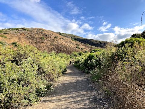
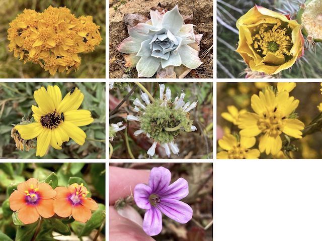
I started hiking at 7:50 a.m. The Lower Moro Parking Lot was 10% full. Being unfamiliar with coastal California blooming patterns, I took my first flower photos in the parking lot, as I was not sure if I would find much further up Moro Canyon. I needn’t have worried. In all, I photographed 25 flower species, and a non-blooming succulent. But there were more flowers than that, plus coastal cholla.
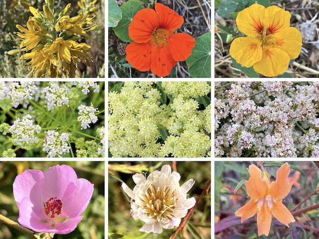
Top Row: bladderpod spiderflower, monk’s cress (red and yellow).
Middle Row: poison hemlock, blue elderberry, California buckwheat.
Bottom Row: chapparal mallow, cliff aster, San Diego monkeyflower.
Moro Canyon Trail is 3.1 mi. long. At 1.0 mi., Moro Canyon Trail intersects the East Cut Across / I Think I Can trail, linking to Moro Ridge Road, for a 4.1 mi., 750 ft. AEG loop. At 1.1 mi., the West Cut Across / Mach One / Poles trail junction makes for a 2.7-3.5 mi., 500 ft. AEG, loop via the free upper parking lot. Each intersection has a map board, with a red grommet indicating current location.
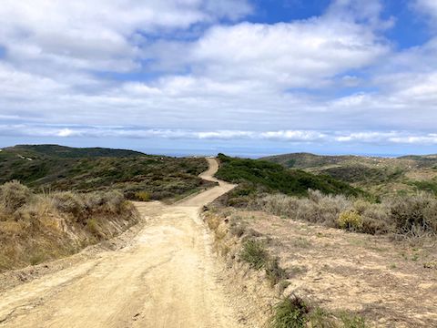
Though rolling up & down, Moro Canyon Trail steadily gains altitude. The exception is 1.8 mi. in, where Moro Canyon Trail gains 150 ft. at 17.8% grade. But by then my legs were warmed up. End-to-end, Moro Canyon Trail is a modest 3.7% grade. There are multiple signs warning hikers to stay on trail, but with as much tangled brush as there is, you would have to be a masochist to attempt bushwhacking.
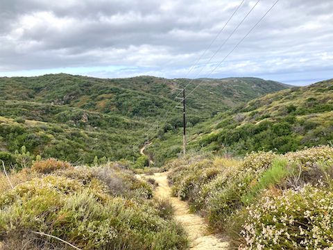
At the end of Moro Canyon Trail, you have a choice: Left on moderate Elevator Trail to Bommer Ridge Road, or straight up the powerline. I chose the powerline, but Elevator Trail is only an extra quarter mile. The powerline climbs 125 ft. in its first 125 yds., a whopping 37.8% grade! I saw no bikes attempting to kamikaze a descent. There weren’t many flowers, other than California buckwheat.
Gate 11 is at the top of the powerline trail. Gate 11 ties together Fenceline Trail, Missing Link Trail, and Bommer Ridge Road. While Moro Canyon Trail is road-like doubletrack, Bommer Ridge Road is an actual road. (Though dirt, as are all the trails in Crystal Cove State Park.) I opted for Missing Link Trail.
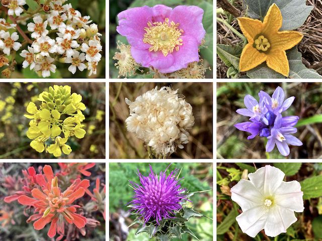
Top Row: toyon, California wild rose, buffalo gourd.
Middle Row: shortpod mustard, California cudweed, blue dick.
Bottom Row: coast indian paintbrush, milk thistle, island false bindweed.
Missing Link Trail is very popular with bikes. It is twisty & narrow singletrack, bordered by dense brush. Keep your eyes peeled! That said, all the bikers were righteous. Missing Link Trail also had the best California buckwheat I found. Some very dense clusters, such as the one on the video thumbnail, below.
Missing Link Trail climbs 80 ft. in a half mile, to a small hilltop, the physical high point of my loop. The Missing Link hilltop had decent views to the east: Laguna Canyon and El Toro Rd. were just out of sight, below the CA-73 tollroad cut in Aliso Viejo. On a clear day, the Santa Ana Mountains would be visible. I joined Moro Ridge Road 4.0 mi. into the loop, 200 yds. from Bommer Ridge Road.
Moro Ridge Road is 3.5 mi. long, dropping 740 ft. between Bommer Ridge Road and B.F.I. Trail. Moro Ridge Road is wide. It’s smooth. It’s popular. But there is plenty of space, so even on Memorial Day, it was never crowded. (Unlike Piestewa Peak in Phoenix.) Mountain bikers were pedaling uphill faster than I hiked downhill, and I was moving pretty good! (My average speed was 2.8 mph.)
Descending Moro Ridge Road, Emerald Canyon was to my left, Moro Canyon to my right. Across Emerald Canyon, is Bommer Ridge and, on the far side of Laguna Canyon, Top of the World. There’s other city and Orange County trail systems down there that tie into Crystal Cove State Park.
Top Row: golden yarrow, chalk dudleya, coastal prickly pear.
Middle Row: California brittlebush, black sage, cluster tarweed.
Bottom Row: scarlet pimpernel, Mediterranean stork’s bill.
The most common flower on Moro Ridge Road were cluster tarweed, plus some more San Diego monkeyflower and, of course, California buckwheat. As far as flowers go, Moro Canyon Trail was definitely the pick of today’s trails. Besides my usual resources WildflowerSearch and iNaturalist, I also found CalFlora and Plants of Crystal Cove useful.
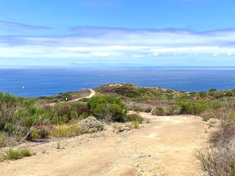
Abalone Point Lookout is not obvious from Moro Ridge Road. The foot path to it is exactly 7.0 mi. into this loop, 150 yds. west of the powerlines. (There’s lots of powerlines in Crystal Cove State Park!) With expansive 170° views, from Dana Point to Palos Verdes, Abalone Point Lookout would be a good place for a picnic. In & out from Lower Moro Parking Lot is 1.5 mi., 450 ft. AEG.
Big “Fat” Incline — or decline, in my case — begins here, even though it is still 0.3 Moro Ridge Road miles to the actual B.F.I. Trail junction. Big “Fat” Incline sure seemed steep, but overall has “only” a 10.9% grade. (By comparison, North Mountain, in Phoenix, is 16.5%.) Nearing the bottom of B.F.I. Trail, about to overtake a couple of hikers, I slipped. 🏄🏻♂️ Staying upright, I commented “Surf’s up!” They laughed. 😆
My hike ended after 7.8 mi., at 11:40 a.m. (I log more miles than the route due to wandering.) After a quick post hike V-8 — potassium & sodium! — in a now packed Lower Moro Parking Lot, we fought our way through mid-day Laguna Beach traffic, back to Mission Viejo. Wish my wife & I had had the time to visit the Crystal Cove beach!
Directions: Whether driving south from Newport Beach, or north from Laguna Beach, you will be on Pacific Coast Highway (US-1, locally referred to as “PCH”). At School – State Park road, turn inland. In 300 yds., turn right. If you then make an immediate left, and don’t mind a bit of extra walking and AEG, parking is free. Else it is straight to the gate; admission currently $20. From the gate, wind downhill a half mile to Lower Moro Parking Lot. Watch out for pedestrians!
GPS File: Moro_Canyon_Missing_Link_Moro_Ridge
Distance: 8.28 mi.
AEG: 1139 ft.
Time: 2h 56m
Rumble Video
Vimeo Video
Hiking Crystal Cove State Park, California from Preston McMurry on Vimeo.