

After a complete lack of flowers at Picacho Peak and Phoenix Sonoran Preserve the last two weeks, I decided to skip this week’s scheduled Phoenix-area flower hunt. Instead, I contacted my hiking buddy Prescottstyle, to see if he wanted to do something up near him on Saturday?
He responded with two options: Old Military Trail #1 and Hyde Mountain Trail #6. Both are 35+ miles northwest of Prescott, off Williamson Valley Rd., in remote Yavapai County. (So far out, I had to check the trails weren’t in Mohave County or Coconino County!) 🗺
Given the length of my drive from Phoenix, and afterwards back home, I picked the shorter Hyde Mountain Trail #6, which has the bonus of summit views and a historical fire lookout.
Traffic has gotten much heavier in Phoenix the last few weeks, post-Wuhan flu, but on Saturday after 6:00 a.m. I-17 and AZ-69 were not bad: No material at all for Kingsnake’s Dashcam. (I wish I could say the same for the living hell I-17 was later that afternoon.) I picked up Paul and his pooch Lily in Prescott around 8:00 a.m.
We headed north on Williamson Valley Rd. Your last chance for fuel, ice, snacks, etc. before Seligman, 62 miles north, is the combination gas station / fire station / sheriff’s substation on the corner of Outer Loop Rd. Just before Williamson Valley Rd. changed to dirt, we turned left onto dirt Camp Wood Rd. ⛽️
Camp Wood Rd. crosses Hitt Wash and Williamson Valley Wash before entering a large burn area between Johnson Mountain and Cottonwood Mountain. I tried googling the fire, but found nothing. It appears recent, maybe 2020, due to the lack of new grass or shrubbery.
The Hyde Mountain Trail #6 hike starts by heading back a few yards on FR 95C, then turning right up an unnumbered jeep trail. The jeep trail has a couple of pullouts you could park on instead, but it saves no appreciable distance. The jeep trail ends, and turns into actual hiking trail, after a ¼ mile.
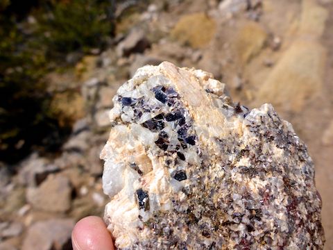
After crossing Stringtown Wash, which had running water, Hyde Mountain Trail #6 climbs 200 ft. in a ⅓ of a mile. At the top of the climb, on the left, is a small Balance Rock. Paul was also mineral hunting, finding several good samples of muscovite, which in the Santa Maria Mountains has thin, silvery, layers. Every time we stopped, Lily would whine to keep moving. 🐶
Past the Balance Rock, Hyde Mountain Trail #6 seemingly levels off the next ⅔ of a mile, but still climbs 300 ft. There is lots of pinyon and juniper along the trail, which was littered with lavender juniper berries. Between the Balance Rock and the junction of Grapevine Springs Trail #9825 — marked by a broken wooden “⬅ Brown Spr.” sign — there are several absolutely massive manzanita. (One had a 14″ trunk, and another may have been two feet!)
Hyde Mountain Trail #6 then begins its summit push, climbing 1000 ft. in a mile. It felt less steep than it is, due to the long switchbacks. Above Trail #9825, I saw some folded dollar bills, that I at first thought was a Jack Chick comic disguised as money. (I’ve seen that trick before.) 😏
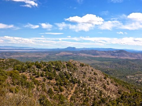
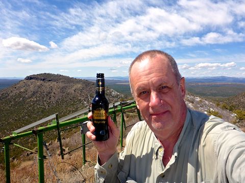
There’s a good shade alligator juniper at the Lower Saddle, but the views from the Upper Saddle are much better. Paul and I took pictures while Lily played in the snow. (There was still spot snow in the shade above 6,000 ft. on north-facing slopes in the Santa Maria Mountains.)
Hyde Mountain Trail #6 is rocky for most of the first two miles, but between the Upper Saddle and the summit it is grassy. The sky was sunny when we started, by the time we reached the summit, clouds started rolling in. It was so windy I had to pocket my baseball cap, giving me an earache.
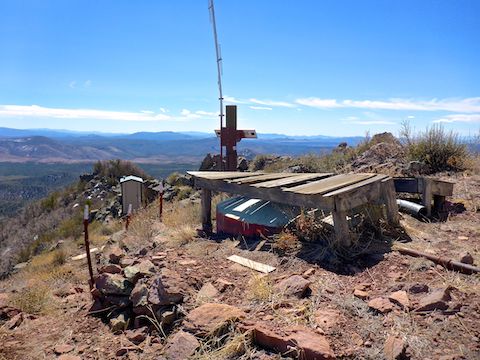
The Hyde Mountain Lookout was established in 1936, and abandoned some time between 1985 and 2004. (The lookout, S. Booth, carved a wood sign each fire season he worked, most recently 1985, and a 2004 HikeArizona.com triplog indicated the shelter was boarded up.) I tried the door, but it was locked, so I settled for shooting a few pix through a grimy window.
On the east side of the Hyde Mountain Lookout, was a “power box” containing at least five 12v batteries. There were also several old solar panels on the summit. There were so many ladybugs next to the power box, I horked one! 😳
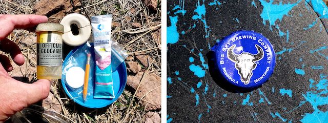
The Camp Wood 2 benchmark was vertically placed on a boulder on the south side of the Hyde Mountain Lookout. The geocache was a few feet away, next to reference mark 2. (Reference mark 1 is close to the power box.)
After nearly an hour on the Hyde Mountain summit — it didn’t seem that long — we headed back down, reaching the trailhead on FR 95C around 2:00 p.m. It’s a bit of a drive, but I really enjoyed it. Recommended! 👍
Directions: From Pioneer Parkway in Prescott, head northwest on Williamson Valley Rd. In 19.6 miles, turn left on Camp Wood Rd. / FR 21 / Yavapai County 68, which is car-drivable dirt. In 15.4 miles, turn right on FR 95. In 0.3 miles, turn left on FR 95C, which is not car-drivable. In 1.8 miles park on the left.
GPS File: Hyde_Mountain_Trail_6
Distance: 5.49 mi.
AEG: 1,605 ft.
Time: 2h 48m
Hiking Video
Hiking Hyde Mountain, Santa Maria Mountains from Preston McMurry on Vimeo.