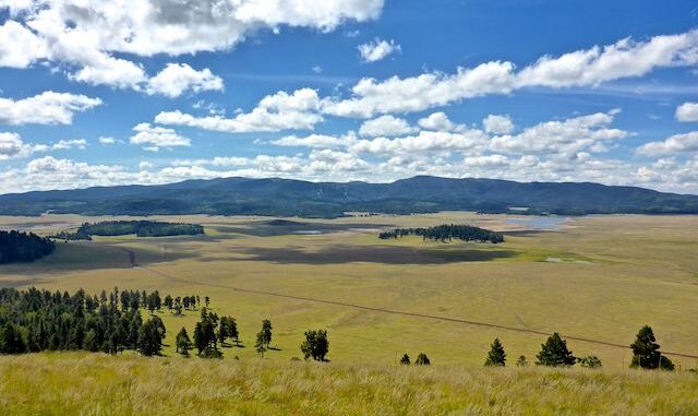
If fall color in Lockett Meadow, near Flagstaff, around 8,600 ft. elevation, peaks the last week of September, then surely the area around Greer, at the same elevation, should do likewise. Right? Right???
Well, last year on Greens Peak that turned out not to be the case. At least not to any significant degree. This year, I figured I would hike a combination of trails in the Pole Knoll Recreation Area — including summiting Pole Knoll itself. ⛰
My plan was to hike a roughly 5½ mile counter-clockwise loop of Pole Knoll Trail #602, Grouse Trail #602G, Viewpoint Trail #602H, Summit Trail #602J, Osprey Trail #602C and Raven Trail #602B. (See the GPS route attached below.) I chose that route as it either travels through, or adjacent to, the thickest forest on Pole Knoll. Overall, there are 18½ miles of trails in the Pole Knoll Recreation Area.
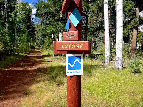
There are many use trails mixed among the named & numbered trails. Some of them more obvious than the official trails. The difference is that the path of official trails is marked by blue diamonds. The only difference in color, or shape, is for difficulty, which follows skiing convention. Personally, for hiking, I would rate no trail more than moderate.
I started hiking counter-clockwise on Pole Knoll Trail #602 at 10:20 a.m. Pole Knoll Trail #602 is old jeep trail for ⅓ mile. The trail then splits: Right is more casual strolling, while left is rather rocky. I went left. Rated “difficult”, it was similar to hiking a Mogollon Rim creek bottom (minus the deadfall). The rocky section is only 150 yds. long. If you mind your footing, no problem. 👣
Back on old jeep trail, at ¾ miles I split left onto Grouse Trail #602G. Just short of a mile, the trail splits again: Go right. 250 yds. later is an x-intersection: Go straight across. If you get onto the wrong trail, like I sometimes did, don’t worry: With all the signs, it’s hard to get lost.
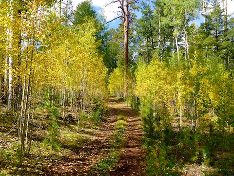
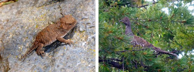
At 1¼ mile, I split left onto singletrack Viewpoint Trail #602H. Just after the split was another short section of fall color in even less mature aspen. Just babies — like the tiny horned lizard I almost stepped on. Viewpoint switchbacks up 300 ft. in ¾ mile. My recent hikes up North Mountain paid off, as even over 9,000 ft. elevation, Viewpoint was no problem.
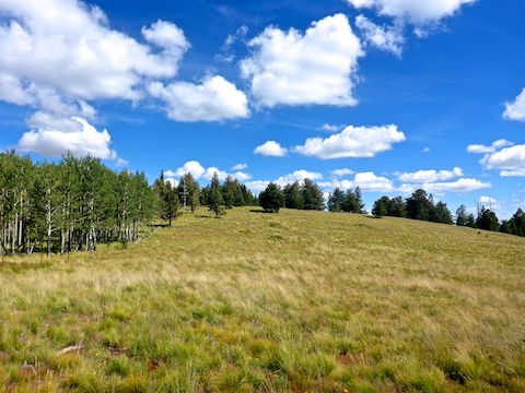
The top of Viewpoint Trail #602H is marked by double blue diamonds. Left Viewpoint continues; right is a contour-following use trail. To summit Pine Knoll, split the difference, heading off-trail, up through mixed grass and cinders. (Pole Knoll is an old volcano.) In 250 yds., there is a false summit, which has awesome views southwest to Sunrise Ski Area. 🤗
From the false summit, it is 150 yds. along a semi-fenced aspen grove to Pole Knoll’s true summit. Overall, the climb is only 250 ft. I searched for a benchmark, but only found tangled wires. Perhaps from a height-of-light. No geocache or summit log either. The only item of interest was a small open-sided structure in the aspen grove, which appeared to be neither a hunting blind nor shelter.
My GPS was low on battery, and I’d forgot my extras back at the trailhead. Nothing in my pack either, as I’d left that at home in favor of a Camelbak. Pole Knoll Recreation Area is so mellow & enjoyable, I didn’t need the weight of all that extra stuff. Instead of dawdling, I headed down with a quickness back to the double blue diamond. 🔹🔹
Viewpoint Trail #602H continues around the north and east slope of Pole Knoll. Summiting from that area would suck, due to all the aspen deadfall on the upper slope. However, it was the shadiest part of a mostly shady hike. At just over 3 miles, Viewpoint Trail widens to jeep trail, seemingly heading right. Instead, split left.
The t-intersection of Summit Trail #602J is 150 yds. further. The obvious route, left, is the way you should go. I could barely make out a trail to the right. It must reveal itself during cross-country skiing season. Summit Trail seemed steeper than Viewpoint Trail, but looking at the route profile, I guess it is the same. Not sure why it is called “Summit Trail” as it does not go anywhere near the top of Pole Knoll.
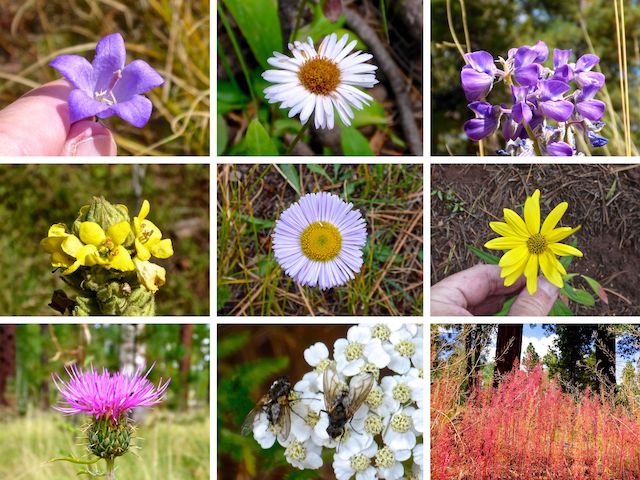
Top Row: harebell, alpine leafybract aster, silvery lupine.
Middle Row: mullein, beautiful fleabane, hairy golden aster.
Bottom Row: Wheeler’s thistle, western yarrow, fetid goosefoot.
Throughout my hike, the dirt and clay of the trail surface was moist, but not wet or muddy. Just enough to get me dirty when I got down for my flower photo closeups. Overall, flower coverage was sparse.
Near the bottom of Summit Trail, I was startled by something exploding out of the bushes. I thought it was two wild turkey. One flew up in an evergreen, sitting still on a branch long enough for me to get a photo. Much googling at home later revealed the bird to be a dusky grouse. There was a small patch of fall color in the same area. 🤔
Just over 4 miles, Summit Trail #602J turns left. (Right is Elk Trail #602I.) After 200 more yards, I turned right onto Osprey Trail #602C. The surrounding terrain was much more open, but there was still plenty of shade. At 4⅔ miles, I split left onto Raven Trail #602B.
Finally, at just under 5 miles, I turned left back onto Pole Knoll Trail #602 for the final half mile back to the trailhead. I got a bit confused there, between jeep trail, singletrack and the trailhead access road. Regardless, you are heading the correct direction.
I really enjoyed hiking through the mixed aspen, ponderosa, conifer and small, sunny, meadows of Pole Knoll Recreation Area! 👍
Directions: From Phoenix, head north on AZ-87, the Beeline Highway, into Payson. Drive east on AZ-260 for 130 miles, through Heber-Overgaard, Show Low, Pinetop-Lakeside and the White Mountain Apache Reservation. At milepost 383, turn right into the Pole Knoll Recreation Area. Park at the end of the road by the pit toilet.
⛷ Pole Knoll Recreation Area Map 🗺
GPS File: Pole_Knoll_Summit_Loop
Distance: 6.42 mi.
AEG: 889 ft.
Time: 2h 18m
Hiking Video
Hiking Pole Knoll Recreation Area, White Mountains from Preston McMurry on Vimeo.
