
 and Mount Union from the Mount Davis OP.")
Our plan was to do the usual double summit, but Yankee Doodle Trail #284 up Mount Union is closed. (It crosses a deeded mining claim, and the owner has pulled his permission to use it.) You could probably hike up Mount Union road (FR 261) instead, by first dropping down the south side of Dandrea Trail #285. 🧭
Dandrea Trail #285 from Potato Patch is as rocky as ever. Some folks have recently complained of deadfall blocking the trail, but it was easily avoided. The large tree which once crossed over the upper reaches of Trail #285 is no longer extant.
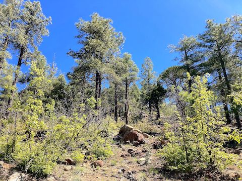
Lobeleaf groundsel were the most common high country flowers. There were silver lupine along the road in Potato Patch and a few Canada violet on the way up Dandrea Trail #285. The saddle area on up is usually good for claret cup cactus, but not today: few blooms, and small too.
The fence that crosses the Mount Davis spur has been repaired, but low crawling is easy as the bottom strand is barbless.
Despite the Crooks Fire, prescottstyle and I saw very little fire damage at the saddle, up the Mount Davis spur, at its summit, or near the OP. However, we did find fire damage while searching for the part of Yankee Doodle Trail #284 east of the saddle. If the trail was there, it is gone. Maybe due to the fire?
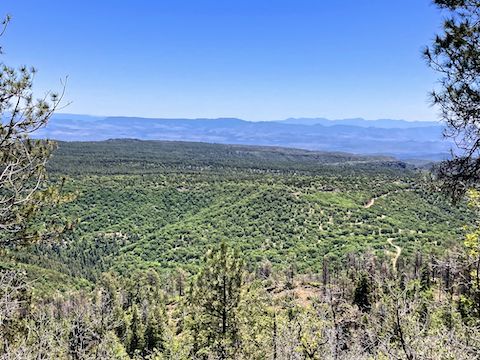
We did not find a summit log, so I signed the geocache log on top of the OP. Great 360° views up there: Moscow Peak, Mount Union, Mount Tritle, Maverick Mountain, Little Granite Mountain, Granite Mountain, Spruce Mountain, Mingus Mountain, Bill Williams Mountain and the San Francisco Peaks.
Heading back down the Mount Davis spur, we passed a dozen folks on a geology fieldtrip from UofA.
On our way out on Walker Rd., we chanced upon a pickup truck with a blown tire. I gave the folks a ride back up canyon to their house, so they could call for a tow. 😇
I forgot to turn off GPS until we were back in Prescott, so my time spent hiking Mount Davis is an estimate.
Potato Patch Directions: From Phoenix, head north on I-17 to Exit 262. Head west on AZ-69 for 31 miles. Just before Gateway Mall, turn left on Walker Rd. After 7.8 miles, Walker Rd. turns to dirt. 10.5 miles from AZ-69, Potato Patch is on the left. (There is a big yellow on brown sign.) Park where you can.
GPS File: Potato_Patch_to_Mount_Davis
Distance: 4.89 mi.
AEG: 1,278 ft.
Time: 2h 50m ?
Hike Video
NEW! Mount Davis panorama, Bradshaw Mountains from Preston McMurry on Vimeo.