

TL;DR Like North Mountain, but on dirt instead of pavement. Great views.
I discovered this hike totally by accident: I usually drive Shea to my Dad’s place, stopping for a hike at the tiny 6-space lot off Tatum. For some reason I was driving down Lincoln instead. Realizing my mistake, I made a quick turn here, deciding to make it up as I went along. Hard to get lost. (No idea how some people end up in the gated community.)
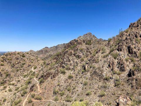
There’s three short sections to this hike:
1) Quartz Ridge Trail #8A from the parking lot: .23 mi, 41 AEG. Wide, smooth, oldster friendly.
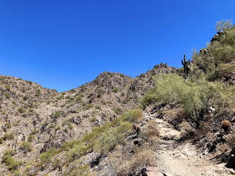
2) Mohave Connector Trail #202 to saddle: .18 mi, 164 AEG. Steep, slightly broken, some step ups, but not bad. I chug right up this.
3) Saddle to summit: .28 mi, 304 AEG. Steeper, more broken, more step ups. Doing the math, it’s not that much steeper, but I had to take it slow. I make the summit in about 20 minutes.
There is no gain on the return. Doing the little lasso off the summit only adds .10 miles to your hike. Other than taking care in the corners, you can trot back to the trailhead.
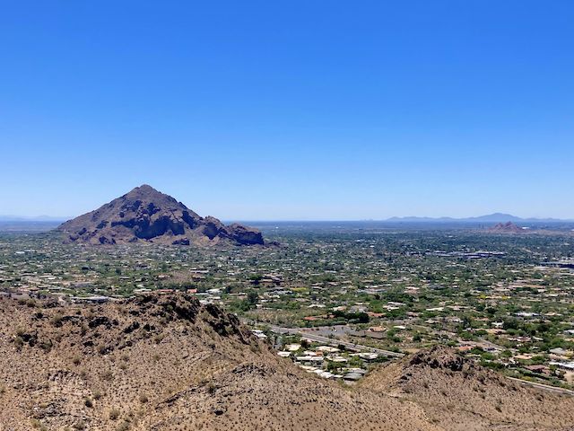
Summary: Good ROI for a quick lunch hike.
Maybe next time I do it, I’ll wear my GoPro chest mount, but for now, no hiking video …
Quartz Ridge Trailhead Directions: Located on northeast corner of 32nd St (from which it is accessed) and Lincoln Dr. Lot has 25 spaces, two of them handicapped. Can get full on weekends and holidays, even in high heat.
GPS File: RJ_Peak_Phoenix_Mountains_Preserve
Distance: 1.38 mi.
AEG: 520 ft.
Time: 35m
Rumble Video
Vimeo Video
Stupid Vimeo won’t allow me to upload a proper thumbnail. If it isn’t one Vimeo bug, it is another. Or glacial, CPU-hogging, slowness. Repeatedly. On multiple videos. And I pay for this crap!?
Climbing RJ Peak, Phoenix Mountains Preserve from Preston McMurry on Vimeo.