
")
Counter-clockwise from Bronco Trailhead, this is the 9th segment of the Maricopa Trail.
Back to another one of my ongoing day-hiking “thru” hike projects: the Maricopa Trail. I suppose you could actually thru-hike it, though you’d be spending some nights in occasionally sketchy spots, like the meth campers near Lake Pleasant, or the barrios of south Phoenix. (That might explain why one guy actually trail ran all 245 miles in just under 70 hours.) 🤯
I’ve divided the Maricopa Trail up into 25 segments of 8-12 miles. At one segment per month, not counting summer, it would take me until Spring, 2024 to finish. So, when the holidays are over, I will be increasing the frequency to two per month. I expect to complete the final segment, from Bartlett Lake Road to Bronco Trailhead by December 20, 2023. (I plan like most people breath.)
There is no official Maricopa Trail trailhead at I-10. There’s a ton of development going on in the Verrado area, and satellite view lags on-the-ground reality by up to three years, so the open desert at the west end of McDowell Rd. may now actually be an auto mall for all I know. Not sure of the legalities of parking in the nearby residential neighborhoods, today’s end point would be the Culver’s on Verrado Way. 🍔
The Maricopa Trail is only about 11 miles from the White Tank Mountain Regional Park visitor’s center / library to the Culver’s. Three weeks ago, to get some extra miles, I figured I would first ride north from the informal 195th Ave. / Jackrabbit Trail trailhead 5⅓ miles to the library, then double back, and continue on bike paths 5⅔ miles to the Culver’s. It did not go as planned.
Today, I started at the library, and rode south. No doubling back.
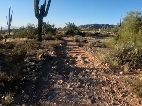
From the library parking lot, head around the south side, 200 yds. past the desert tortoise enclosure and park gate, to where Maricopa Trail crosses Olive Ave. The next 1½ miles are rather rocky. Early on, my left pedal hit a rock. It does not take any force for the serrated grip on a bike pedal to gouge flesh. So, imagine hitting a rock, causing the pedal to snap back into your shin …
If you aren’t bleeding, you aren’t trying hard enough. On, I rode. 💪
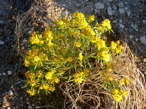
After 1¾ miles, the Maricopa Trail turns east onto dirt Northern Ave. Other than a turd I could not avoid, it was a smooth ¾ miles to Beardsley Canal. Just before the canal, turn south onto the singletrack which parallels the access road. You could ride the gravel road, but the singletrack is smooth. Besides, why are you riding in nature?
The Maricopa Trail south of dirt Northern Ave. is wider, and usually smoother. It often divides small areas of lush brushiness. At 5 miles, the trail turns east along the north boundary of Verrado. On your left will be a barbed wire fence; on your right Bethany Home Rd. After another ⅓ mile, I arrived at the 195th Ave. / Jackrabbit Trail “trailhead”.
On Google Maps, the road is referred to as Jackrabbit Trail, but on my auto’s GPS, it is labelled 195th Ave. Just so you aren’t as confused as I was. 🤪
Maricopa Trail turns south on paved bike path. South of Montebello Ave. (6 miles), the route becomes gravelly, very wide, shoulder. South of Meadowbrook Ave. (6¾ miles), despite still being on the shoulder, the trail actually becomes singletrack for a quarter mile, before finally returning to paved bike path. On a weekday morning, I didn’t see anyone else on those paths.
At just under 7½ miles, the Maricopa Trail arrives at Indian School Rd. The only signs I saw were campaign posters, but turn west. There is a sidewalk, but it crosses many shopping center driveways. Instead, I chose to ride in the bike lane, as I figured it would give me greater visibility to a turning vehicle.
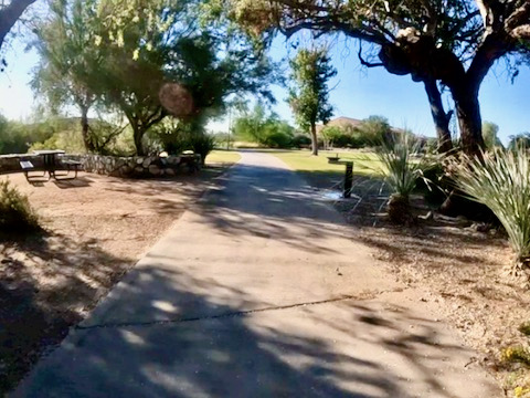
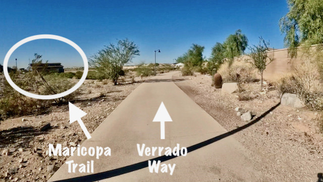
A mile later, just past Verrado High School, turn left onto the Acacia Way bike path. Maricopa Trail soon crosses the road, travelling through small pocket parks between Verrado houses on the right and a wash on the left. Besides doggie doo bag staions, there was at least one water fountain. I passed several joggers and dog walkers. At 9½ miles, a bridge was being built to extend Thomas Rd. into Verrado. 🚧
At 10¼ miles, the bike path bends to right. If you look to left, across some desert, you will see the sewage plant. Turn left there to stay on Maricopa Trail. Instead, I followed the bike path, which briefly cut through a corner of the housing, before heading slightly downhill, under Verrado Way. Immediately loop right, up to the Verrado Way bike lane. Culver’s is ahead, on the right, in another ¼ mile.
White Tank Library Visitors’ Center: Take Loop 303 exit 112. Take the first left, onto Cotton Ln. In one mile, turn right on Olive Ave. In 4.0 miles, just before the pay gate, turn right into the visitor’s center parking lot — which is free.
Verrado Culvers Directions: From Phoenix, head west on I-10. Take exit 120 onto north Verrado Way. Quickly get into the left lane of Verrado Way. The Culvers is on the left, with a Shell Gas Station, Taco Bell, etc. Either turn left directly into the Culvers lot, or at the next light, then double back through the shopping area.
GPS File: Maricopa_Trail_White_Tanks_to_Verrado
Distance: 12.55 mi.
AEG: 131 ft.
Time: 1h 37m
Biking Video
Maricopa Trail: White Tank Mountains to Verrado from Preston McMurry on Vimeo.