

Heading east from Dewey, this is the 2nd segment of General Crook Trail.
In 1872, General George Crook — or rather his troops — built a road from Fort Apache, Arizona, west across the Mogollon Rim to Camp Verde, then on to Fort Whipple in Prescott. “Vanished Arizona: Recollections of the Army Life of a New England Woman“, by Martha Summerhayes, contains a detailed description of travel on the General Crook Trail in the 1870s. 🏜
The Forest Service divides the General Crook Trail up into three numbered trails: General Crook Trail #64 from Old Cherry Road (P21) to Camp Verde (P0), General Crook Trail #130 from Camp Verde (V0) to Rim Top Trailhead at AZ-260 (V62), and General Crook Trail #140 from Al Fulton Visitor’s Center (V63) to Cottonwood Wash (V114). I’ll spare you the math: That makes the General Crook Trail 135 miles long. Not sure why the Forest Service designated three trail numbers.
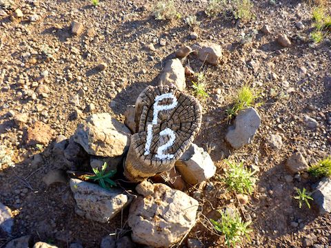
Today, I hiked the second east-bound segment of the General Crook Trail, on General Crook Trail #64, from CF Canyon to Copper Canyon Trailhead, just outside Camp Verde. (Roughly P12 to P2.) I could have continued on to the historical Fort Verde cavalry post (P0), but suburban road walking bores me to tears. If you’re up for it, I’ve included the final miles in the route attached below.
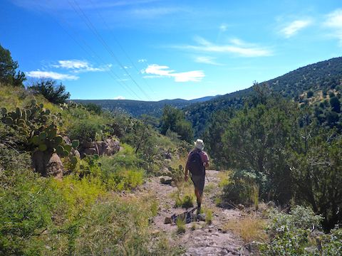
My hiking buddy Paul, aka Prescottstyle, and I started hiking at 7:25 a.m. Scattered showers were expected mid-afternoon in the Verde Valley, but morning was sunny. But we were so early, and heading slowly uphill to the east, that taking photographs of trail conditions was difficult. Despite the glare, the slight depression that is the 150-year old General Crook Trail was obvious. ☀️
At one point, General Crook Trail was more obvious than where we should have turned onto a jeep trail, and we did not realize it until we deadended at a gateless fence. That cost us an extra ⅔ mile — which explains why my total mileage, below, is more than the attached GPS route. (I do a lot of wandering & backtracking for photos & route confirmation.) Turn left after 1 mile, before the double boulders.
At 1¼ mile, wait for a gap in traffic, then sprint across AZ-260. (There is no tunnel.) On the north side of the highway, there is a wired-shut gate. Without the tools or time to open it, Paul and I low crawled it. (The bottom strand is barbless.) Because the hiking General Crook Trail has diverted from the historical General Crook Trail, we curved northeast ¼ mile to FR 9603F.
FR 9603F heads east, past a full-looking Mistake Tank. (On satellite view, it is a mudhole.) When FR 9603F bends north (left) to parallel Interstate 17, there is a General Crook Trail #64 sign. Split right past the sign, through creek bottom shrubbery, to a double culvert under the freeway. I was surprised at the lack of graffiti. 🎨
On the east side of I-17, Paul and I resumed following the now faint General Crook Trail which heads east a ½ mile to Bates Windmill. The windmill is non-functional and the corral fenceless. After 3 miles, at Bates Windmill, turn left onto FR 136, which winds through pinyon & juniper as it climbs north. Paul & I briefly stopped to chat with some deer hunters in an OHV.
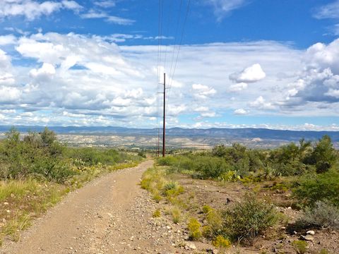
At the 4 mile mark, by the powerline, FR 136 intersects FR 9603J. Bend left aiming at a saddle just ahead. From the saddle, it is all downhill through Copper Canyon, to the trailhead 5⅓ miles away. Just over the saddle, the trail splits: FR 136 left, General Crook Trail right. Paul and I went right. Stay left to avoid a 30 ft. drop off and numerous catclaw. General Crook Trail rejoins FR 136 in ⅓ mile anyway.
Following the powerline, FR 136 drops 500 rocky feet in only ⅔ mile. Though FR 136 continues to descend all the way to the Copper Canyon Trailhead, General Crook Trail basically levels out, becomming a pleasant three mile stroll through moist & verdant Copper Canyon. The foliage was so tangled, you would not want to be canyon crawling it like I do on the Mogollon Rim. 👋
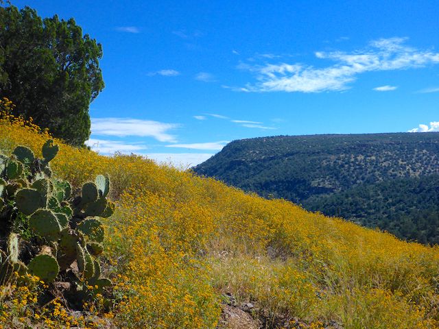
The best flowers were on the steepest part of FR 136: A dense 200 yd. long patch of yellow longleaf false goldeneye. But variety increased in deepest Copper Canyon. Besides the blooms below, I also spotted common sunflower, tansyleaf spine aster and broom snakeweed. Note, oak apple gall wasp is the fruited covering of wasp larvae laid on an oak branch. So, don’t eat the delicious looking berries!
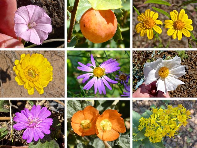
Top Row: field bindweed, oak apple gall wasp, longleaf false goldeneye.
Middle Row: desert marigold, fall tansyaster, southwestern prisklypoppy.
Bottom Row: trailing four o’clock, globemallow (rusbyi or hastulata?), velvety goldenrod.
Along the lush part of Copper Canyon, FR 136 is never more than 250 yds. from Interstate 17. Trucks air braking can be heard, and occasionally seen, 200 ft. above, but the foliage deadens most of the sound. The creek was running, and FR 136 crosses it several times. There were also quite a few wide puddles.
At 7¼ miles, I found a prospect on the south side of General Crook Trail. Paul spotted the mine adit. It was not hard, or dangerous, making entrance. Inside, I was able to stand up. But it only went in 30 ft. and there were only small traces of copper. Certainly nothing like the other Copper Creek!
A ¼ mile past the mine is Copper Corral, which is in slightly better shape than Bates Windmill. A ¼ mile past Copper Corral, I saw an open area to my right (FR 513). As I turned to look, two large male javelina snorted as they ran for cover. Past FR 513, Copper Canyon opens up, with the vegetation returning to typical Sonoran Desert scrub.
CF Canyon TH Directions: From I-17, take exit 278 west, onto AZ-169. In 1½ miles, just before the cut, between MP 14 and MP 13, onto FR 9604F. Park wherever.
Copper Canyon TH Directions: From I-17, take exit 285 east, onto General Crook Trail (a paved road). In 1½ miles, turn right on AZ-260. Take the next right, in ¼ mile, onto Oasis Rd. In just under ½ mile, turn right onto FR 136, which is car-drivable dirt. In ¾ mile, turn right into Copper Canyon TH.
GPS File: General_Crook_Trail_P12_P2
Distance: 11.44 mi.
AEG: 591 ft.
Time: 4h 28m
Hike Video
Hiking General Crook Trail: P12-P2 from Preston McMurry on Vimeo.