

Heading east from Dewey, this is the 5th segment of General Crook Trail.
I hiked the previous General Crook Trail segment, from Upper Sawlog Tank #1 to FR 9361K back in May. I planned to do this segment next, but the Wilbur Fire scotched that plan. Instead, I skipped ahead to Baker Lake to Kehl Spring Campground, as it was outside the burn area. First I shuffled this segment to next spring, then to this fall, and finally to this week. (I plan my hikes as much as a year in advance.) 😆
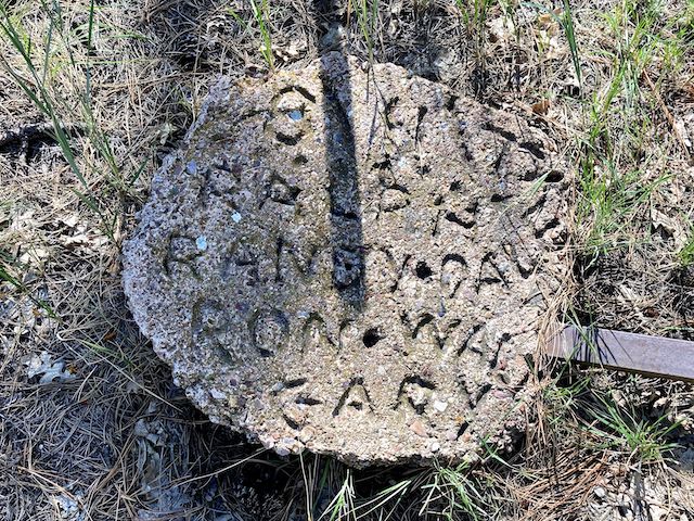
The trail is named after General George Crook, who surveyed a supply route between Fort Apache and Fort Whipple (now in Prescott), in 1871. The Army used the General Crook Trail until the Apache Wars died out in the 1890s. In the early 1970s, the Boy Scouts tried as best they could to retrace the old route, marking it with chevrons, gabions and mileposts. Currently, no two resources agree on the General Crook Trail’s exact route. Personally, I’m trying my best to follow the Boy Scouts.
You might suspect that hiking General Crook Trail from V27 to V33 would be six miles. You would be wrong. As the GPS file below shows, it is eight miles. Taking the fixed point of V21, from the previous segment, then this segment’s FR 9361K trailhead is at milepost 26.7. V31, next to AZ-87, is also known, and it is two miles from there to Baker Lake. I knew something was funny before I headed out.
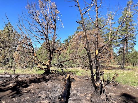
I started hiking at 8:40 a.m. The weather was perfect. As I hiked FR 9361K, I discovered the Wilbur Fire had not burned as throughly as it appeared from the highway. Some trees were not burnt at all, others only singed, some killed, and even a few that left only an ashen “ghost” of where they fell. Mostly, the damage was concentrated around individual trees, not many contiguous acres. 🔥
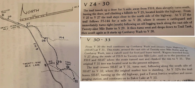
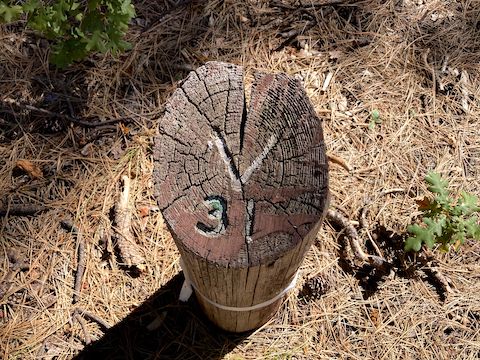
After 1¼ miles, General Crook Trail arrived at FR 9364R, just yards from AZ-260. Given the mileage from V21, Bowman claims it is where V27 is located. After searching for 10 minutes, I could find neither marker (which are usually a 24″ high log, 4″ diameter, with the mileage etched into the angled top, and painted white). Following the chevrons, I turned left onto FR 9405D.
Measuring from V21, Twentynine Tank is about mile 28½ on the General Crook Trail. Rounding up, 29 — not 27½ per Bowman. Twentynine Tank’s water level was very low. A ⅓ mile past Twentynine Tank is where things got interesting.
FR 9405D ends at FR 144, which is a very nice gravel road. Across FR 144 is a camping area. (More on this later.) Hiking The_Eagle‘s route, I turned left, following FR 144 for a mile along the lower northern slope of Twentynine Mile Butte to FR 9385G — Bowman’s “V28” at the “old logging track”. I turned south on FR 9385G along the east side Twentynine Mile Butte. After a ½ mile, I realized I had seen no chevrons on either FR 144 or FR 9385G. 🤔
I had however seen plenty of flowers on FR 144. Especially western dayflower: more than I’ve seen elsewhere, combined. Plus fleabane, alpine false springparsley, western yarrow, pineywoods geranium and pinewoods spiderwort. Around FR 9385G, it was only Wheeler’s thistle and mullein. Before FR 144, it was mostly goldenrod, plus a few morningglory and, near Twentynine Tank, yellow evening primrose.
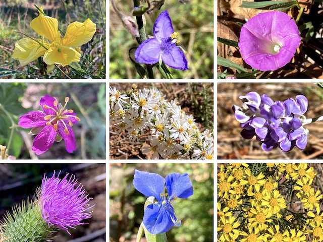
Top Row: yellow evening primrose, pinewoods spiderwort, Huachuca Mountain morningglory.
Middle Row: pineywoods geranium, {unknown}, silver lupine.
Bottom Row: Wheeler’s thistle, western dayflower, Richardson’s bitterweed.
I briefly considered cutting cross-country to Corduroy Wash. Instead, I continued down FR 9385G, past an unnamed tank — Bowman’s “Trail Tank”? — to a double gate. Right of the gate was the first chevron I’d seen in two miles, laying in the dirt, where it’d fallen off a burnt tree. I nailed it back up. I searched 100 yds. that way and found a second chevron. Interesting. Another 100 yds., another chevron.
I kept following the chevrons, cross-country, along the west side of Twentynine Mile Butte. There was only a hint of trail: Basically a clearing in the sparse brush. After ½ mile, the chevrons tracked along FR 6176 and FR 9387A back to the camping area I mentioned earlier. I’d found the correct route: At the end of FR 9405D, turn left on FR 144, then take the next right onto FR 9387A. Then follow the chevrons. 🧭
All that extra travel added over four miles and two hours to my day.
I doubled back to the double gate. The General Crook Trail chevrons continued on the south side of FR 9385G, for more easy cross-country travel to FR 9387H. I took a lunch break in the shade.
After finishing my murderwich and hiking beer, I hiked south on FR 9387H for 1¼ miles. (I realize all these different forest roads with similar numbers are confusing: Even I have trouble keeping them straight!) Just before reaching AZ-87, I turned left on FR 9382G for the final chevron-following ½ mile to the highway. V31 is easily visible across the road.
On the other side of AZ-87, General Crook Trail turns north, along the west side of a barbed wire fence. For some reason the chevrons were red, not white or silver. Just before mile marker V32 — which I did not find — the official trail crosses the fence, following foot trail and decommissioned jeep trail to Baker Lake. The turn may be gated, but I missed it. I was just too used up. 😓
The GPS file, below, has the correct route. Instead, I continued along the highway. The ground was rockier, and the brush thicker, but not as bad as some of Mogollon Rim canyons I’ve bushwhacked. I dragged into the Baker Lake trailhead at 4:00 p.m. Despite the late EndEx, I saw no cars driving back down AZ-260 to Camp Verde, and I-17 traffic to Phoenix was blessedly thin.
FR 9361K Directions: From Phoenix, head north on I-17. Take exit 287 east onto AZ-260 through Camp Verde. In 29 miles, After milepost 247, but before 248, on the left is FR 9361K. Park just off AZ-260. It’s easy to miss, so make sure to download the GPS route below, and have it turned on as you drive along AZ-260.
Baker Lake Directions: Continue east on AZ-260 for 4.6 miles. At the t-intersection, turn left on AZ-87. In 2.6 miles, turn right onto Rim Rd. / FR 300. Pull over by all the signs. Baker Lake is on your right.
GPS File: General_Crook_Trail_V27_V33
Distance: 14.22 mi.
AEG: 1,112 ft.
Time: 5h 24m
Hike Video
Hiking General Crook Trail: V27-V33 from Preston McMurry on Vimeo.