

I last hiked Deem Hills 12½ years ago. Another one of my pre-video hikes, I’ve been meaning to get back for at least five years. I wanted to hike Deem Hills when it is Phoenix flower season — which generally starts in late-February — but I already have other hikes scheduled for the prime spring slots.
Unfortunately, Phoenix has only received .03″ — you read that right! — of rain this monsoon. That’s 4.5″ less than last year, and 1.5″ less than normal. (Flagstaff has been nearly snowless, getting a scant 8″ of its normal 58″.) A downpour won’t help much: We need some steady precipitation. The cacti will mostly survive, but unless something happens soon, spring flower season will be a bust.
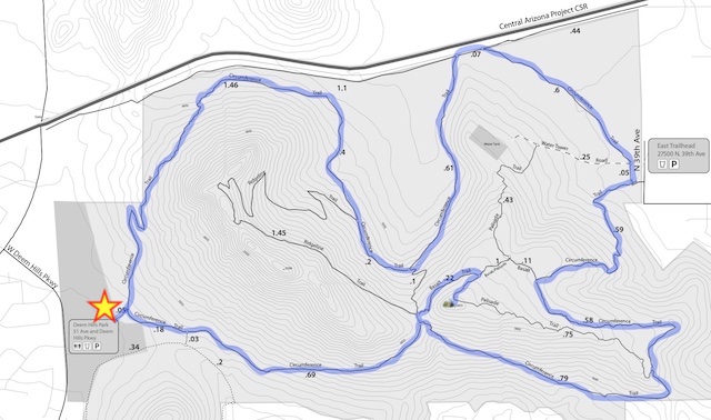
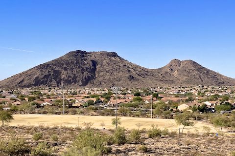
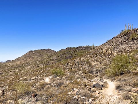
Circumference Trail climbs 170 somewhat rocky feet in the first half mile north of Deem Hills’ west trailhead. The highlight is the view of Ludden Mountain, just one mile southwest, and Pyramid Peak, one mile northwest, on the other side of the Central Arizona Project Canal. Around 0.6 miles, the trail splits: Left is canal road acess. Like the sign indicates, stay right. You can’t get lost: There’s lots of signs.
Circumference Trail is relatively smooth as it parallels the CAP Canal, then curls left around a small basin. There is an info sign extolling the canal’s benefits. Circumference Trail intersects Ridgeline Trail at 1.4 miles, then descends 170 ft. in a half mile. Along the way, Circumference Trail intersects Basalt Trail at 1.6 miles, and joins the canal road at 2.2 miles.
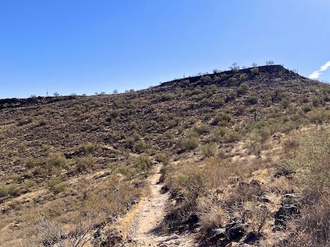
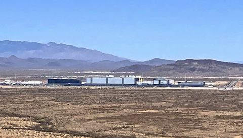
After 200 yds. on the CAP Canal road, Circumference Trail turns south. It is wide, flat and barren, before arriving at the east trailhead at the 2.8 mile mark. Whereas the west trailhead has all the amenities — flush toilets! — the east trailhead just has shade and signs about the Deem Hills Recreation Area’s history, flora and fauna. The climb out is steep and very rocky, rising 270 ft., before arriving at yet another Basalt Trail junction at 3.5 miles. If you head straight up Hill 1893 from there, you’ll save yourself 1.5 miles and an additional up & down.
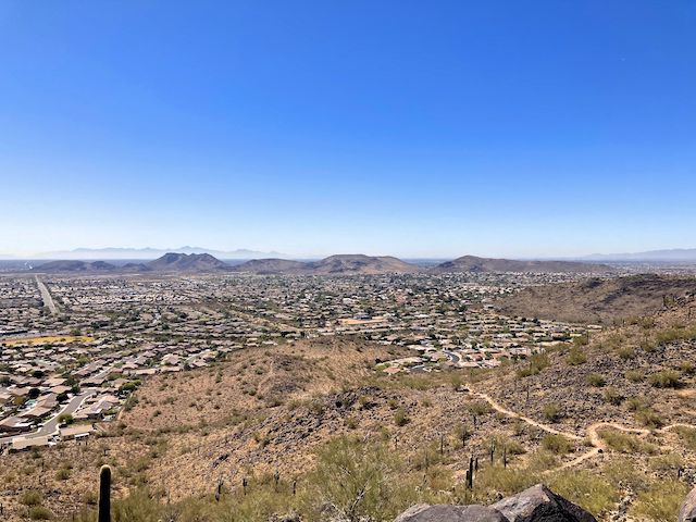
Circumference Trail climbs, again, 250 ft. in a half mile to the saddle between Hill 2098 (above left) and Hill 1893. I saw my first flowers along that stretch, ocotillo. After 5.0 miles, if you turn left at the saddle, it is a mile of exposed bedrock back to Deem Hills west trailhead. Instead, I turned right, onto Basalt Trail for a quarter mile. Just before Palisade Trail was the only decent sitting shade. Once on Palisade Trail, it is 200 yds. to the top of Hill 1893.
The views were fantastic! I could pick out just about every major hill, mountain, or range around the Valley, including the Phoenix Sonoran Preserve, McDowell Mountains, Lookout Mountain, Piestewa Peak, North Mountain, Shaw Butte, South Mountain, Hedgpeth Hills, Sierra Estrella, and White Tank Mountains. I could see more, but regrettably it was hazy.
Deem Hills West Trailhead: From I-17, take exit 218 west, onto Happy Valley Rd. In 3.0 miles, turn right onto 51st Ave. In 0.5 miles, turn right on Deem Hills Pkwy. In another 0.5 miles, turn right into the trailhead.
Park Map: Deem Hills Recreation Area (pdf)
GPS File: Deem_Hills_Circumference_Trail
Distance: 3.67 mi.
AEG: 658 ft.
Time: 1h 46m
Rumble Video
Vimeo Video
Hiking Deem Hills Circumference Trail from Preston McMurry on Vimeo.