

It’s been a couple of years since I last hiked in Buckeye’s Skyline Regional Park, at the south end of the White Tank Mountains. But, unlike last time, I at least I managed to get a hike in, despite this week’s frustrations: Almost left my GPS at home. Drove thru McDonald’s for breakfast; the Shamrock Shake machine was down. Got to Skyline: For second week in a row, no route loaded on GPS. And more … 🤦🏻♂️
Thankfully, my intended hike was straight forward: Quartz Mine Trail, a bit of Tortuga Trail, then up Javelina Summit Trail. I headed out at 8:30 a.m., under heavy overcast.
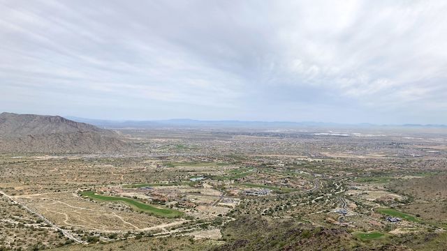
Quartz Mine Trail starts at the map / info board cabana on the south side of the main parking lot, at the far north end of Watson Rd. Quartz Mine Trail “climbs” 30 ft. to its intersection with Watson Overlook Trail, on the right. Ahead, Buckeye Valley stretches miles & miles beyond I-10.
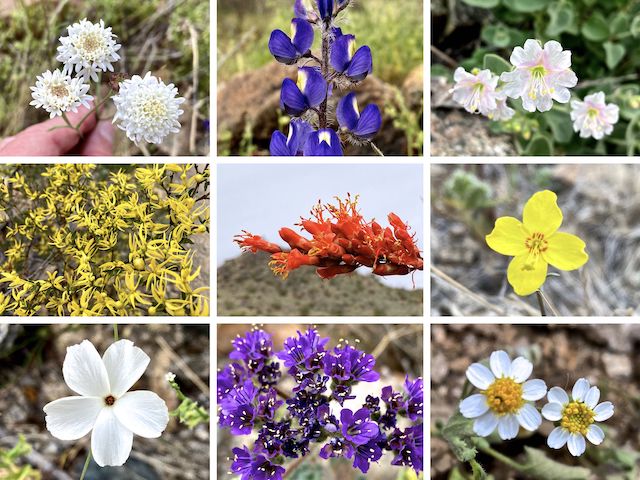
Top Row: Steve’s dustymaiden, Coulter’s lupine, desert wishbone bush.
Middle Row: creosote, ocotillo, California suncup.
Bottom Row: evening snow, scorpionweed, white woolly daisy.
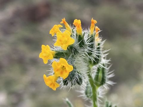
I saw many purple desert flowers along my drive down Sun Valley Parkway, on the west side of the White Tank Mountains. I thought they were lupine, but based on species distribution I observed during my hike, they were probably scorpionweed. Overall, Skyline Regional Park’s flower coverage was light, but scorpionweed were most common. Creosote were next most common. The best lupine were along Tortuga Trail. There was a nice patch of fiddleneck near Javelina Summit.
Quartz Mine Trail drops 170 ft. to intersect the access trail from the front gate’s small parking area at the ½ mile mark. If you want to knock a mile (round trip) off an already short hike, start there. Quartz Mine Trail then bends east, wrapping around the lower slope of Crest Summit.
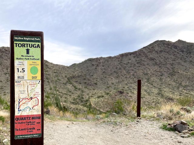
Quartz Mine Trail eases up to a small saddle, then turns north. Quartz Mine Trail intersects Skyline Crest Trail at 1½ miles and, 150 yds. later at a more prominent saddle, Tortuga Trail. The 170 ft. climb from the park entrance is a good warmup for the real climb to come. (Pictured above.)
From the saddle, Tortuga Trail drops 200 ft. to an unnumbered jeep trail. A hundred yards later, at emergency marker TG-2, Tortuga Trail intersect Javelina Summit Trail. From TG-2, Tortuga Trail heads south towards the Sienna Hills development on 217th Ave. 🏗
I started up Javelina Summit Trail. It is a 300 ft. climb in a half mile from the jeep trail to the saddle. From the saddle, Javelina Summit Trail pitches up, climbing 500 ft. in the final two-thirds of a mile. That may not seem too bad, but there are several flat spots, so the climby bits are steeper than the numbers indicate.
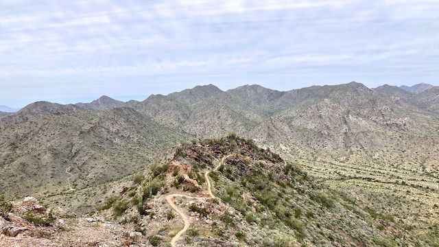
It took me two hours to reach Javelina Summit’s … summit … but that included probably 30 minutes of photo stops. Then I spent 20 minutes on top admiring the views, watching F-35s, and taking more photos. I somehow shot 217! Photos that is, not F-35s. I think my iPhone may have accidentally been on burst mode. 🤔
I felt good, so I tried to move fast heading down Javelina Summit Trail. I fell once, no big deal. Gotta watch out for pea gravel.
It may seem counter-intuitive, but descending is harder than climbing. That’s because climbing works your cardiovascular system, but your leg muscles are at least propelling you. Whereas descending, your leg muscles are braking you, to keep you from going too fast. Descending also puts a lot of stress into your joints.
I made it back to the Skyline Regional Park trailhead in maybe 1h 15m. I tried sending my wife a message, but it didn’t get through. What good are the emergency markers if you can’t get reception to actually call in an emergency?
Afterwards, stopped at Carl’s Jr. on Watson Rd. for a fountain drink. The tinny drive-thru speaker now has voice-activated ordering. No! Just no. After the guy in front of me cleared, I drove right through. So, I crossed Watson Rd. to the Circle K. That had some sort of scan yourself setup, with a vending machine-like bill slider, and change coming out God knows where. I left my change. The Circle K in Payson has that too. Never again. Circle K now on the permanent Ban List.
But the hike at least was good! 🙂
Skyline Regional Park Trailhead: From Phoenix, head west on I-10. Take Exit 117 onto north Watson Rd. Drive 2.0 miles to the no fee gate, then another 0.9 miles to the end of the road.
GPS File: Javelina_Summit_Skyline_Regional_Park
Distance: 6.46 mi.
AEG: 1,454 ft.
Time: 2h 42m