

Counter-clockwise from Bronco Trailhead, this is the 13th segment of the Maricopa Trail.
My goal is to hike or bike all 245 miles of the Maricopa Trail, which encircles the Phoenix metro area. I am doing one segment every two weeks, from November through April, when The Valley of the Sun is not quite so hot. Around 90-100 miles of the Maricopa Trail are canals, or even city streets, including most of today’s ride beween Tres Rios Wetlands and the Bajada Trailhead in South Mountain Park.
Because I’ve been sick the last couple of weeks, I have not got out to do “away” hikes, or even anything in my backyard, like North Mountain. Even though I am almost fully recovered, I went out despite today being the chilliest morning of the week. Judgment call, but exercise is also important to health. 😉
From the Tres Rios Wetlands railhead, the lucky 13th segment of the Maricopa Trail heads south on 91st Ave. for ¼ mile. I couldn’t tell which side of 91st Ave. the trail is officially on. I didn’t see any signs. Don’t turn left (east) at the gated road, but the next turn, a jeep trail.
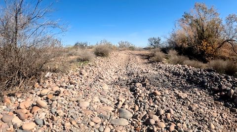
From 91st Ave., the Maricopa Trail winds east a little over one mile. The jeep trail is often garbage-strewn. Besides being usually rocky, the turns are frequently bermed, making it difficult pedalling through the deep dirt on the inside line. My dearth of recent exercise was already telling. 💔
When the Maricopa Trail reaches the powerlines, it turns southeast. Just ahead, on the left, is a Salt River lagoon. I saw a homeless guy camping there. On the right, all the way to Dusty Lane, is the Gila River Indian Community. After 1¾ miles, the Maricopa Trail crosses, dry, to the east side of a small aqueduct.
After a half mile, my way was blocked by a storm channel. I doubled back, looking for a way to the west side of the aqueduct. I saw a board across, but decided to try riding through a concrete ford. No wussing out. I was doing okay, until a second, unexpected, drop into sandy bottom ended my bike’s momentum, but not mine, dumping me in the water. I was soaked head to toe.
My Panasonic Lumix DMC-TS5 pocket camera was missing. (That’s it, in the video thumbnail, below.) I spent 15 minutes digging around the aqueduct bottom, but never found it. Supposedly waterproof, it might have continued working. My GoPro took the dunking like a champ. Unfortunately, my iPhone was unbagged in my pants pocket. Though doused, it miraculously didn’t die! 🙏🏻
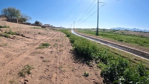
Regardless of which side of the aqueduct you are on, continue southeast. If you are on the concrete bike path, in ¾ mile at Baseline Rd. you will need to switch to the west side of the aqueduct to stay on the Maricopa Trail. Even though the bike path continues, it soon turns east, becomming the Laveen Channel Wash. (A mistake I made.)
If you look at Google Maps satellite view, everything south of Baseline Rd. is vegetable fields. Not any more. It is being rapidly developed. All those fleeing Californians need places to live.
The Maricopa Trail stays on the west side of the aqueduct past Dobbins Rd. (4 miles) to Elliot Rd. (5⅓ miles). There is a cross aqueduct at Elliot Rd. There are dry crossings left and right. Continue on the west side of the aqueduct, as it will give you some distance from the many beehives tucked up against the adjacent Loop 202 Freeway. The bees are not aggressive, but if you stop they will check you out. 🐝
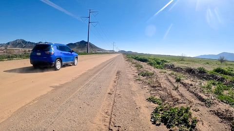
The aqueduct turns left, and disappears under the Loop 202 Freeway, at the six mile mark. Continue on the smooth dirt road. All along the edge of the reservation, there is an irrigation ditch. South of Estrella Dr. (6⅔ miles), the irrigation ditch switches to the east side of the smooth dirt road.
When the Maricopa Trail crosses busy 51st Ave. (8 miles), a rare Maricopa Trail sign seems to indicate a quick jog left. Go straight onto Dusty Lane and save the hassle. Neither way is protected. 🤷🏻♂️
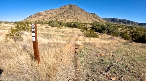
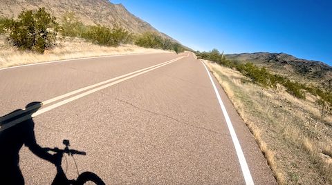
After ½ mile on Dusty Lane, the Maricopa Trail turns left, passing under the Loop 202 Freeway via Multiuse Crossing #4. After so many uninspiring miles, the remainder of this segment is a relief. Visually. The 110 ft. climb along the lower slope of Alta Ridge, on gravelly single track, was more than I could peddle. Between lack of exercise, and increasing respiratory congestion, I walked my MTB up the climb.
I walked probably half of the grassy mile to San Juan Rd. Even small wash crossings were more than my rapidly dwindling energy level could handle. If it had been the first full weekend of the month, when San Juan Rd. is open to motor vehicles, I would have called my wife for a pickup. Rather than follow the Maricopa Trail’s final mile to Bajada Trailhead, I decided it would be wiser to bail down San Juan Rd. 🥵
Eventually, even good grip on pavement couldn’t negate the effects of a slow climb. When I dismounted, I almost fell on my face, my quads were so tight. It was agonizing. Worse yet, even Bajada Trailhead is banned to vehicles most of the month. After a brief rest there, I still had another 2⅓ miles of San Juan Rd. walking to go. But I made it. Hopefully, I don’t get flesh eating virus from the canal water …
Tres Rios Wetlands Directions: From I-10, take exit 134, south onto 91st Ave. In 4½ miles, there is a sewage plant on the left. Just past the plant, the Tres Rios Wetlands trailhead is on the right. There is no parking fee, but a free permit is required.
Bajada Trailhead Directions: From Phoenix, head south on Central Ave. until it enters South Mountain Park. Mind your speed, as there is a lot of bicycle traffic on the narrow road, and hikers crossing it. In 2½ miles, Telegraph Pass Rd. curls up to the left. Park in the triangle at that intersection. Or, if it is the first full weekend of the month, continue driving west on San Juan Rd. for a 2⅓ miles to Bajada Trailhead. (Cars are not allowed on the other days of the month.)
Park Map: South_Mountain_Park_Trail_Map (pdf)
GPS File: Maricopa_Trail_Tres_Rios_to_Bajada_TH
Distance: 15.62 mi.
AEG: 788 ft.
Time: 3h 05m
Biking Video
Biking Maricopa Trail: Tres Rios to South Mountain from Preston McMurry on Vimeo.