Two weeks ago, due to heavy rain, I bailed out of Alder Canyon. Didn’t want to risk the flash flood I’d seen evidence of the previous mile. Today, I returned to finish that hike. Note the URL above: “alder-canyon-mogollon-rim”. Because Arizona has another Alder Canyon, near Mount Lemmon. Arizona also has multiple Granite Mountains (6+), Black Canyons (12+), and Black Mountains (24+). Madness!
Today’s plan was to hike two miles of Dye Ridge Rd. Then two miles of FR 717B and FR 717A back to my bail point. Drop into Alder Canyon, bushwhacking the next half mile to West Fork Alder Canyon. Then bushwhack up West Fork Alder Canyon, to Dye Ridge Rd., taking that two miles “back home”. Today’s hike video (see below), starts where my last one left off. Complete with fuzzy iPhone 17 Pro photos.
Dye Ridge Rd. has actual Forest Service mile markers, counting up from FR 169. Today, I parked 1.5 miles north of my previous trailhead. (The campers who were across from me two weeks ago left a ton of garbage.) That’s saves at least an hour of hiking. A SUV could drive all the way to the head of West Fork Alder Canyon, but I also wanted some exercise ROI.
I started hiking at 9:25 a.m. with a rocky 40 ft. drop that should be avoided by cars. An easy exit from Cliff Springs is at the bottom of the drop. I walked two miles of Dye Ridge Rd. to FR 717B in 40 minutes. Along Dye Ridge Rd., all the intermittent cattle tanks, and even a meadow, had water. (Nearby Forest Lakes has had 5″ of rain the past six weeks.)
Leaving Dye Ridge Rd., I turned east on FR 717B. I zipped along FR 717B, which imperceptibly descended for 1.5 miles, before a very steep drop to the FR 717A t-intersection. The drop was so rocky, I walked to the side of the “road”. At FR 717A, left (towards West Fork) is more obvious, but I went right (east), aiming for my previous bail point, which I reached about 11:20 a.m.
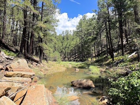
The drop in to Alder Canyon is only 60 ft., but it is a 35% slope. Yes, I previously chose the steepest part to bail. In the rain. Anyway, when I got to the bottom there was a good size pool of water. Climbing over some small boulders, I managed to avoid getting wet. The next half mile of Alder Canyon alternated small pools, running water, “islands” of rock piles, and forest shelves. I got up & down a lot for photos.
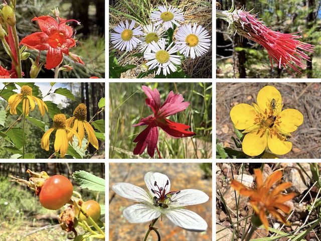
Top Row: skyrocket, spreading fleabane, Arizona thistle.
Middle Row: yellow coneflower, {unknown}, woolly cinquefoil.
Bottom Row: {unknown}, Richardson’s geranium, and—I swear!—orange agoseris (via fuzzy iPhone 17 Pro).
I’ve already given up on my new Kodak PixPro WPZ2 pocket camera. The 1-star review I left on Amazon: “Nice flash froze fan across room. But that’s about it. Worse than Ricoh WG-6. Read screen very dark & fuzzy. Focus is random, if it occurs at all. (I’ve tried multiple combinations of settings.) So disappointed, I basically quit after one heavy field use. DO NOT BUY.” I miss my Panasonic Lumix DMC TS-5. 😢
As is typical of most — not all — Mogollon Rim canyon junctions, the up canyon “point” of Alder Canyon and West Fork Alder Canyon was shelf like. (Willow Springs Canyon‘s junction with Woods Canyon is one of the exceptions.) Some shrubbery and deadfall, but plenty of space. I spotted a foot trail up to FR 717A, which at that point is only 250 yds. away. There’s an unnumbered jeep trail just 50 yds. north.
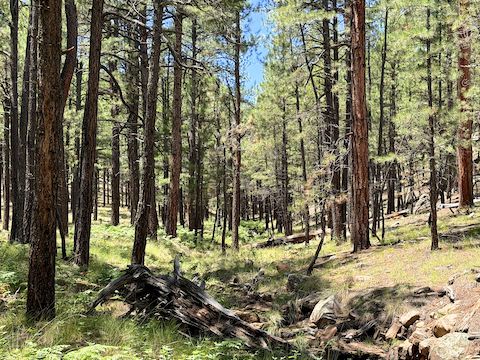
After a third of a mile, West Fork Alder Canyon broke out into the open. The canyon widened, it flattened, the trees were less dense, no deadfall, and no underbrush. Off & on, I had been following another foot trail, but cross-country was a breeze. FR 717A and the other jeep trail were now only 100 ft. either side of the canyon.
Despite the topo’s claims, FR 717A ended a half mile up West Fork Alder Canyon. I randomly wandered across the turn-around. A quarter mile later, the unnumbered jeep trail that had been on the north side of the canyon switched sides. Easy enough to do, as the dry creek bed is almost imperceptible. That threw me until I crossed the road to stay near the canyon bottom. Such as it was.
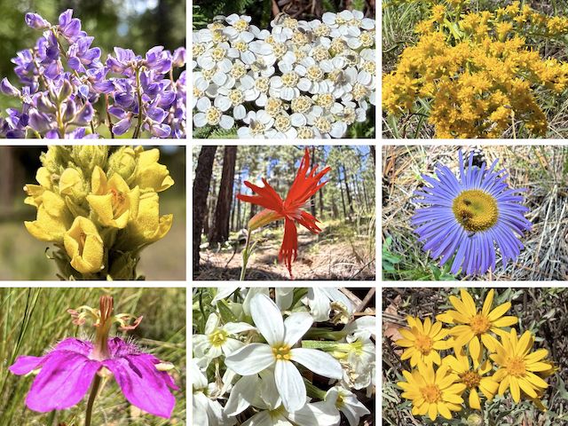
Top Row: silver lupine, western yarrow, velvety goldenrod.
Middle Row: mullein, Mexican silene, showy fleabane.
Bottom Row: pineywoods geranium, Nuttall’s linanthus, showy goldeneye. (More high country flowers.)
Besides the pictured flowers, I also saw red and yellow pea (Acmispon wrightii), slimleaf plainsmustard (Hesperidanthus linearifolius), alpine false springparsley (Cymopterus lemmonii), and either Geyer’s onion or long-stalked clover. (I didn’t look too close: I was already getting up & down enough as it was!) Nuttall’s linanthus (Leptosiphon nuttallii) were most common in Alder Canyon and West Fork.
As I got near its head, West Fork Alder Canyon got a bit narrower, but never remotely difficult. I followed the unnumbered jeep trail the last 200 yds. to Dye Ridge Rd. (For some reason the topo map insists that unnumbered jeep trail is now FR 717A, even that clearly ended back down canyon. Regardless, I’d seen two small groups of side-by-sides on it in little over an hour.
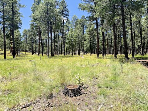
From West Fork Alder Canyon, I zipped back along Dye Ridge Rd., to my patiently waiting wife, in only 40 minutes. West Fork Alder Canyon was my 76th Mogollon Rim hike, above or below the Rim, and 42nd different Rim canyon. Below are two GPS files: The first for today’s hike; the second for the full, uninterrupted, Alder Canyon – West Fork Alder Canyon Loop.
Directions: From Phoenix, head north on AZ-87, the Beeline Highway, into Payson. Turn right on AZ-260. In 29 miles, after cresting the Mogollon Rim, take the first left onto Rim Rd. / FR 300. In 8.4 miles, make a sharp right onto FR 169. Take the next left onto Dye Ridge Rd. / FR 717. In 150 yds., park at the camp on the right.
Today’s GPS File: Alder_Canyon_Part2_20260729
Full Route GPS File: Alder_Canyon_and_West_Fork_Mogollon_Rim
Distance: 9.46 mi.
AEG: 499 ft.
Time: 3h 29m
Rumble Video
Vimeo Video
Alder Canyon Part 2 + West Fork Alder Canyon from Preston McMurry on Vimeo.
