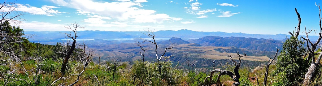
Upper Goldwater Lake and Lower Goldwater Lake are a city park located just south of Prescott in the Prescott National Forest. At 15 acres, the lakes are formed by dams across Banning Creek. Amenities include picnic tables, grills, water fountains, doggie fountains, well pumps, his & hers pit toilets (with hand cleanser), a playground, horseshoe pits, sand volleyball, and boat ramps. But I was there to hike!
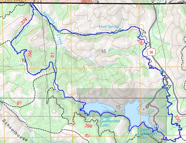
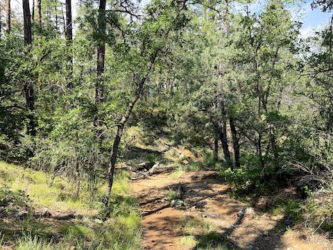
Goldwater Lakes Trail #396: We started hiking at 9:00 a.m., heading down to the lake, then turning left (east), uphill to Trail #396. We weren’t on it long, quarter mile at most. It is smooth, mountain bike-optimized (twisty), singletrack. We saw no one for hours after we left the lake.
Feldmeier Trail #330 parallels Senator Highway for 1¾ miles, to a gravel pit. Despite being only around 100 yds. from the road, the ponderosa pine and slight elevation difference meant we heard little traffic. Assessing Feldmeier Trail #330’s groomed, level, surface, Prescottstyle commented that it would be easier for hikers to cut across its many switchbacks. But we stayed on trail.
A quarter mile after crossing paved Goldwater Lake Rd., there is a dirt trailhead that can be used to access the Goldwater Lakes Loop without paying the park entrance fee. I’d rather pay the fee: It’s a tax that goes towards something that actually benefits me. At the gravel pit, Feldmeier Trail #330 turns left (west), descending along Deer Spring. The next ¾ mile was straighter, more hikey. If that is a word.
Just before Banning Creek Trail #81, Feldmeier Trail #330 crosses an old City of Prescott water main. We initially hiked past the pipe, but then I doubled back, and followed it right (north). Good thing I did, as I found a Kindness Rock that I picked up as a gift for my patient, hike-supporting, wife.
Banning Creek Trail #81 — at least the quarter mile we hiked — was old jeep trail. But smooth. Trail #81 ends with a locked gate, and no trespassing signs, at Cougar Trail. (A paved road.) We turned left (southwest) on Hidden Valley Trail #374.
During the day, I spotted over two dozen flower species: Besides those I photographed, there were velvety goldenrod (horribly blurred by my crappy iPhone 17 Pro camera), skyrocket, yellow columbine, and several others, possibly including longleaf cologonia. The most common high country flowers were toadflax penstemon, followed by red and yellow pea, and pinewoods spiderwort.
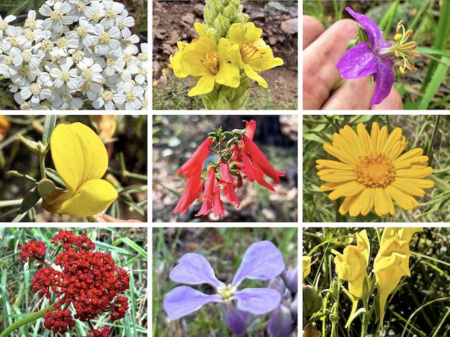
Top Row: western yarrow, mullein, pineywoods geranium.
Middle Row: red and yellow pea, scarlet penstemon, camphorweed.
Bottom Row: a rare red alpine false springparsley, slimleaf plainsmustard, Dalmatian toadflax.
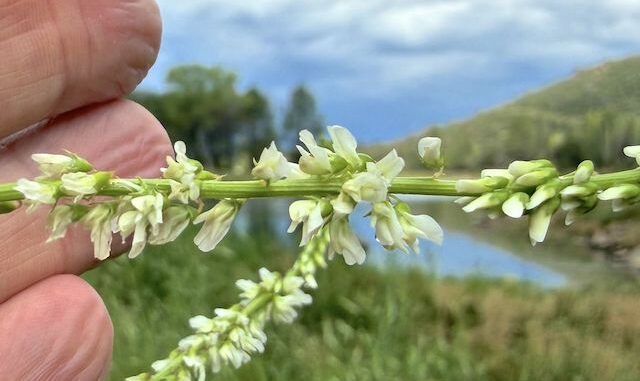
Hidden Valley Trail #374 is only a half mile long, climbing 150 ft. Singletrack, Trail #374 is sometimes a bit rocky or eroded. There’s fewer ponderosa pine, and more shrubbery. I spotted silky evolvulus, which was a new flower species for me. (As was the white sweetclover by Upper Goldwater Lake.) Bright and sunny for the past 90 minutes, the sky clouded over. Uh oh.
Back at Goldwater Lakes Trail #396, we turned left (southeast). Trail #396 climbs 100 ft. in ⅓ mile to the top of Hill 5935, which has a Granite Mountain Hotshots memorial, and nice views west towards Mount Francis, Wolverton Mountain, Williams Peak, Porter Mountain, Thumb Butte, Two Rock Mountain, Little Granite Mountain, and Granite Mountain. After paying our respects, we moved on.
From the Granite Mountain Hotshots memorial, Goldwater Lakes Trail #396 descends 160 ft. in a half mile, back to Banning Creek Trail #81. If we’d taken Trail #81, as Prescottstyle suggested an hour earlier, we would have shaved a mile off our hike. But I had plans. Instead, we crossed Banning Creek, onto Forest Road 61. The sun was back out.
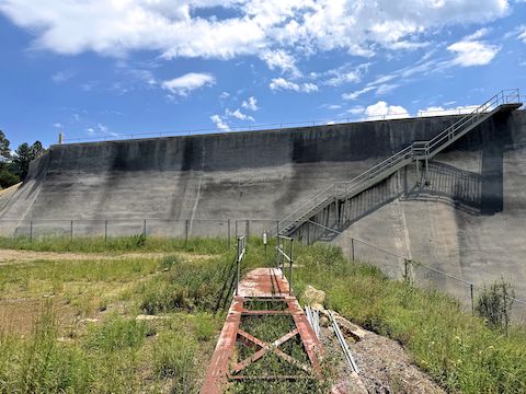
Forest Road 61 was the only other climb on the Goldwater Lakes Loop, at another 150 ft. in a half mile. It is rocky, and decommissioned, with a locked vehicle gate 200 yds. from Lower Goldwater Dam. You could also hike up the actual Banning Creek bottom, as I did during my Bean Peaks Loop back in 2014. (Before the mountain bike network was recently added.)
Lower Goldwater Dam was the first dam to impound Banning Creek, in 1923. It is a gravity dam with a height of 67 ft. (73 ft. from bedrock). It is 508 ft. wide, with a total volume of 10,673 cu. yds. Lower Goldwater Lake’s current storage capacity is normally 271 acre ft., maximum 351 acre ft., with a surface area of 15 acres.
Upper Goldwater Dam followed a half mile east, in 1932. It is a buttress dam with a height of 52 ft. (76 ft. from bedrock). It is 383 ft. wide, with a total volume of 5,630 cu. yds. Upper Goldwater Lake’s storage capacity is normally 525 acre ft., maximum 700 acre ft., with a surface area of 23 acres.
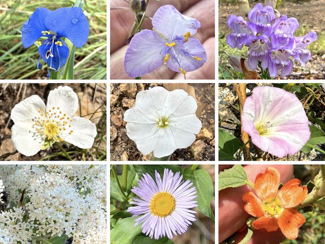
Top Row: western dayflower, pinewoods spiderwort, toadflax penstemon.
Middle Row: Apache plume, silky evolvulus, field bindweed.
Bottom Row: Fendler’s ceanothus, spreading fleabane, thicket globemallow.
Lower South Shore Trail extends for a half mile along — you guessed it! — the south shore of Lower Goldwater Lake. It’s level, only 10 ft. above the lake, for a quarter mile, before it begins climbing towards Upper Goldwater Dam. We finally started seeing other hikers. Near the east end of Lower Goldwater Lake, there’s a signed trail split. Initially we went left. We were wrong. Go right.
Upper South Shore Trail drops back down from Upper Goldwater Dam. It is also a smooth half mile, with rest benches. Prescottstyle and I made good time, because I’d already taken enough photos. (Nearly 200, hoping my iPhone 17 Pro might accurately focus a few.) We finished hiking at 1:00 p.m.
After some post-hiking beers at La Casa Prescottstyle, my wife and I headed down AZ-89 to Peeples Valley. We hadn’t been to T-Bird Cafe since the Chinese Lung AIDs. Unfortunately, it’s now only open Thursday-Sunday. Bummer. Well, we could always pick up pizza at the Wild West Saloon in Congress. Sonofab … They were closed too! So, we just cut our losses and headed home for leftovers. 😕
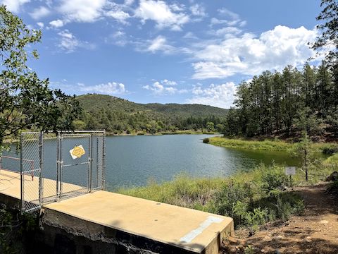
Goldwater Lake Directions: From Gurley St., near downtown Prescott, turn south on Mount Vernon Ave., better known as the Senator Highway. In 3.0 miles, turn right into the paved Goldwater Lake Park entrance. The entry fee is $5. Parking begins in ⅓ mile at the one-way loop, but if you go halfway around the loop, then make a right and drive another ¼ mile, you will be at the parking spots nearest Goldwater Lake Trail #396.
GPS File: Goldwater_Lakes_Loop
Distance: 7.52 miles
AEG: 778 ft.
Time: 3h 13m
Rumble Video
Vimeo Video
Hiking Goldwater Lakes, Prescott National Forest from Preston McMurry on Vimeo.
