

There’s so many diverse places to hike in Arizona that — other than the Mogollon Rim — I figure I am doing well if I hike them once a year. Some, like the Chiricahua Mountains, I’ve never been to, because they are such a long drive from Phoenix, and I don’t camp. (I did that enough in the Army.)
Today was my annual trip to the Goldfield Mountains, located just east of Phoenix. My plan was to hike from Apache Junction, north to the Blue Point Picnic Area on the Salt River, via Bulldog Canyon.
Bulldog Canyon OHV Area has ~20 miles of legal jeep trails spread over 34,000 acres of the Goldfield Mountains. Part of the Tonto National Forest, a $6 Tonto Motorized Vehicle Use Permit is required to open one of the combination locked access gates. Or you can climb over the gate and walk. 😉
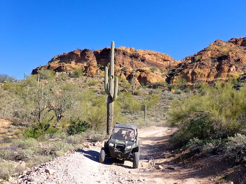
One of the legal jeep trails in the Bulldog Canyon OHV Area is FR 10. There’s rugged terrain to either side of FR 10, so the only option for a thru-hike is to perhaps hike some of the creek bottom sections between wash crossings. Or, if you are feeling sporty, hike the creek bottom the whole way.
If you stick to FR 10 all 8.3 miles through Bulldog Canyon, there’s a good chance you will encounter some of those off-highway vehicles. I saw three OHVs, all travelling a reasonable 10 mph, due to the ruggedness of the road. Ironically, the first “vehicle” that crossed my path was a mountain bike. 🚵🏻♀️
RV camping is also popular in the Bulldog Canyon OHV area. There are campsites all along FR 10, but because the middle of Bulldog Canyon is so rugged, the RVs are concentrated along the northern two miles, with a few scattered near the southern ½ mile.
The last time I hiked from Wolverine Gate, in Apache Junction, was an aborted attempt at climbing Dome Mountain in 2015. I’m a much stronger hiker now, so I better do Dome Mountain soon, before I get too old.
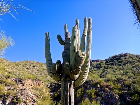
The first ¾ mile of FR 10 is also the smooth dirt access road for the hilltop FAA radar site a ½ mile west of Wolverine Gate. When you reach that ¾ mile point, instead turn right, north on the rougher jeep trail. A mile into the hike, is an open tube metal gate similar to the trailhead, which I used as a “tripod” for this blog’s header image. 📸
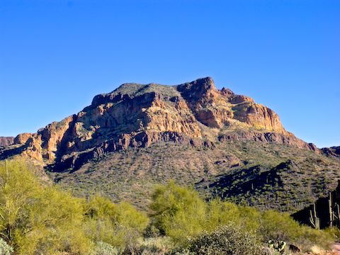
Dome Mountain is to the right, and the morning sun creates areas of light and deep shadows on its west flank. Opposite Dome Mountain, on the west side of Bulldog Canyon is a beautiful cliff band that I had a very hard time getting a decent photo of because it was directly lit.
Almost two miles into Bulldog Canyon, I spied a sign on my left for Deer Tanks Trail. Not having noticed it during my planning, I figured I should at least scout it. 200 yds. up Deer Tanks Trail, is a catchment area, which gathers & retains water for wildlife. The upper half of the tin-roofed catchment was bone dry. However the overflow box was 100% full of light green, but otherwise clear, water.
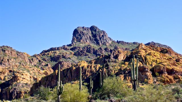
After Deer Tanks Trail, FR 10 enters the middle section of Bulldog Canyon. Bearing in mind that the whole hike only accumulates 528 ft. of elevation gain, there are still some steep & rocky sections. Fine gravelled descents are always the trickiest, and I slipped several times. Thankfully, no falls. ⛷
Although FR 10’s high point is near the two mile gate, around five miles is the visual “saddle” of Bulldog Canyon. That is where Fountain Hills, Fort McDowell and the Mazatzal Mountains hove into view.
I should have mentioned earlier that a triple-cable power line, mounted on ~40 ft. high wood poles, runs down Bulldog Canyon, from Wolverine Gate to FR 3554, where it veers northeast to its origin at Stewart Mountain Dam.
FR 3554 is another legal Bulldog Canyon OHV Area jeep trail. FR 10 crosses FR 3554 in a wide, sandy, wash. Like every other wash crossing in Bulldog Canyon, it was bone dry. The two miles between FR 3554 and Bush Highway, are car drivable, so not the most enchanting part of the hike. 😑
I arrived at Bush Highway, just after noon. After playing Frogger across the road, I started up a wash towards the Salt River. As I was hiking, I pulled out my phone to let my wife know I was about 15 minutes away from Blue Point Picnic Area. My wife had left me a message that the gate to it was locked, and she was parked next to the highway. Good thing I checked!
Dome Mountain TH Directions: From the Loop 202 / Red Mountain Freeway, take exit 26, east onto Brown Rd. In 4.0 miles, turn left on Meridian Rd. In 1.0 miles, turn right on McKellips Blvd. (There is no median.) In 2.5 miles, turn left on Wolverine Pass Rd. In 0.9 miles, turn right on Tonto St. In 0.2 miles, turn left on Cactus Rd. Follow the road a ¼ mile to its end. Do not depend on your car’s GPS: Mine misdirected me! Follow this blog’s directions instead.
Bush Highway TH Directions: I’m assuming you are doing this as a shuttle hike as I did, so from the Dome Mountain Trailhead, double back the way you came to Brown Rd. Before the freeway, turn right on Ellsworth Rd. In 7.8 miles, turn right on the Bush Highway. It’s full of cops, so mind your speed. In 1.8 miles, park in the trailhead on the right. I’m not sure how to get the gate open, but cars can safely drive as far as 1.8 miles south on FR 10.
GPS File: Bulldog_Canyon_Goldfields
Distance: 10.11 mi.
AEG: 707 ft.
Time: 3h 32m
Hike Video
Hiking Bulldog Canyon, Goldfield Mountains from Preston McMurry on Vimeo.