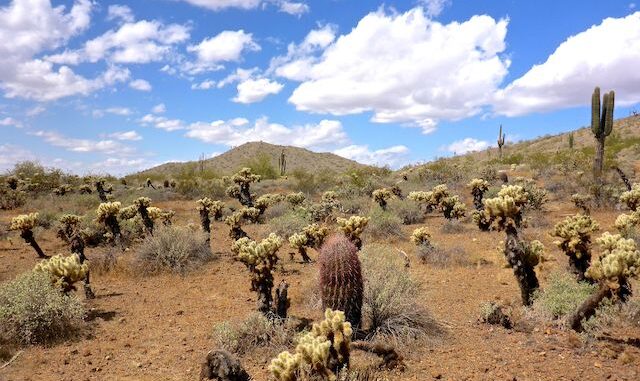
In 2020, I started finding heavy flowers the first week of March, when I hiked a half dozen trails in the Phoenix Sonoran Preserve‘s south unit: desert chicory, globe chamomile, lupine, desert globemallow, Mexican gold poppy, brittlebush and owl clover. (Though not as much owl clover as the epic amount I found on the Black Canyon Trail between the Boy Scout Loop and Table Mesa Rd. a month later.)
So, you would think that when I hiked one of Arizona’s better flower destinations — Picacho Peak State Park — last week, it would have been an angiospermatic extravaganza. Nope. 👋
I originally planned to hike Cave Creek Trail #4 today, which has an even better variety of flowers, but given spring’s slow start, I decided to stick to lower, slightly warmer, terrain in hope that would make a difference: I headed for the Phoenix Sonoran Preserve’s north unit.
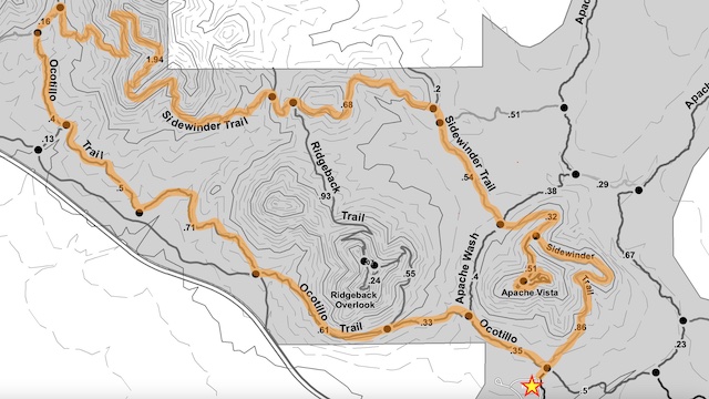
There’s an infinite number of options, but here some alternatives:
- Short Loop: Taking the Apache Wash Trail shortcut is 2.0 miles, 200 AEG (accumulated elevation gain). Apache Vista adds a ½ mile and 150 AEG.
- Medium Loop: Taking the Ridgeback Trail shortcut is 5.4 miles, 610 AEG. Ridgeback Overlook adds a ¼ mile and 50 AEG.
- Long Loop: What you see in the map, above. Ocotillo Trail, Sidewinder Trail and Apache Vista Trail are a combined 8.2 miles, 960 AEG. ✅
- Really Long Loop: I only did roughly half of Ocotillo Trail and Sidewinder Trail. If you do the whole thing, all the way to the Desert Hills Trailhead and back, that is 13.2 miles, 1300 AEG. If you want to do Apache Vista Trail after that, more power to ya!
Apache Wash Trailhead is located a half mile north of Sonoran Desert Dr. I’m lucky I found it, as the area was undeveloped eight years ago when I bought my Acura RDX. (I’ve been too lazy to update the GPS.) The trailhead has a jillion spaces, plus a horse trailer lot. There are his & hers flush bathrooms, but no potable water. It has the usual array of trail maps and nature info signs. The most interesting feature of the trailhead, were cement inlays pointing out the direction and distance to various terrain features, such as Piestewa Peak. 🧭
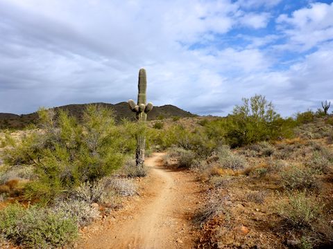
Ocotillo Trail is rated easy, which is accurate. It crosses multiple washs, but never climbs more than 50 ft. at a time, even when heading up to meet Sidewinder Trail. Ocotillo, which is mostly smooth dirt, parallels the paved Skip Rimsza Paseo, which is about 30 ft. downslope. While the Paseo is for casual bike riders, there are tons of mountain bikes on the Phoenix Sonoran Preserve’s easy dirt trails. There are several access points between the Paseo and Ocotillo Trail.
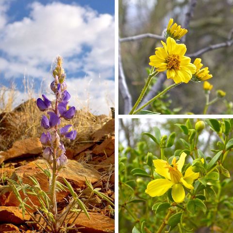
Just standing at the Apache Wash Trailhead, it was obvious there would be very slim pickings for flowers. So, as I headed west on Ocotillo Trail, I was shooting video, instead of stills, because I wanted to have enough material for my hike video (below). Otherwise, it might have been less than a minute long!
Sidewinder Trail is rated moderately difficult — entirely for the 350 ft. climb up Hill 2199 from Ocotillo Trail. (Or from the northern Ridgeback Trail connector if you are hiking counter-clockwise.) Otherwise Sidewinder Trail is easy. It is a bit rocky in a few spots, but never bad. There are several access points from ranch properties on the north side of Phoenix Sonoran Preserve, but there is no traffic noise. (Unless you count the planes and helicopters that were overhead all morning.) ✈️
I only remember one dog walker and one trail runner on Sidewinder Trail, but there were plenty more mountain bikes. Even I could ride Sidewinder (except for Hill 2199). Maybe I should get my MTB tuned back up? It’s been almost seven years since I went bike riding.
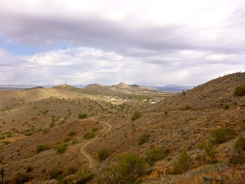
Apache Vista Trail is rated moderate, which is fair for the grade, but the distance is very short. Apache Vista Trail is actually a small loop of its own, with a lower “summit” and the actual high point, 25 ft. higher. Both are worth a visit, for slightly different perspectives on the surrounding terrain. Although not very prominent, the miles & miles of surrounding flat terrain means Apache Vista has line-of-sight to pretty much every major prominence in the Phoenix area. 🔭
I didn’t stay long on top of Apache Vista: As elsewhere in the Phoenix Sonoran Preserve, there is no shade. (The only decent shade I recall was on Sidewinder Trail, in a wash on the east slope of Hill 2199.)
I finished my hike in 3:08, which is over 2.9 mph, moving time — which should give you a good idea how casual a stroll this hike is. Along the way, I only drank two bottles of water and half a G2 Gatorade. Totally forgot lunch, so I plowed through my gorp on the way home!

Directions: From northbound I-17, take exit 222 to Dove Valley Rd. Turn right. In 5.1 miles, turn left into the Apache Wash Trailhead. From the Loop 101, take exit 28 to Cave Creek Rd. Turn north. In 4.7 miles, turn left onto Sonoran Desert Dr. In 4.0 miles, turn right into the Apache Wash Trailhead.
Park Map: Phoenix Sonoran Preserve Park Map (pdf)
GPS File: Phoenix_Sonoran_Preserve_Ocotillo_Sidewinder_Apache_Vista
Distance: 9.17 mi.
AEG: 1,124 ft.
Time: 3h 08m
Hiking Video
Hiking Phoenix Sonoran Preserve from Preston McMurry on Vimeo.
