
 were common on the east and west slope of Mahan Mountain.")
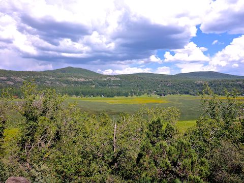
Sandys Canyon and Walnut Canyon, just outside Flagstaff, always have great #flowerporn this time of year, even when the summer monsoon has not been so generous. Even though Mormon Lake is twenty miles south of Flagstaff, and Mahan Mountain another ten past that, just off the end of Stoneman Lake Rd., near Happy Jack, I figured it might still be a good candidate for a flower hunt. 📸
I plotted an easy 9.8 mile, 770 ft. AEG (accumulated elevation gain) loop, of Arizona Trail Passage 28 and FR 135A, around Mahan Mountain. My loop starts where FR 135 crosses the AZT. Options include:
- Starting from Allan Lake Landing adds 4.0 miles, 450 AEG.
- Climbing Mahan Mountain adds 2.0 miles, 400 AEG.
- Climbing Hutch Mountain adds 3.5 miles, 700 AEG.
For the highly motivated, the whole shot is 19.3 miles and 2,300 AEG.
… Or just hike to Shuffs Tank and back (5.6 miles, 350 AEG), a casual stroll with great flower variety.
I started hiking south, counter-clockwise, on Arizona Trail Passage 28, at 8:30 a.m. It was a perfect morning, high 60s, mostly sunny. There was plenty of quality shade the whole way to Shuffs Tank, and not just because the sun was on the opposite side of Mahan Mountain. The AZT maintenance crews have done a fantastic job on the trail. 👍
After photographing Shuffs Tank, I continued across FR 135D on Arizona Trail Passage 28. I soon realized I was off my route. I doubled back to the tank to re-orient myself. I wasn’t worried about getting lost, but I didn’t want to end up in Happy Jack, or points further south. After a short break, I decided to stay on route, turning left onto FR 135D.
In the GPS route attached below, my route is in orange. The AZT segment I bypassed is in blue. I recommend staying on Arizona Trail Passage 28 as it is only a ½ mile longer and, I am sure, much more enjoyable. FR 135D had some nice meadows, but many fewer flowers and was rocky as well. Both FR 135D and the AZT end up in the same place, rejoining near FR 9255A.
There were a number of cattle on the west slope of Mahan Mountain. There were loud crickets (?)—I’m not good identifying critters—all along FR 135D, east of Shuffs Tank. I saw orange-belted bumblebee (bombus huntii) snacking on Wheeler’s thistle. Arizona Trail Passage 28 between FR 135D and FR 135A had too many gnats. Thankfully, the route is not too strenuous, so I could breathe through my nose. 👃🏻
That AZT segment beween FR 135D and FR 135A was rocky, and not as shady, with scrub oak predominating. I took a second break there, finding I still had 2-bar Verizon on my iPhone SE. (I had 4-bars at my trailhead, and again when I took my final break at the bottom of the Hutch Mountain summit road, north of Mahan Ranch.)
I turned left off Arizona Trail Passage 28 for good at FR 135A. This time on purpose. (The trail continues straight across the forest road.) The first mile on FR 135A was similar to FR 135D, but it climbed 200 ft. The slight change in elevation was enough to change the microclimate, so that the area around Mahan Ranch was densely wooded, almost like an old growth forest.
Mahan Ranch, itself, was thoroughly fenced and frequently posted with a variety of no trespassing signs. I could see the buildings through the spruce and pines, but not in detail. The property, though, was idyllic and perfectly located. Would love to own it. 💰
Past Mahan Ranch, the forest roads get a bit confusing, twisting around. Several of the forest roads are decommisioned for vehicle traffic. (In one case, being blocked by logs across FR 135A.) At least two appear to be routes to the summit of Mahan Mountain.
By the time I reached gate #5, at the Hutch Mountain summit road (FR 135B), the “old growth” forest had ended, and I was back in the type of terrain I’d started in four hours earlier. My pocket camera battery had died an hour earlier, so I was reduced to taking photos on my iPhone SE. Good thing I’d already shot all the flowers I could handle.
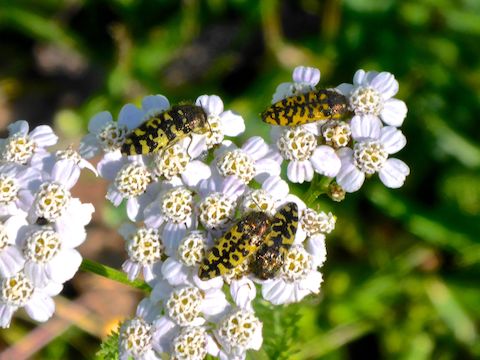
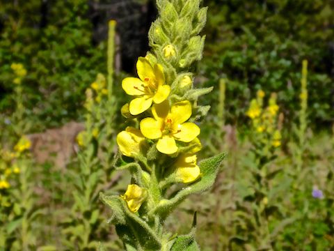
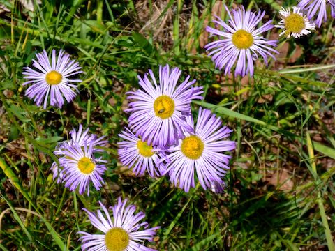
There were too many species of flowers to do the variety justice in a collage: I identified silvery lupine, velvety goldenrod, Wheeler’s thistle, showy fleabane, paintbrush, Mexican silene, Huachuca Mountain morning glory, mullein, western dayflower, western yarrow, pineywoods geranium, showy phlox, redroot wild buckwheat (a first for me), showy goldeneye, scarlet penstemon … and dandelions.
Thick clouds had come in on my way north past Mahan Mountain, and I’d even heard distant thunder. But I did not feel even a spinkle, though my car was doused. It needed it. 😆
Directions: From Phoenix, head north on I-17 almost to the top of the Mogollon Rim. Take exit 306 onto Stoneman Lake Rd. / FR 213. The first six miles are paved; the final nine miles are car driveable dirt. (This is much quicker than taking AZ-87 through Payson!) At the east end of FR 213, turn left onto Lake Mary Rd. In 1.3 miles, turn right onto improved dirt FR 135. In 1.3 miles, just after the cattle grate, park on the right.
GPS File: Mahan_Mountain_AZT_28_Loop
Distance: 11.12 mi.
AEG: 739 ft.
Time: 3h 50m