

My plan — the one I had loaded in my GPS — was to follow BLM Route 5026 up Bear Canyon, over a ridge, and down Arizona Gulch to abandoned Dry Camp Ranch (fka Sanford Ranch), then down Deer Creek, through Hell Hole, before following Aravaipa Creek back to Aravaipa Canyon East Trailhead. 🗺
At least that was my plan.
It is a 13½ mile loop, which I figured would take me 7-8 hours to hike. There’s no major obstacles in Deer Creek’s slot canyon, and you can walk right up the middle of Aravaipa Creek. But still, it’s a long haul, so I planned to do it counter-clockwise, getting a 1000 ft. climb out of the way at the beginning, rather than the end, when I would be tired after a long day.
Well, it was overcast and quite cold Wednesday morning in Thatcher, and even colder in Aravaipa Canyon. (Officially, 34℉.) I’m willing to be miserable for good photos, but not to struggle with poor lighting. Rather than hit the trail at a time giving me a reasonable chance of finishing before dinner, my wife & I waited until 9:15 a.m. before leaving the Springhill Suites: Driving Klondyke Road.
Thankfully, it was sunny and 48℉ when we arrived the east end of Aravaipa Canyon at 11:00 a.m. The problem was, even colder weather, with heavy clouds, high winds and rain, was predicted for mid-afternoon. Instead of hiking the Deer Creek loop, I went with Plan B: Hiking BLM Routes 5026 and 5026C to the Deer 3996 Benchmark. The area in question.
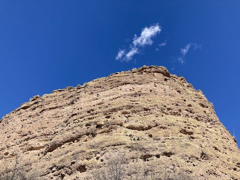
From the trailhead, I headed west 100 yds. to a split in the road: Left to continue down Aravaipa Creek to Turkey Creek; right onto BLM Route 5026, up Bear Canyon. As I headed up Bear Canyon, the cliffs on the right (east) gradually gave way to bluffs, then easily climbable slope. To the left (west), several washes looked worth taking down on my return trip.
For a mile up Bear Canyon, BLM Route 5026 is gravel, somewhat mushy in spots, but recently well maintained. (As evidenced by bulldozer tracks all the way to BLM Route 5030.) After a mile, BLM Route 5026 turns left, up and out of Bear Canyon.
BLM Route 5026 climbs 600 ft. in the next 1¼ miles. The steepest section, a mile up, wasn’t bad, because it was so short, but I did have to mind my footing on the way back down. OHVs would have no problem, and I think even my SUV could do it. Driving up wouldn’t save any effort on the loop, but it would allow you to save the best for last if you hiked the loop clockwise out of Dry Camp Ranch. 🏕
At the top of the climb, there is a triangle intersection: The first left goes directly to the weather station, the second left is BLM Route 5026C. I was going to check out Deer 3996 Benchmark, but decided to first at least take a peek further down Bear Canyon Ranch Road (as 5026 is also known).
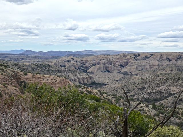
The road is fairly flat for the next ½ mile to BLM Route 5040, on the left. The initial section is rougher than BLM Route 5026. 5040 heads southeast three miles, bordering the Aravaipa Canyon Wilderness, 600 ft. down a ridge to a possible observation point 300 ft. above Deer Creek, and two miles north of Aravaipa Creek. I bet that OP has great elevated angles of Hell Hole! 📸
BLM Route 5030, is on the right, just past 5040. I only went maybe 50 yds. down 5030, which curls four miles around the south rim of Arizona Gulch, until it connects to Aravaipa Townsite Rd., just below the ghost town. But I did find a concrete pole base, marked “?-26-1965 / J.T. Sanford / D.B. Sanford”. (Doubtless related to Sanford Ranch / Dry Camp Ranch.)
The sky was getting darker & darker, the breeze picking up. Still, I went a bit further down BLM Route 5026, to where I had decent view down to the Arizona Gulch junction with Deer Creek. I didn’t dally, as I was getting quite chilly. After a few photos, I headed back up 5026, then started down towards Deer 3996 Benchmark.
On satellite view, BLM Route 5026C is obvious, and a mile long. On the ground, it was grassed over, with parallel 4×4 depressions. I lost it after ⅓ mile. I could have gone cross country, but with the late start and worsening weather, said screw it.
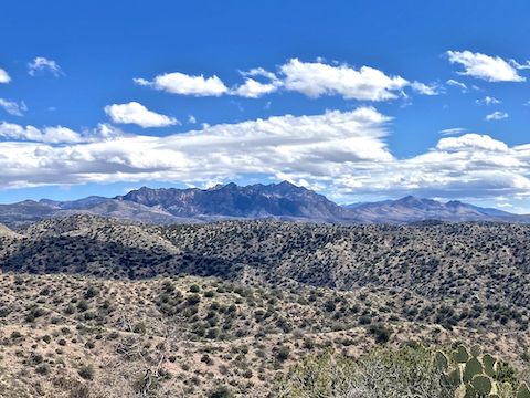
Back at the weather station, I couldn’t see any equipment other than a small solar panel. The base pole was marked “BLM Serial Auth No A-34960”. Located on a small hill, besides the previously mentioned formations, the weather station also had great views south to Table Mountain, Holy Joe Mountain and Zapata Peak in the Galiuros. Shockingly, I had 3-bar LTE Verizon reception on my iPhone SE. 🛰
Freezing my huevos off, I made the 2¼ miles back to the trailhead in a speedy 43 minutes. Changed shoes, chugged a restorative V-8, and headed out, making the drive back to AZ-70 in 65 minutes. Good thing too, as the weather went all to hell that night. The wind was howling in Thatcher: I can only imagine what was happening in Aravaipa Canyon!
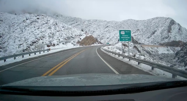
Aravaipa Canyon East Trailhead Directions: On US-70, heading southeast from Peridot, or northwest from Pima, at the small substation between MP 313 and MP 314, turn west onto dirt Aravaipa Klondyke Rd. The quality dirt surface is easily car drivable. Aravaipa Klondyke Rd. climbs towards the 5,000 ft. pass between the Santa Teresa Mountain and the Pinaleno Mountains. At 15 miles, on the left, is a memorial for the Wham Paymaster Robbery. At Sand Tanks Rd., Klondyke Rd. drops through a short shaded area, then down to a t-intersection at 25 miles. Split right, heading north. The Ranger Station and ghost town of Klondyke are at 32 miles. The Nature Conservancy’s Cobra Ranch is at 36 miles. There are six water crossings — which are probably not car drivable — the final 4½ miles. Permit required.
GPS File: Aravaipa_Bear_Canyon_Exploration
Distance: 7.33 mi.
AEG: 1167 ft.
Time: 2h 29m
Hiking Video
Exploring Aravaipa Canyon Rim from Preston McMurry on Vimeo.