

This was my fourth trip to Spur Cross in the last four weeks. Might not seem much to those folks who have second homes in the Superstitions. 😁
Today’s objective being Hill 3342, on the east face of Elephant Mountain, to take a closer look at the indian ruins. There was no one at the trailhead at 0700, and it was again windy, and very chilly. I took the shortcut up Maricopa Trail. Just short of the small metal tank, at the Limestone Trail #252 intersection, I got passed by a guy. I was surprised enough I let out a 🤬! He had one of those 60 Hikes books, and the trailhead map (which isn’t bad), and was wondering which way to Spur Cross Trail — to which I gave him directions.
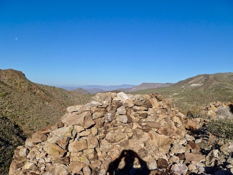
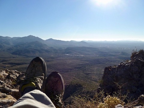
I made the saddle in a little over an hour. (By comparison, taking the ‘shortcut’ is 2.73 miles and 1073 AEG from the big port-a-potties, whereas continuing north towards Black Mesa is 3.61 miles and 1264 AEG, to the saddle.) I looked across at Hill 3342 and … Do not enter. 🚫
Well, I did not come out here to bore myself silly hiking back on the Spur Cross Trail. Certainly not without some sort of payoff. Up I went. 😉
I did see one other set of footprints up there, that was less than three weeks old. At one point I let out a loud belch, immediately after which I heard voices below. I was wondering if they thought I was a mountain lion.
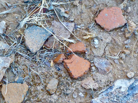
No petroglyphs, metates, kivas, or even pottery shards. (Until 45 minutes later, when I was leaving, and found two small piles.) Not enough space for agriculture. Still it was pretty freaking cool.
I had been planning on returning via the Elephant Mountain Trail ‘shortcut’, but it is steep in spots, and slippery, and my depth perception going downhill is not the greatest, so I took boring old Spur Cross Trail instead and, to avoid being too bored, Dragonfly? (Not sure.)
Directions: From Loop 101 / Pima Freeway, head north on Cave Creek Rd. for 12.2 miles. Just as the road curves east into ‘downtown’ Cave Creek, turn left onto Spur Cross Rd. Take the next right, then a quick left. The trailhead is four miles ahead. The final mile is semi-paved but car drivable. There is no fee to park, but there is a $3 envelope fee to hike / bike / horse ride into the conservation area.
Distance: 7.55 mi.
AEG: 1,586 ft.
Time: 3h 06m