

This loop is a tale of three segments: The out, the fun — Limestone Trail #252 — and the back.
As I hiked it, the out was from the drive-in port-a-potties, across Cave Creek, up Metate Trail, with a brief diversion into Towhee Trail, arriving at the Tonto National Forest gate in 1.2 total miles. Plenty of quail on Towhee Trail in winter, but very little vegetation beyond scattered orange berries. From there proceed north along FR 48 for about a mile to the old corral, which looks like it still gets occasional use. (Or, like I did, at .7 miles, where FR 48 crosses Cave Creek at a wash, get some minor rock-hopping in by going up Cave Creek to the old corral.)
Limestone Trail #252 kicks off from the southwest corner of the old corral. There’s a short, rocky climb out of the corral, then a slow steady climb on a decent track, towards Sugarloaf Mountain. (It looks like you will head north, around the mountain, but actually you will end up turning south across Sugarloaf’s east slope.)

There’s lots of cactus in this area — prickly pear, hedgehog, etc. At 2.5 total miles, you will cross to the south bank of the wash, and Limestone Trail #252 will slope up a bit, until you arrive at Limestone Spring in 2.9 total miles. (You can see where it gets its name from the scaling on the pipe.) The spring box was full, with a steady trickle. Probably okay with filtering. Quite a few bees, but not the aggressive kind.
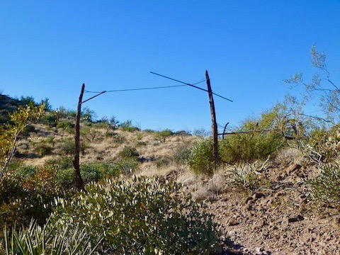
Limestone Trail #252 gets a bit confusing crossing south across a lush wash, before proceeding between Sugarloaf Mountain and Hill 2803. The highpoint of the hike, 3.3 miles in, is about 2900 feet, in the saddle between Sugarloaf Mountain and an unnamed 3100-foot hill. It is marked by an old gate. It’s not a government boundary, so must be from an old ranch. (There were quite a few foundations along Metate Trail.)
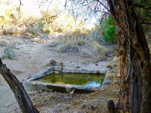
From the old gate, it is only a couple hundred yards to Page Spring, another concrete tank. With, for some odd reason, a shovel hanging next to it. The Page Spring box was also full, and looked filterable. Both the north and south slopes of the saddle have several white rock runoffs that would make for an interesting exploratory diversion.
So far, Limestone Trail #252 has been relatively benign, easy route finding, and not at all primitive like the Maricopa County Parks map claims. However, from Page Spring south, the story changes. It’s gets very rocky, often hard to route find and, in the segment between the two perma-cairns, up and down across washes.
Limestone Trail #252 is over, unless you continue south to the second perma-cairn, then back on Elephant Mountain Trail. Otherwise, like I did, dodge dog-walkers on the 2-mile trudge along Tortuga and Spur Cross back to the drive-in port-a-potties. (To make it intesting, I fantasized that I was skier moguling rocks with my hiking poles.)
Directions: From Loop 101 / Pima Freeway, head north on Cave Creek Rd. for 12.2 miles. Just as the road curves east into ‘downtown’ Cave Creek, turn left onto Spur Cross Rd. Take the next right, then a quick left. The trailhead is four miles ahead. The final mile is semi-paved but car drivable. There is no fee to park, but there is a $3 envelope fee to hike / bike / horse ride into the conservation area.
GPS File: Limestone_Trail_252_Loop
Distance: 6.49 mi.
AEG: 1,169 ft.
Time: 2h 37m