

I haven’t done a canyon crawl in Apache-Sitgreaves National Forest since I sliced my arm in West Chevelon Canyon fourteen months ago. Sure, I did a bike ride in ASNF a month ago (General Crook Trail), and a hike in the spring (HL Canyon), but neither of those were off trail in a tangled and/or rocky canyon bottom. (Technically, East Leonard Canyon is ASNF’s border with Coconino National Forest.)
East Leonard Canyon is a short canyon between Knoll Ridge and an unnamed ridge topped by FR 115 / Limestone Road. The head of East Leonard Canyon is on Rim Road, at milepost 24. After six miles, East Leonard Canyon combines with Middle Leonard Canyon and West Leonard Canyon to form, simply, Leonard Canyon — which eventually empties into East Clear Creek at Leonard Point. 🏞
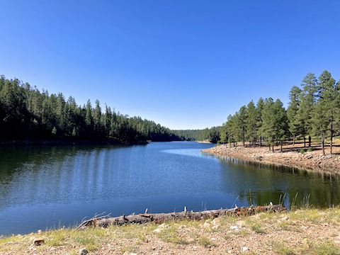
East Leonard Canyon is dammed at it’s midpoint, forming Knoll Lake. I previously hiked the upper reaches of the canyon, and around the lake. Today’s plan was to canyon crawl the three miles below the dam to the other Lennies, climb out and — as is my habit — circle back on forest roads.
We drove Rim Road from the east. It is now paved west to MP 31, near Bear Canyon Lake Rd. Not sure if that is where the pavement is supposed to end, but no one was working there. They were, however, laying down a second layer of asphalt, near the General Crook Trail crossing at ~MP 38. The unpaved parts of Rim Road seemed rougher than I remember — probably due to the summer monsoon.
I started hiking from the Knoll Lake dam at 9:30 a.m. I went down the west side of the grassy earthen dam. The middle would be easier. Avoid the rocky spillway at the east end. There’s a few minor cement structures at the bottom of the dam, but nothing really interesting. One structure had the only graffiti on it I recall seeing on the Mogollon Rim. 🤔
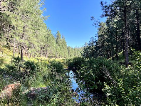
The first ⅓ mile below Knoll Lake dam, East Leonard Canyon was tangled, the vegetation wet with dew and night rain. My feet got soaked and stayed that way the remainder of my hike. The humidity — which was murder — did not help. The creek, which had had pooled water, subsequently disappeared underground for a little over a mile.
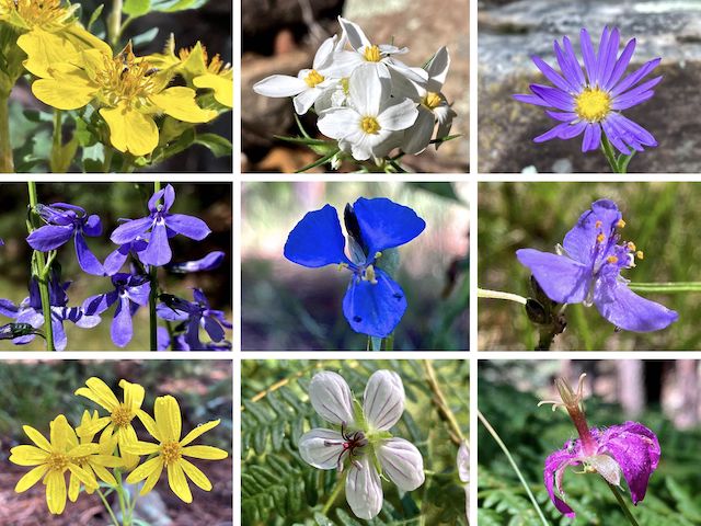
Top Row: Scouler’s St. Johnswort, Nuttal’s linanthus, alpine leafybract aster.
Middle Row: Apache lobelia, western dayflower, pinewoods spiderwort.
Bottom Row: hairy golden aster, Richardson’s geranium, pineywoods geranium.
Unlike Houston Draw, East Leonard Canyon has no fenced enclosures. There is no formal hiker trail, but I managed to follow a game trail part of the way. Where there was no trail, I took the path of least resistance: Sometimes that was up the main channel, other times a side channel, the “island” between the two, or the usually shady shelf to either side. (Side channels are rare, even in wider Mogollon Rim canyons.)
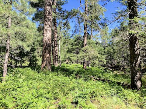
East Leonard Canyon’s channels never got too rocky. There were no serious ankle breakers, nor boulders to scamble over. Other than easily avoided spots of further brushiness, there were no obstacles at all: No pours to downclimb, nor deadfall to low crawl. A couple of times, crossing a fern-covered shelf, I had to lift my leg a little higher over deadfall. Does that count as an obstacle?
At East Leonard Canyon’s 1¾ mile mark, there is non-strenuous bail west to FR 9745A. It’s marked on the GPS route attached to this blog. Just past that, the creek reappeared as a 200 yd. long pool that was up to 18″ deep. At the 2¾ mile mark is the neat little cliff in this blog’s banner. You could easily bail east, via the side of the cliff, to FR 115M (though that would be a long walk back).
Hairy golden aster (Heterotheca villosa) were the most common flower in East Leonard Canyon. I found Apache lobelia (Lobelia anatina) spotted throughout the canyon. There were a fair number of coneflower (Rudbeckia laciniata), but it is getting late in the season for them, so many were missing petals. I did not realize Wood’s rose (Rosa woodsii) hips are edible, or I would have tried a few. 🍒
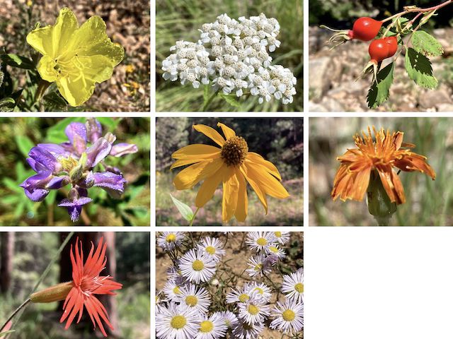
Top Row: desert evening primrose, western yarrow, edible Wood’s rose hips.
Middle Row: silvery lupine, coneflower, orange agoseris.
Bottom Row: Mexican silene, spreading fleabane.
Other high country flowers in East Leonard Canyon included red & yellow pea (Acmispon wrightii), ragleaf bahia (Hymenothrix dissecta), wild bergamot (Monarda fistulosa), linearleaf four-o’clock (Mirabilis linearis), velvety goldenrod (Solidago velutina), woolly mullein (Verbascum thapsus), alpine false springparsley (Cymopterus lemmonii), and Geyer’s onion (Allium geyeri).
I reached the end of East Leonard Canyon at the 3-mile mark. Climbing the spur formed with West Leonard Canyon was mellow the first 50 ft. of vertical. I heard ATVs up, ahead. The next 100 ft. were steep, but not as bad as other Mogollon Rim canyons. No obstacles either. And I picked up FR 295 right at the top. No sign of the ATVs. 👍
The first mile on FR 295 was SUV-able; I would avoid it in a car. At the 4⅓ mile mark, to avoid traffic and maximize peace & quiet, I turned right onto decommissioned FR 9715N. FR 295 is the same length, but FR 9715N seemed to have better shade. I took a lunch break at the 5-mile mark. Reconnecting to FR 295 at the 6-mile mark, I soon turned west down Knoll Lake Road, finishing my loop in 3h 14m hiking time.
Directions: From Phoenix, head north on AZ-87, the Beeline Highway, into Payson. Turn right on AZ-260. In 29 miles, after cresting the Mogollon Rim, take the first left onto FR 300 / Rim Rd. 9.4 miles from AZ-260 is a t-intersection. Turn left. (Right is FR 34 to Winslow.) Since late 2024, Rim Rd. pavement ends at MP 31. Just before MP 23, turn right on FR 295. In 3.1 miles, turn right onto FR 295E. Drive past the Knoll Lake Campground, parking near the boat ramp in 1.3 miles. Or take I-17 and AZ-260, then drive east on Rim Rd. It’s basically the same time & distance either way.
GPS File: East_Leonard_Canyon_Loop
Distance: 8.12 mi.
AEG: 502 ft.
Time: 3h 14m
Rumble Video
Vimeo Video
For some reason the icompetents at Vimeo will not allow me to upload a custom thumbnail! 😡
Hiking East Leonard Canyon, Mogollon Rim from Preston McMurry on Vimeo.