

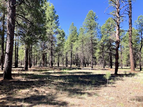
Garland Prairie is an oblong, ~14,000 acre, meadow in the Kaibab National Forest, halfway between Flagstaff and Williams. I-40 forms Garland Prairie’s northern border; the Coconino National Forest is across the powerline road which forms the prairie’s southern border. Besides deer and elk, I’ve seen pronghorn in the area. There’s scattered ranches, some abandoned.
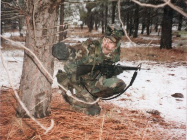
From 1985-1989, I was an MP, doing facilities security, at Navajo Army Depot (now Camp Navajo). Garland Prairie is just a mile west of Camp Navajo. I was also in Army ROTC at Northern Arizona University, and we did training exercises at Garland Prairie, or near Rogers Lake, on the east side of Camp Navajo. Today, I decided to return.
I planned a totally cross-country, amoeba-shaped, loop that took advantage of the thickest forest available, while avoiding Boy Scout Camp Raymond, and other private property. (See the .gpx file below.) No reason you would need to follow it exactly, but you’ll be close enough for government work if you navigate from waypoint to waypoint.
I started from the southeast corner of Garland Prairie, at the intersection of FR 9017D and the powerline road. Hiking counter-clockwise, I headed west towards WP-1 (waypoint 1), parallel to the powerline road, which was 100-150 yds. to my right. Despite being inside the treeline, there’s still space between the ponderosa pine, so I navigated from shadow to shadow.
WP-1 is where I crossed an anonymous dirt road and, at 0.9 miles, turned south. (There are many old logging roads near Garland Prairie.) As I hiked towards WP-2, Manterola Ranch Road was 100-150 yds. to my right. Manterola Ranch Road, and FR 530, is how I actually drove to the trailhead on FR 9017D, as I missed the turn on powerline road. Only saw a few fleabane along Manterola Ranch Road.
I reached WP-2, on the edge of a meadow, at 1.5 miles. Railroad Spring is in that meadow, but I didn’t inspect it. Instead, I angled east, crossing FR 530, slightly climbing alongside a rocky knoll. I reached WP-3, at 1.9 miles. I slanted northeast, along a contour line, towards WP-4 (on a jeep trail at 2.3 miles) and WP-5 (at 2.8 miles). I spotted small-leaf pussytoes, showy phlox, and a few doubting mariposa lily.
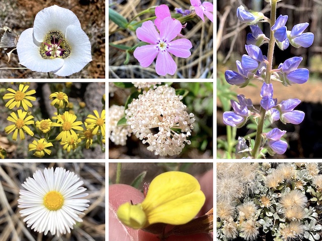
Top Row: doubting mariposa lily, showy phlox, silver lupine.
Middle Row: lobeleaf groundsel, Fendler’s ceanothus.
Bottom Row: fleabane of indeterminate species, red and yellow pea, small-leaf pussytoes.
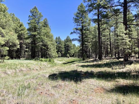
At WP-5, I bent east, along a rocky ledge with a short slope twenty feet down, to my right. When I reached WP-6 (3.1 miles), I aimed southeast on a gentle downslope to WP-7 at Volunteer Wash (3.7 miles). Very few flowers today, overall, but good variety. Volunteer Wash was bone dry, but had the best flowers, including Lewis flax, shrubby cinquefoil, Rocky Mountain iris, and American vetch.
Volunteer Wash starts about a mile east of Bellemont, cuts across the east end of Camp Navajo, runs along the base’s southern boundary, past Sliker Hill and Mooney Mountain to Sheep Tank, drops into 1,000 ft. deep Volunteer Canyon, before emptying into Sycamore Canyon after 23 miles. The part of Volunteer Wash which I hiked was a bit lumpy, but certainly no Mogollon Rim canyon crawl.
I took a break at Sheep Tank, enjoying the shade, a murderwich and a hiking beer (Sam Smith Organic Apricot Ale). The only vehicles I saw all day were a couple of Forest Service pickups that drove by Sheep Tank on FR 527C. (Presumably Coconino National Forest, as I was still south of powerline road.) With 2-bar Verizon at Sheep Tank, and at the FR 9017D trailhead, I texted my wife I would be 30 minutes late.
From Sheep Tank, I hiked northwest. I crossed Volunteer Wash at WP-9 (4.3 miles), FR 530 at WP-10 (4.6 miles), and then powerline road, entering the Kaibab National Forest. There was a mostly collapsed barbed wire fence just inside the tree line. No “stay out!” signs, so over I went. It was only later I realized the fence was the Kaibab National Forest boundary.
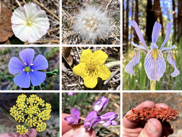
Top Row: field bindweed, some sort of agoeris seed pod, Rocky Mountain iris.
Middle Row: Lewis flax, shrubby cinquefoil.
Bottom Row: alpine false springparsley, American vetch, no clue.
By that point, I was trying hustle through the final two miles. (The predicted high was 83°, and it was already 86°.) Continuing northwest, I hit WP-11 (4.9 miles) and WP-12 (5.4 miles). At WP-12, I turned west, towards WP-13 (5.7 miles), staying 200-300 ft. away from Garland Prairie private property lines. At WP-13, I angled southwest passing by a barbed wire fence corner, to WP-14 (6.1 miles).
From WP-14, it was a straight shot south, back across powerline road, to my wife waiting on FR 9017D. Good day that ended at the Deer Valley Rd. Culvers for a butterburger, cheese curds, and chocolate Heath crunch custard. 🤤
White Horse Lake Directions: From I-40, west of Flagstaff, take exit 178, south onto FR 141 / Garland Prairie Rd. At 2.6 miles, FR 141 changes to car-drivable dirt. At 7.1 miles, FR 141 makes a right turn. FR 141 changes back to pavement. At 8.1 miles, turn left on paved FR 527 / Boy Scout Camp Rd. At 9.1 miles, FR 527 changes back to dirt, and splits in a bunch of different directions. Turn left on the powerline road. It should be car-drivable. If not, park near WP-1, and start your loop there. Else at 10.2 miles, turn right on FR 9017D, then park.
GPS File: Garland_Prairie_Sheep_Tank_Loop
Distance: 7.24 mi.
AEG: 210 ft.
Time: 2h 51m
Rumble Video
Vimeo Video
Hiking Garland Prairie – Sheep Tank Loop, Arizona from Preston McMurry on Vimeo.