

I was originally going to hike the Chesapeake and Ohio Canal from Oldtown to Spring Gap, but that is barely 6½ miles, and would have left me a nearly 12 mile segment to complete my towpath “thru hike” in the Fall. Since my wife so helpfully performs shuttle driving duties, I figure it’s best to anchor my hikes on trailheads where toilets are available. 🚻
Spring Gap is one — but so is North Branch, an unincorporated community south of Cumberland, near the CSX rail yard. North Branch is exactly half way (9 miles) beween Oldtown and the end of the C&O Canal at the Western Maryland Scenic Railroad in downtown Cumberland. Better yet, segmenting my hike that way adds some cool canal stuff that the Oldtown to Spring Gap stretch otherwise lacks.
Rather than drive through Berkeley Springs, then Paw Paw to Oldtown, I chanced driving the twisty route from I-68 through North Branch to Oldtown. (Stopping at Lock 75 along the way, so my shuttle driving wife could see where it was.) A road map vehicle GPS came in handy.
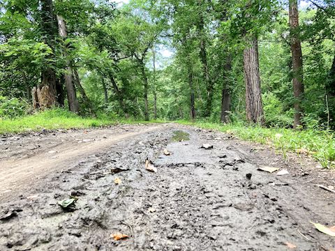
MP 166.7: Oldtown Lock 70 has two portapotties (one wheelchair accessible), four picnic tables (three with grills), direction & distance sign, and a trash bag dispenser. The lockhouse is open on summer weekends. The next six miles to Spring Gap is supposed to be one of the best birding spots along the C&O Canal, but I didn’t hear as many birds as the Bonds Landing to Paw Paw segment.
Lock 71 is ¼ mile past Oldtown Lock 70. Heading downstream, Lock 71 is first of thirteen upper composite locks (made with more than one material). Prone to decay, the composite locks’ kyanized wood was replaced with concrete between 1891-1924 (when the C&O Canal ceased operations). 🪵
MP 168.4: I’m not sure if the previous mile is part of Battie Mixon’s Pond, or if this is it, but it’s definitely a pond. I didn’t bother checking out the whazzits on the far shore. Named after the Allegany County game warden who thought of the idea, Battie Mixon’s Pond dates to 1945. Maryland DNR stocks the pond with bluegill, sunfish, channel catfish, smallmouth bass, crappie, shiners and even trout.
MP 169.2: Pigman’s Ferry Campground — “hiker biker campsite” is too wordy — has a portapotty, picnic table, grill, fire pit, direction & distance sign, trash bag dispenser, and a well hand pump. The water is non-potable, but that was irrelevant as it gave none even after 20 pumps. You may have better luck. The adjacent fallow field turned to prairie contains an ancient haystack.
MP 170.9: Historical marker for Turner Ashby’s Attack, one of the small, early, Civil War engagements pre-dating the First Battle of Bull Run. (The battle is also known as the Kelley’s Island Engagement.) Opposite the marker is a jeep trail across the canal and uphill. I walked 200 yds. up the jeep trail to a smooth gravel road, which appears to be an extension of Buckley Rd. 🗺
Besides the flowers below, I also photographed Atlantic goldenrod (Solidago arguta), hollow joe-pye weed (Eutrochium fistulosum), sweet-scented joe-pye weed (Eutrochium purpureum), woodland lettuce (Lactuca floridana), Amur honeysuckle (Lonicera maackii), thistle, yarrow and, of course, dandelion. Thanx to Maryland Biodiversity and Wildflower Search! Check out my C&O Canal video to see them all.

Top Row: butterfly milkweed, chicory, I don’t know from mushrooms.
Middle Row: Allegheny monkeyflower, woodland sunflower, summer phlox.
Bottom Row: purple loosestrife, New York ironweed, crimson-eyed rosemallow.
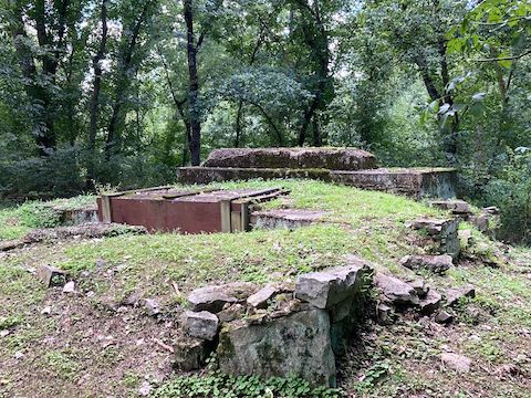
MP 171.4: There’s a short section of stone buttressing wall on the Potomac River side of the C&O Canal towpath. Bolted stone blocks adjacent to the towpath do not appear to be in their original location. It’s far from the first time I found something interesting, with no indication what it might have been.
MP 173.3: Spring Gap Campground has 14 numbered vehicle-accessible camping spots, each with a picnic table, grill and fire pit. There is a portapotty by the campsite, and two pit toilets at the other end of the campground, by the boat ramp. (Where there are more picnic tables.) The well hand pump had a handle that was stuck. Camping is $20 / night and reservations are required. 🏕
MP 174.4: Lock 72 is known as The Narrows or Ten Mile Lock (being 10 miles down the C&O Canal from Cumberland). There was a fair amount of vehicle noise from MD-51 / Oldtown Rd., which is sometimes visible through the trees. I, uh, spotted a spotted lanternfly, an invasive species I didn’t know you are supposed to kill on sight.
MP 175.4: Irons Mountain Campground has a portapotty, picnic table, grill, fire pit, direction & distance sign, trash bag dispenser, and a well hand pump. (Which I forgot to check for water.) The campground has easy access to the Potomac River.
Lock 73 / North Branch 1 is directly across the C&O Canal towpath from Irons Mountain Campground. Lock 73 is followed in quick succession by Lock 74 / North Branch 2 and Lock 75 / North Branch 3 (aka Keifer’s Lock). The low bridge over Lock 74 is River Rd. The three North Branch locks were built from 1840-1841, and rebuilt in 1869. For more info, see Locks on the Chesapeake and Ohio Canal.
I finished hiking the Oldtown to North Branch C&O Canal segment in 3h 30m, plus 54 minutes “stopped time”. Most of that stopped time was consumed taking photos & videos. 368 of them — three or four of each subject, just to be sure — which I whittled down to 143, from which I selected 50 for my blog, video and HikeArizona.com. Two more C&O Canal segments to go!
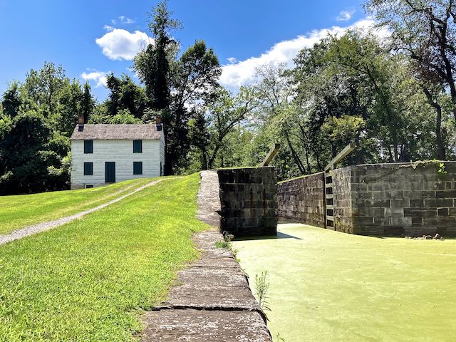
Lock 75 Directions: From I-68, take exit 44 south / east onto MD-639 / Willowbrook Rd. Go straight through both traffic circles. In 1½ miles, turn left on Williams Rd. In ½ mile, turn right on Messick Rd. In ¾ mile, turn left on MD-51 / Oldtown Rd. In 2¾ turn right on Pittsburgh Plate Glass Rd. (That appears to be its name.) In ½ mile, turn left into the Lock 75 trailhead.
Oldtown Directions: Instead of making the final turn to Lock 75, continue on MD-51 / Oldtown Rd. Mind your speed: The road gets tight. In another 8½ miles, turn right on Oldtown Cemetery Rd. Make a quick left onto Opessa St. Take the next right onto Green Spring Rd. Take the next right into the Lock 70 trailhead.
GPS File: CO_Canal_166to175_Oldtown_to_North_Branch
Distance: 10.48 mi.
AEG: 236 ft.
Time: 3h 30m
Hiking Video
Hiking C&O Canal: Oldtown to North Branch from Preston McMurry on Vimeo.