

Cave Creek Regional Park (CCRP) is considered one of the top spring flower destinations in the Phoenix area. There aren’t a whole lot of trails in CCRP, but usually plenty of blooms. Today did not disappoint.
I’m not concerned about coronavirus, so much as I am being able to find things open if I travel for an “away” hike. For instance, a trip to the Mogollon Rim will probably require refueling, and it would be nice after eating gorp all day to get some more substantial hiking food on the return home, while rehydrating with a few cold beers. (Especially since National Beer Day was this week!) 🍻
That said, my wife & I were planning on being in Hagerstown, Maryland, for Easter. We even had reservations I made around the beginning of the year, before China sprung Wuhan Flu on the rest of an unsuspecting world. On earlier trips, when our grandaughter Boo was a toddler, I day-hiked segments of the Appalachian Trail. (One of my favorite hikes ever was in early April snow from Pen Mar to Old Forge, Pennsylvania.) ❄️
After a few years, as fresh Appalachian Trail segments started getting further and further away, I began mixing them with Chesapeake & Ohio Canal Towpath segments. I soon realized that the C&O Canal is only 184.5 miles long. That made it an achievable goal for me to day hike C&O Canal segments one or two per trip, twice per year — our other visit is Halloween — finishing end-to-end by 2025.
My wife is is kind enough to drop me off, then pick me up, at the end of shuttle hikes. (Sometimes even resupply me in the middle, if there is a nearby trailhead.) But she is a bit older than me, and I had to take that into account in my planning. (A shuttle hike is no 5 Paragraph Operations Order, but it’s complex enough on often unfamiliar roads.) 🚙
So, while Chinese Lung AIDs is ravishing Western economies, I’m sticking close to home, doing locals hikes, getting my minimum 50 miles per month, like I have for 52 straight months. Even if there is a quarantine, the desert is literally out my back door, so I can always do Charles M. Chistiansen Trail #100 for the one thousandth time.
Back to Cave Creek Regional Park and today’s hike …
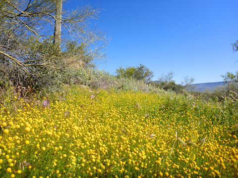
The hillsides surrounding the trailhead were golden. I thought at first it might be globe chamomile, an invasive species which is common in the Cave Creek area, but nope! Brittlebush spread across the hills like butter on bread. 🤗
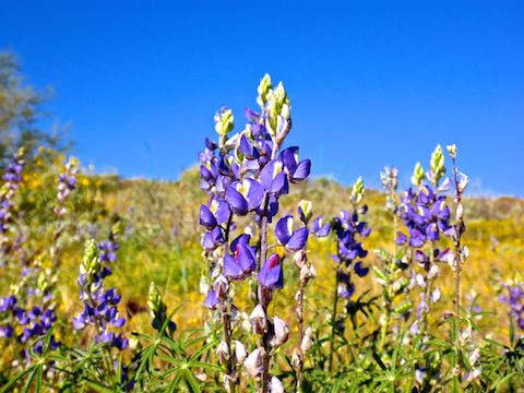
Overton Trail, west of the Cave Creek Regional Park visitor’s center, is the only CCRP trail I have not been on. It gains 400 ft. in 1.5 miles. That’s a bit of a climb, but I never needed my hiking poles. (Which I purposefully left behind after not using them last week at Granite Mountain.) Besides the usual array of desert flower species, on Overton Trail it became obvious that there would plenty of Coulter’s Lupine photo ops on this hike.
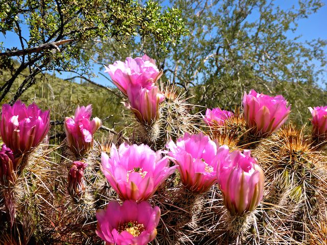
The Strawberry Hedgehog — aka Engelmann’s Cactus, which look like spikey cucumbers — had big pink blooms all morning long, but I saw not a single other cactus flower. Not even a cholla bloom, like I had in my backyard a few days earlier. That was a bummer, as cacti have the most beautiful flowers.
Go John Trail, a loop in itself, is 5.4 miles and 900 ft. accumulated elevation gain (AEG). I hiked the 3.2 miles, 400 AEG, of it on the “backside” of Cave Creek Regional Park, from Overton Trail to Quartz Trail. Go John Trail was the only segment of my loop where I saw no other people. Plenty of “social distance” as it were. 🙄
Go John Trail crosses several washes, and other than Overton Trail in the early morning, that is the only shade on this loop until you get back to to a picnic cabana at the trailhead. There was no water in the washes, not even standing puddles, but the greenery made it obvious there had been. The only memorial bench was at the bottom of the first wash, near the State Trust Land gate.
Quartz Trail, on the other hand, had at least a half dozen memorial benches, some only 200 yds. apart! Since Quartz Trail overlooks Cave Creek and Black Mountain — yes, another one — I assume the memorial benches are overlooking where those folks most enjoyed hiking. Only 1.4 miles, north-to-south Quartz Trail is mostly downhill. Heading the opposite way, it climbs 300 ft.
I started encountering people again on Quartz Trail. Due to Sino Sinus Syphilis, most kept a distance when I passed them, some even going so far as to stop and turn their backs to me.
Slate Trail is basically flat, and only 1.3 miles long. Parking at the rest room by the horse lot, it would be a nice out & back for less adventurous hikers, with plenty of flowers still to photograph. 📸
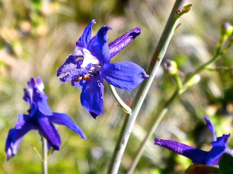
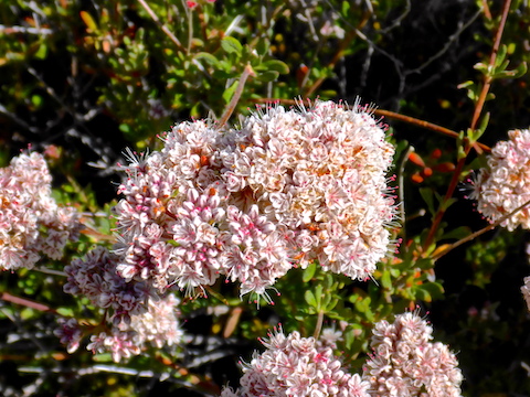
Besides brittlebush, lupine and strawberry hedgehog, flowers I spotted today included desert wishbone bush, desert globemallow, Mexican gold poppy, filaree, owl clover, globe chamomile (aka stinknet), scorpion weed, desert chicory, California goldfields, flat top buckwheat, barestem larkspur and many others.
Starting at 8:00 a.m., I was done by 11:30 and home just after noon, getting a jump on my photos — over 160 of them! — blog, hiking route, video and other post-hike tasks. Such are the advantages of a locals hike!
Directions: From Loop 101 / Pima Freeway, head north on Cave Creek Rd. for 9.6 miles. Turn left on Carefree Hwy. (From Spur Cross, head back to Carefree Hwy., and turn right.) In 1.7 miles, turn right on 32nd St. The fee station is in 1.6 miles. It costs $7 / vehicle. The Nature Center is in ¾ of a mile, where this loop starts.
Park Map: Cave_Creek_Regional_Park_Map
GPS File: CCRP_Overton_Go_John_Quartz_Slate_Loop
Distance: 7.88 mi.
AEG: 959 ft.
Time: 2h 48m
Hiking Video
Flowers @ Cave Creek Regional Park from Preston McMurry on Vimeo.