

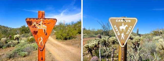
The Boy Scout Loop is the second segment, south-to-north, of the Black Canyon Trail. The BCT is a National Recreation Trail that stretches 80 miles from Carefree Highway, in far north Phoenix, to Russian Well, in Brushy Wash, near Orme School in Yavapai County.
I could not find out much about Emery Henderson (1921-2009) other than that he was an Arizona horseman and trail advocate who was awarded two Bronze Stars and a Purple Heart in World War II. The trailhead which bears his name, on New River Rd. in northern Maricopa County, has several picnic cabanas, lots of room for horse trailers, many hitching posts, a composting pit toilet and, despite no camping being allowed, a site host. (A friendly chap who offered me a map.) 🙂
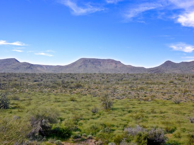
The first Black Canyon Trail segment, from Carefree Highway to New River Rd., is flat as a board. The Boy Scout Loop offers a bit more terrain variety, as it climbs into the foothills of the Bradshaw Mountains.
Black Canyon Trail is for horses, mountain bikers, hikers and trail runners. Motorized vehicles are not allowed, but on its second segment the BCT is co-located with several jeep trails, including FR 9949 near the top of Boy Scout Loop. About ⅓ of this hike’s distance is jeep trail, though on a Thursday I only saw two off-highway vehicles (OHVs): One side-by-side and a dirt bike that stopped to ask me if I was looking for javelina. 🐗
The second segment strarts at the far end of the parking lot, by the pit toilets & white, metallic, trail log stand. New River Rd. doesn’t get nearly as much traffic as Carefree Highway / AZ-74, so the traffic noise rapidly faded as I headed north.
The Boy Scout Loop starts out single track. In a ¼ mile, the BCT crosses what is essentially a 3-lane dirt road. That is El Paso Gas Pipeline Rd.
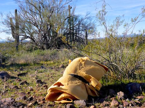
Unlike the cleaned up first segment of the Black Canyon Trail, I found two garbage piles in the first mile of the Boy Scout Loop: The first, several rolls of foam padding; the second, a cheap metal futon and frame mattress. I actually took a look at the rolls to see if there was a body inside. It may not seem like it, but the desert is a great place to hide bodies. 🔎
There are several informal firing ranges on or near Boy Scout Loop: The first is 1.6 miles north of the Emery Henderson Trailhead. When I last hiked the Black Canyon Trail’s second segment nearly nine years ago, the first range was riddled with shell casings and shot up targets. There was still some casings left, but it looked like whoever used it last at least tried to do a cleanup. I can just imagine how long 1st Sergeant would have had me beat my boots if it wasn’t “No Brass! No Ammo!” when I left the Ft. Bragg range.
The first 2.7 miles of the Boy Scout Loop, the Black Canyon Trail parallels, and often crosses a good size wash. On this trip, the flood plain along that wash was was thick with thigh-high grassy reed things. (Not a botanist.) 😏
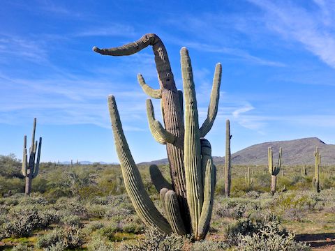
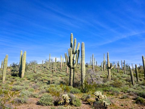
The Boy Scout Loop is a 4-mile out & back, with a small two mile loop at the end. So, more like a lasso than a loop. The fourth mile out is on a wide, smooth, jeep trail. About halfway along the nice jeep trail, there is a small hill on the left, which is festooned with saguaro.
In a mile, at a low ridge, the jeep trail splits: The rocky left split is the Black Canyon Trail. The right split is a 4WD, high clearance climb to firing range #2 and, in a mile, back to New River Rd. That right split crosses El Paso Gas Pipeline Rd., which I’ve used before as a trailhead for doing the BCT’s third segment to Table Mesa Rd. (The other third segment option is to use the official trailhead on Table Mesa Rd., but that area is riddled with shooting garbage and nails.) 😬
After checking out firing range #2, I returned to the Black Canyon Trail, heading north on the rocky split. In a ⅓ of a mile, after crossing the same wash I’d been following all along, the BCT split again: That is the base of the two mile loopy part of the Boy Scout Loop. Left to go clockwise up more jeep trail; right to go counterclockwise along single track.
I went right, counterclockwise. In a ½ mile, at “3 o’clock” on the loop, the Boy Scout Loop crosses a fence. There used to be a half-collapsed barbwire gate there with a “close gate livestock in pasture” sign. It was been replaced by a modern metal square tube gate. Not sure why, as “9 o’clock” a ½ mile west, on the jeep trail part of the loop, there is no gate at all. Why go to the expense of installing that gate when cattle could wander out the other way? 🙄
There was quite a bit of jumping cholla along the trail, which had dropped a number of balls on the trail. Make sure tweezers and a comb are in your pack and watch out for the “landmines”!
At 5.2 miles there is a trail intersection. The single track right is the beginning of the Black Canyon Trail’s third segment to Table Mesa Rd., left is the western mile of the loop. (Also single track for 200 yds., before co-locating with FR 9949 back to the bottom of the loop.)
From the top of Boy Scout Loop, I booked it 5.2 miles back to Emery Henderson Trailhead in only 1h 45m. When I check my pack back at the trailhead, I found I’d only drunk a liter of fluids. That won’t last long with higher temperatures looming … 😅
Emery Henderson TH Directions: From Phoenix, head north on I-17 to Exit 232, west onto New River Rd. The Emery Henderson Trailhead is on the right in 3.2 miles. There is no entry fee.
GPS File: BCT_New_River_Rd_to_Boy_Scout_Loop
Distance: 10.34 mi.
AEG: 874 ft.
Time: 4h 03m
Hike Video
Hiking Black Canyon Trail: Boy Scout Loop from Preston McMurry on Vimeo.