

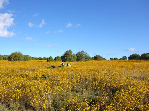
Last week’s expedition to Greens Peak did not yield the rainbow of fall color I had hoped for. The best fall color I’ve found in Arizona was a year ago in Merritt Draw & Maverick Canyon. Since Merritt Draw and Barbershop Canyon are maybe a ¼ mile away from each other for most of Merritt’s length, I figured Barbershop would be a viable fall color option. 🍂
The head of Barbershop Canyon is at Burnt Point, on the edge of Mogollon Rim. Barbershop heads north for 14 miles, until it empties into East Clear Creek at the FR 95 crossing. A little over half way down Barbershop, Merritt Draw empties into it, below the north end of FR 139C. McClintock Ridge forms Barbershop’s east slope.
My plan was to hike the upper 4½ miles of Barbershop Canyon, follow a cairned use trail up & out, then double back to my trailhead via FR 139C and FR 139.
FR 139 was open just a week ago, but 200 yds. north of Rim Rd., it was blocked by deadfall. I bet the 2″+ of rain yesterday had something to do with it! (After I got home, I tweeted photos & location to the Coconino National Forest.) I hiked the ½ mile to FR 9734X instead.
FR 9734X is drivable for a ½ mile, then the road splits: Left is a legal drive, but FR 9734X goes right. I went right. The path is easy to follow. Just after a very rocky section, as FR 9734X approaches Rim Rd., I dropped left into the head of Barbershop Canyon. 🏞
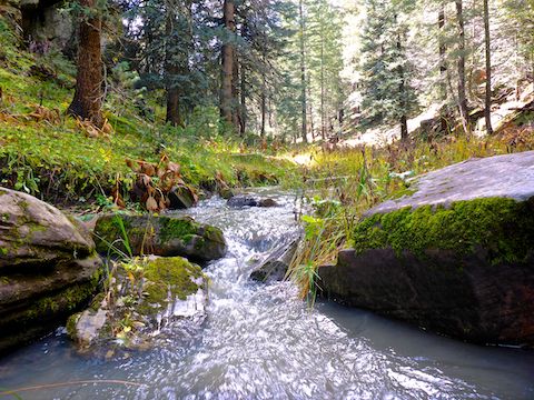
As soon as I entered Barbershop Canyon, I had to negotiate a 10 ft. rock formation. No big deal. Water was dripping off it. Every river starts with a rain drop, and so it proved as the creek flowed for the next 4½ miles, until I climbed out. Sometimes slower, sometimes faster, but always moving. And with plenty of wide, deep, pools.
Just past that first rock formation, was a small grove of maple, with leaves just turning gold. Pleasant, but not the stunning fall color I was hoping for. Other than maybe hints of lime, I saw no other fall color until I was almost done with my hike. If the leaves are popping, an in & out hike to this grove would be an easy two mile, 200 AEG (accumulated elevation gain) round trip hike.
The upper ¾ miles of Barbershop Canyon are tight, but nothing difficult. Then the canyon opens up a bit, with typical Mogollon Rim grassy shelves, cut by creek banks, for the next 2½ miles. Several of those creek banks have metal pipes under them, I assume to prevent erosion. 🤔
Despite the record summer monsoon, and the previous days heavy rain, there were surprisingly few fungi in Barbershop Canyon. Nor were there many flowers left, this late in the season, but I did see hairy golden aster, western yarrow, alpine leafybract aster, yellow salsify, Wheeler’s thistle and Canadian violet.
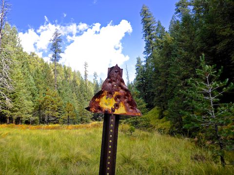
Two thirds of a mile past that metal General Crook Trail (?) sign, is a wood sign for Barbershop Trail #91, where it splits Barbershop Canyon. Most folks will want to cut this loop short, taking Trail #91 west ⅔ of a mile to FR 139. (For a milder 5.4 mile, 400 AEG hike.) If you like getting wet, and steep canyon exits, soldier on!
Barbershop Canyon tightens up north, down canyon, of the wood sign. Unsure how deep some of the pools were, I never took the plunge, instead utilizing the occasional elk trail or grassy shelf. At least I never had to low crawl any deadfall. 👍
Though there were interesting rock formations earlier in Barbershop Canyon, four miles down it was a cliff that actually made me exclaim “Whoa!” (See the header image, above.) A ⅓ of a mile later, I arrived at where I expected to find a relatively easy trail up & out.
After 15 minutes, I gave up searching, and headed 280 ft. straight up. Other than exiting Woods Canyon two weeks ago, it was the steepest canyon exit I’ve negotiated. At the top of Hill 7547, I stepped across a barb wire fence, then headed down to FR 139C. 😅
FR 139C was open, but rocky enough I would only drive an SUV on it. FR 139 — other than one large puddle — was in great shape, despite yesterday’s deluge. Plenty of shade on both, even while hiking. I saw some half decent color on the west side of Dick Hart Ridge, but didn’t feel like straying too far off FR 139. However …
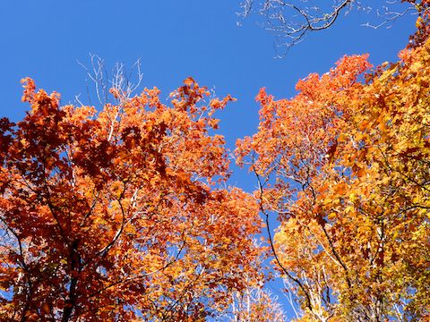
A ½ mile north of FR 9734X, on the east side of FR 139, was a fenced enclosure around which were many beautiful maples festooned with orange and red leaves. If FR 139 is open, you could drive right up to the maple grove, otherwise it is the easiest fall color hiking option on this Barbershop Canyon hike. (Only 2.0 miles and <100 AEG, round trip from Rim Rd.)
We drove from the west, via AZ-87, as it is only 16 miles. After my hike, we kept heading east along Rim Rd., 27 miles, all the way to Woods Canyon Lake, so I could have one last Good Humor ice cream before the bait shop closes for the winter. I’ll be day hiking the C&O Canal in a few weeks, then after that it will be back to doing locals’ hikes in Phoenix for the winter. 🥶
Directions: From Phoenix, head north on AZ-87, the Beeline Highway, through Payson, Pine and Strawberry. (Alternately, take I-17 north, then AZ-260 east.) 2.6 miles north of AZ-260, turn right onto Rim Rd. / FR 300, which after a record monsoon, is still in great shape. In 12 miles you will cross the Arizona Trail at the Battle of Big Dry Wash monument. In another 4.4 miles, turn left onto FR 139. In 0.5 miles, FR 9734X is on your right. Park there.
GPS File: Upper_Barbershop_Canyon
Distance: 12.14 miles
AEG: 803 ft.
Time: 4h 56m
Hiking Video
Hiking Barbershop Canyon, Mogollon Rim from Preston McMurry on Vimeo.