
 Woods Canyon, Chevelon Canyon and Willow Springs Canyon, at the end of 235 Road Trail #502.")
A month ago, five out of six national forests in Arizona, plus BLM and State Trust land, shut down for the 2021 wildfire season. I quickly re-planned my hiking schedule, to include hikes at elevation, but with still legal access.
Two weeks ago, the monsoon kicked in. In earnest: The Cline Creek area, north of Phoenix, had almost 4″ of rain yesterday alone. (Cline Creek’s flow peaked at over 11,000 cubic feet per second!) 😳
The forests re-opened. I re-re-planned.
A year ago, I attempted through hiking Willow Springs Canyon and Woods Canyon. When I reached the junction where they feed into Chevelon Canyon, I tried to climb out. That did not go well. Today, I was back to take a look at bail points from the opposite perspective, atop the rim of Willow Springs Canyon.
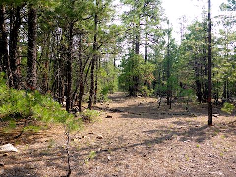
235 Road Trail #502 was once FR 235 and, apparently, FR 502 as well. But now the mesa (?) — or whatever the land type is between the tops of Woods Canyon and Willow Springs Canyon — is completely vehicle-free. The gate at Rim Top Trailhead is locked except for vehicles on official business.
There are jeep trails all over the “mesa”, but most of them were decommissioned decades ago. (The old forest roads show x’d out on the Apache-Sitgreaves National Forest website.) Even if you know where the jeep trails are, you could easily walk by them if you are not looking. 235 Road Trail #502 is obvious, though.
And straight.
And flat.
And rocky, though despite other online reports, you don’t need to worry about ankle breakers.
So, after hiking a mile on 235 Road Trail #502, I turned east onto FR 9502W. In almost a mile, I only wandered off the old road bed once: It’s the more clear path through otherwise fairly clear terrain. I’m not sure why, but pine forest tends to have much less underbrush than deciduous forest. 🤔
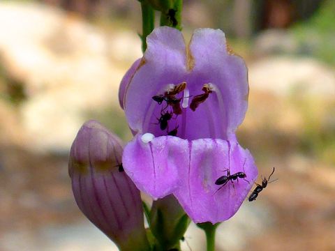
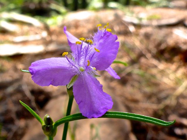
The Wildlife Habitat Area was mostly untouched by fire. There were lots of yellow coneflower in muddy puddles at either end of 235 Road Trail #502. I saw plenty of clustered fleabane, plus regular small clusters of western yarrow and alpine spring parsley. I only recall ever finding three Mexican silene: I counted six today! Other flower species included Wheeler’s thistle, wiry lotus, wandbloom penstemon, longleaf colongonia, paintbrush, and pinewoods spiderwort.
When I got to the west rim of Willow Springs Canyon, I turned north, off FR 9502W. Though there were occasional rocky outcroppings or washes to negotiate, cross country travel was still a breeze. I could have moved quicker, except I was carefully scanning the brushier slope for good routes to the canyon floor.
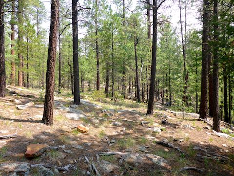
All told, I found four safe routes to the bottom of Willow Springs Canyon: The first three are only 50-70 ft. descents. The third matches where the foot trail peters out at the bottom of Willow Springs Canyon. (The canyon gets ~25 ft. deeper for every ¼ mile you hike north.)
The fourth route to the bottom of Willow Springs Canyon, ¾ of a mile north, was suggested by hikearizona.com user ljcygnet. It is a steep 170 ft., but not dangerous or cliffed out, like the rim gets closer to Chevelon Canyon. When you see two pines with green ribbons, marked “3” and “4” in blue paint, you are near the top of ljcygnet’s route. 🧭
Though rain had been predicted all day, all week, at nearby Forest Lakes, I had observed that it typically did not start until early afternoon. In fact, the sky was mostly sunny until late morning, when clouds started rolling in, particularly north of Chevelon Canyon.
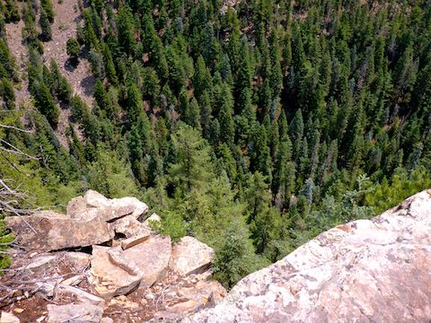
I found four good OPs (observation points) the final 1¼ mile of the Willow Springs Canyon rim. Because, as the canyon floor drops away, the elevation of the “mesa” remains fairly consistent. OP 2, just off the end of 235 Road Trail #502, has two outcroppings, so your hike partner could take a “Look at me!” photo of you standing over the canyon. I was not so lucky. I hike alone.
OP 3 requires a bit of care to access, but has the best view of Woods Canyon and Chevelon Canyon. OP 3 is where I filmed my hike video’s outro. Whether you follow my route, or simply stroll up 235 Road Trail #502, you will surely find other observation points — any one of which would make a great picnic spot. 🧺
The clouds had gotten heavier, and I heard distant thunder. Rather than continue to explore the Woods Canyon rim, I hauled butt back down 235 Road Trail #502 to Rim Top Trailhead. I hiked the four miles in a zippy 1h 15m. Dry. The rain did not start until my drive back, east of Star Valley. I call that perfect timing!
Rim Top Trailhead Directions: From Phoenix, head north on AZ-87, the Beeline Highway, to the main intersection in Payson. Head east on AZ-260. In 29 miles, just after AZ-260 tops the Rim, turn left onto FR 300, aka Rim Road. In 250 yds., take the first right into the Rim Top Trailhead.
GPS File: Willow_Springs_Canyon_Rim_235_Road_Trail
Distance: 10.55 mi.
AEG: 497 ft.
Time: 4h 06m
Hiking Video
Willow Springs Canyon, Mogollon Rim from Preston McMurry on Vimeo.