

Flying is miserable enough without adding useless coronavirus masks, and subtracting airport bars. So, I decided to drive 2,200 miles from Phoenix to Hagerstown, MD, for Halloween.
I was going to leave on Monday, but then I saw a forecast for an ice storm in the southern plains, and I wanted to get ahead of it, so I threw a bag together and headed out the door. I made 700 miles to Amarillo the first day. On 4½ hours sleep, and despite three hours of driving in that ice storm across the Panhandle, followed by 10 hours of heavy rain, I made 940 miles the second day to Terre Haute, IN. Even though I-70 is one long construction zone across Indiana, the third day was a relative breeze. But it was a lot of driving. 🌨
After Halloween, and another hike along the C&O Canal, I took four relatively leisurely days to drive back to Phoenix. I spent the second night in Conway, AR, but I arrived at only 2:30 p.m., so I decided to go for a leg-stretching hike.
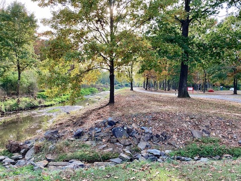
Tucker Creek Trail (as it is called on the map), or Kinley Trail (as it is called on mileage markers), is a 3.2 mile paved multi-use trail in Conway, AR, just northwest of Little Rock. There is a parallel dirt “mountain bike trail” that is no more challenging than merely riding on the path for some length. Every .02 to .05 miles, there is a white-on-green mileage marker, usually posted on one of the many trailside light poles. There is no noticeable elevation gain, though the trail does drop slightly as it heads southwest.
Tucker Creek is 10-30 ft. wide, no more than a foot deep at most, and slow-moving. All the Tucker Creek crossings are bridged. Two of the road crossings are tunneled; with one low-traffic exception, the other road crossings are signaled crosswalks. 🚦
There is a regular restroom at Gatlin Park and several portapotties along the way. Also, at various points along the trail are the usual park stuff: doggie doo stations, jungle gyms, picnic tables, rest benches, etc. Each trailhead, other than at the Walmart, has room for 12-20 cars.
The Tucker Creek Trail is clean as it winds through some nice neighborhoods. There a bit of garbage in Tucker Creek though.
The water was enough that I spotted both a heron and an egret. I’m sure there’s frogs or toads as well. 🐸
Directions: From the main Conway hotel cluster at the I-40 / US-65 interchange, head south on Harkrider St. to the Winfield St. traffic circle. (Conway LOVES its traffic circles.) Go right. At the next traffic circle, go “straight” onto Tyler St. In a little over a mile, Gatlin Park will be on your left.
GPS File: Tucker_Creek_Trail
Distance: 6.36 miles
AEG: 50 ft.
Time: 1h 48m