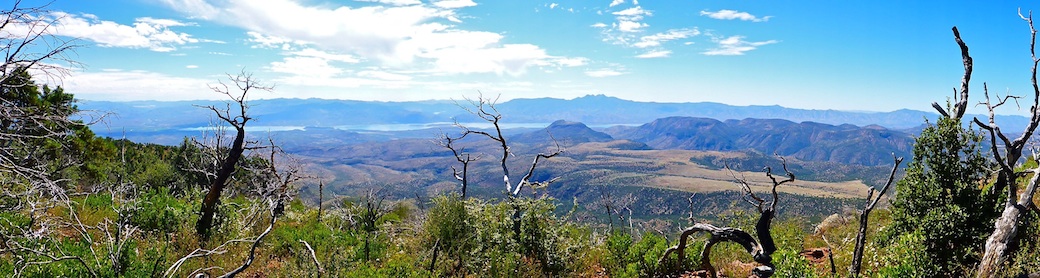

Last April, on a Friday, I hiked the Appalachian Trail from Ashby’s Gap to Mount Weather. But the afternoon traffic on I-81 back to Hagerstown was so horrific I decided to skip my Monday A.T. hike from Mount Weather to Snicker’s Gap. Morning? Fine. Afternoon? Bad. I used the past six months to figure out a number of hopefully less frustrating routes back, so today, also a Friday, I returned.
Like six months ago, I meant to prepare for The Rollercoaster by doing North Mountain intervals. Due to weather and circumstances I did less work than I intended. It’s a lifelong trend: I never exercise as much as I plan, going all the way back to buying Charles Atlas from the back page of a early-1970s comic book. Now, instead of being a 97-pound weakling, I’m an old fat guy with no ACLs.
Today, I continued The Rollercoaster, which started 3.3 miles ago, in Rod Hollow. The Rollercoaster is a series of roughly half mile 400 ft. climbs (~15% slope), followed by matching descents. Mostly switchbacked. Sometimes rather rocky. The Rollercoaster ends at Bear’s Den Overlook, above VA-7 at Snicker’s Gap. (The end of today’s hike.) Bear’s Den is also known as Bear’s Den Scenic Lookout.

We left Hagerstown at 6:30 a.m. I started hiking at 8:30 a.m. The sky was overcast on Mount Weather, with light rain predicted for early afternoon.
0.0 mi.: From the Pua Falls Trailhead, walk 100 yds. back up Morgan’s Mill Rd., then turn left (north) onto the Appalachian Trail. The trailhead is in the middle of a Rollercoaster climb, so this segment starts out by gaining 165 ft. at 13.0% slope. I actually felt it more than North Mountain, despite ⅓ the gain, and only carrying two bottled waters and a Camelbak. Plus a bag of gorp. Heavy on the Jelly Bellies.
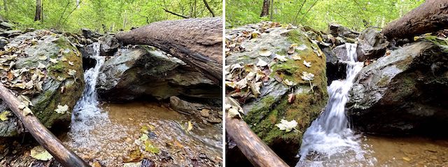
0.8 mi.: Hollow Brook. Needing to save energy for The Rollercoaster, I didn’t climb up canyon to the actual Hollow Brook Falls, but I did follow the use trail for ~150 yds. until I got a decent photo op. The creek had excellent flow all the way back down to the Appalachian Trail crossing.
North of Hollow Brook, there is steep rise of 110 ft. at 13% slope. I call it a “quarter climb”. The quarter climb is followed by a half mile of basically level trail to the saddle below Buzzard Hill’s summit.
1.5 mi.: The second Rollercoaster climb on this Appalachian Trail segment is 165 ft. at 13% slope up Buzzard Hill. Briefly chatted with a SOBO (southbound) A.T. hiker on the way up. With just over 1,000 miles to Springer Mountain, GA, I asked if he was worried about snow. He expected to be done in a month. Hauling ass!
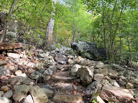
2.2 mi.: The southern branch of Fent Wiley Hollow. No word on which old guy the holler is named after, but Fent Wiley Hollow has been on maps since 1884. The other branch is 250 yds. north. Neither branch had any flow. Not even a trickle. Just north of Fent Wiley Hollow’s north branch is a “Bears Den 4 mi.” sign. It’s about a half mile less. Signs are guidelines, not absolute.
The third Rollercoaster climb begins at the Bear’s Den sign: 395 ft. at 17.4% slope is the steepest on this segment. At the bottom of the descent is a signed trail split: straight to continue, east (right) 200 yds. to Sam Moore Shelter. (The Appalachian Trail’s Mount Weather to Snickers Gap segment is 6.8 miles: I hiked an additional mile due to diversions like this.)
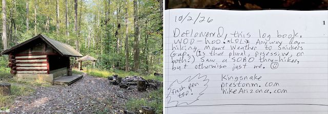
3.2 mi.: Sam Moore Shelter has a cabana with benched picnic table, three-sided single-level shelter, and a firepit with sitting logs. I did not see an outhouse, bear box, nor Sawmill Spring, which is somewhere nearby. I deflowered the brand new logbook, which also had a fresh pen. Score!
The A.T. crosses a creek, then begins climbing the fourth Rollercoaster, 375 ft. at 14.5% slope. About fifty feet up, the A.T. crosses an old jeep trail whose name is apparently, actually, Old Forest Road. Not sure where it connects uphill, but downhill I suspect Old Forest Road connects to VA-604 / Ebenezer Rd. If you need help, it’s an easy bail. I finally started seeing a bit of fall color. Didn’t see many flowers at all.

4.4 mi.: Spout Run had decent trickle over a gravelly bottom. Water looked good. The fifth Rollercoaster is a modest climb 240 ft. at 10.9% slope, but by noon my legs were feeling it. I took a sit down break to enjoy my gorp. I was starting to see more fall color. Besides black gum being red, sugar maple was orange. At least I think it was sugar maple: I’m not a treeologist.
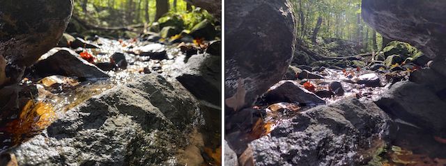
5.5 mi.: Peaceful Creek has a rickety wood walkway across half its width. No flow. The Rollercoaster’s sixth, and final, climb of this Appalachian Trail segment is 400 ft. at 16.6% slope. Including breathers, it took me 40 minutes to cover a half mile. At the top, there is a gravel road that lead’s east (right) to the Bear’s Den Visitor Center. I was a bit confused where the Bear’s Den Lookout is. It’s obvious, on the left.
After enjoying the Bear’s Den views — see video thumbnail below — I booked it downhill the final ⅔ mile to the Snickers Gap Trailhead on VA-7, finishing just before 2 p.m. I felt good, but that was a challenging hike. I can’t imagine doing the whole Rollercoaster in one go! 😳

Mount Weather Directions: From I-81 in Winchester, Virginia, take exit 315 east onto VA-7 / Harry Byrd Hwy. In 14.5 miles, you will cross the Shenandoah River, and begin climbing to Snickers Gap. At 16.8 miles, Raven Rocks Trailhead is on the left; in another quarter mile, Snickers Gap Trailhead is on the right. Take the next right onto VA-601 / Blue Ridge Mountain Rd. In 4.7 miles — by lots of fences, and cameras, and other secret stuff — turn right onto VA-605 / Morgan’s Mill Rd. In 1.3 miles, park at the Pua Falls Trailhead.
Snickers Gap Directions: Double back to VA-7 / Harry Byrd Hwy. Park on the left.
GPS File: AT_Morgans_Mill_Road_to_Snickers_Gap
Distance: 7.95 mi.
AEG: 2,049 ft.
Time: 3h 59m
Rumble Video
Vimeo Video
Hiking Mount Weather to Snicker’s Gap, Appalachian Trail from Preston McMurry on Vimeo.
