

This morning’s pre-game meal was again courtesy of Rainbow Donuts, but to get some variety in my diet, I had a kolache (a sausage roll) and a bacon-maple donut. Got up to Sunflower, then exitted west. Saw the dead end signs, but continued. I never believe signs. It was a dead end. And of the type there was no going around, through, under or over. Not even with 4WD.  Okay … now what? Back to 87, head north because I know the road loops back to 87 at some point, but not sure where. Oops, that looked like it was it. Drive 10 more miles into the valley before I could find an (illegal) place to U-turn.
 ![]() Turns out the north end of Sycamore Rd is at the “check brakes” signs, just before dropping into the valley. Drove all the way south on Sycamore Rd to where the other half dead ends, just to see why. Apparently it’s some sort of conservation thing. Noticed three roadside memorials in the quarter mile between the Trail #244 TH and the dead end. Why, in an area so untrafficked?
Turns out the north end of Sycamore Rd is at the “check brakes” signs, just before dropping into the valley. Drove all the way south on Sycamore Rd to where the other half dead ends, just to see why. Apparently it’s some sort of conservation thing. Noticed three roadside memorials in the quarter mile between the Trail #244 TH and the dead end. Why, in an area so untrafficked? 
It was very chilly, with the ground heavily frosted, but thankfully no breeze. Bushwhacking is not currently necessary along Little Saddle Mountain Trail #244, and the creek is intermittent at best: Bone dry in spots, pooled in others, audibly moving in others. No wet crossings to speak of. Other than one clump, the only flowers were a few scattered patches with blooms a few millimeters across. Very tiny.
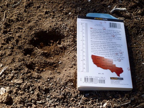
It’s a long, steady climb to the high point, which occurs between the Saddle Mountain Trail #91 intersection and the Mormon Grove TH. A hair less than 500 feet per mile, with a few small downs mixed into the steady climb. It does not seem like much, but it wore out my legs more than the longer, more AEG, climb to the Ballantine Corral. I’m guessing because I started at roughly the same elevation as Ballantine’s highest point. It was scenic, but mostly I kept my head down and ground out distance — which is one reason I noticed so many animal tracks along the way. I don’t know what they all were, but obviously it was many different species.
When you finally exit the creek area, at the saddle south of Hill 4905, the trail splits. Stay right to continue on Little Saddle Mountain Trail #244. Looking at satellite photos, the left split descends to an old ranch at Upper Sheep Creek Spring. At the next saddle, about a half mile south of the Saddle Mountain Trail #91 intersection, stop and look southwest. That’s Bartlett Reservoir, and on the hills past it, Carefree.
I did not feel like doing any of the small ups on the way back down Trail 244, so I headed east to Mormon Grove TH. Granted, the trail, and the jeep road, was not exciting, but there was still some great scenery to be had. A lot more expansive vistas, especially of Mount Ord, than back in the canyon. Depends on what you like.  Btw, what the topo shows as a jeep trail, has got to be the nicest, smoothest, widest, gravel road I’ve ever been on. Pretty steep, but even my can’t-handle-Firstwater rust bucket would have no problem with the surface. (Angle, maybe, not surface.) Lots and lots of deer tracks along the jeep trail.
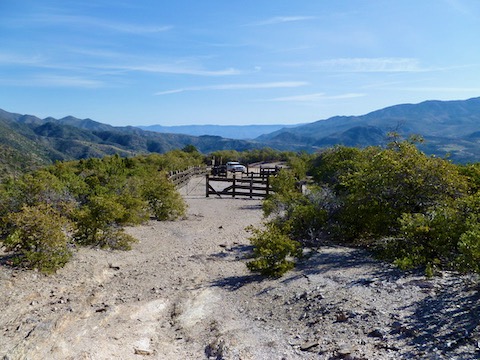
 ![]() Thought I would have a peaceful lunch at the pond, but turns out it is just a man-made dirt tank … with a deer stand at one end. Ate quick, then left.
Thought I would have a peaceful lunch at the pond, but turns out it is just a man-made dirt tank … with a deer stand at one end. Ate quick, then left.
The “improved” gravel road along Sycamore Creek, from the Mormon Grove jeep trail to Sycamore Rd, was considerably rougher than the Mormon Grove jeep trail. I did not want to follow it twisty north to where it joins Sycamore Rd, so I turned south down the trail that follows the western edge of the Cross F Ranch / Sycamore Creek. Sycamore Creek was seriously algae’d up in spots. Why is that?  Low-crawled a few barbwire fences — once through an unnoticed horse turd. (Luckily it was dry.)
  After that it was a quick half mile of pavement back to the trailhead.
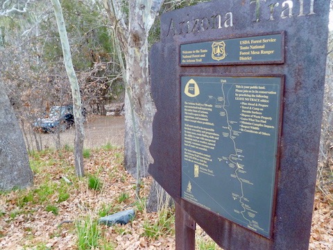
Directions: From Phoenix, exit Loop 101 at Shea. Go east on Shea to the Beeline Highway (AZ-87). Go north on the Beeline Highway for 34 miles to the Mount Ord exit / intersection. Turn west onto paved FR 627. Stay on pavement as FR 627 as it turns south. In 3.6 miles, park on the left, behind the Arizona Trail sign.
Distance: 9.86 miles
AEG: 1,925 ft.
Time: 3h 42m