
")
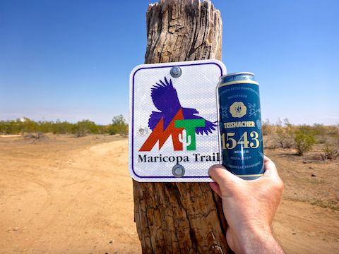
Counter-clockwise from Bronco Trailhead, this is the 7th segment of the Maricopa Trail.
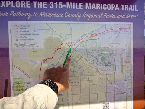
The Maricopa Trail is a 315-mile trail system around the Phoenix metro area (aka, The Valley of the Sun). About 75 miles of that are access trails, with the remainder a massive loop trail. Once a fall & winter month — I’m not insane! — I am knocking out another 8-12 mile Maricopa Trail segment.
Today’s Maricopa Trail segment is from 119th Ave. at Happy Valley Pkwy., to the Trilby Trailhead at Grand Ave. / US-60, then on to Sun Valley Pkwy. The whole route is 13.6 miles, 150 ft. accumulated elevation gain (AEG). I have a shuttle driver — my loving, but non-hiking wife — so I could have hiked it, but to save time, I rode my mountain bike. 🚴🏻♂️
Of course, I brought my GoPro along. I like the view angle of my handlebar mount, but for a two hour ride I’d have to do a lot of editing, as no one is watching a two hour video. Even with image stabilization, speeding the video up 8x makes the video extremely herky-jerky due to handlebar movement.
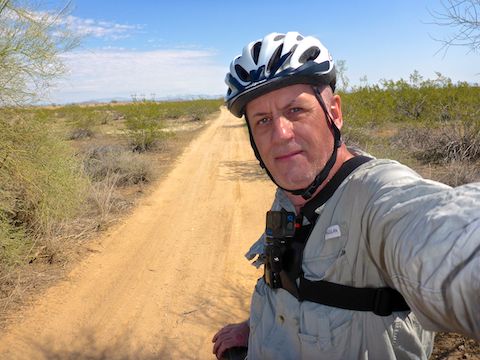
My solution was a STUNTMAN chest mount. On test rides around my neighborhood, I found that a vertically oriented GoPro had my hands center frame, with my pumping knees visible. Nothing ahead — and little to the sides (even at wide angle) — due to body lean over the handlebars. Angling the GoPro 15° behind vertical worked better, but not perfect. Today, I angled it 30° back. 📐
Standing, as in the top photo, 30° worked great. Riding was better, but needed more back angle: My knees were out of view, and I could see a sliver of horizon, but not enough. I hear other mountain bikers like seeing handlebars, but I want to see terrain. I think 45° will work better.
I started biking from 119th Ave. a little after 10:00 a.m. The Maricopa Trail runs south along 119th Ave., in roadside dirt, for a ¼ mile. There is a wall on the other side of the road. Just before the fire station, turn right (west), onto jeep trail, to continue along the wall. In ⅔ mile, just past the West Wing Substation, turn right onto single track.
For the next ¾ mile, Maricopa Trail is close by Happy Valley Rd. before angling away. A lonely, but prolific, saguaro indicates the two mile mark. Otherwise, no cactus until I was west of Trilby Trailhead. The vegetation was either non-blooming creosote or splotchy patches of brown, ground-hugging, weed grass. No flowers I recall. 😕
Starting at 3.0 miles, Maricopa Trail parallels recently built McMicken Way for 1¼ miles. On the other side of the road is a new housing development. After ¾ mile of semi-isolation, Maricopa Trail parallels Planada Way, past a sewage treatment plant and RV storage, until it reaches Trilby TH after 6.0 miles.
Past Trilby Trailhead, turn right (north), crossing Beardsley CSR canal, onto Santa Fe Dr. At 163rd Ave., turn left, weaving through the fence, across the railroad tracks and Grand Ave. / US-60. In a few yards, 163rd Ave. ends at a t-intersection. Turn left, towards a dead end, then a quick right back onto single track. In another 100 yds., the Maricopa Trail turns right onto jeep trail. 🚂
The Maricopa Trail heads northwest for ¾ mile to the McMicken Dam flood-control levee. Follow the spray-painted “path” across one of the dam’s cement sub-structures. The trail parallels the bottom of the curving dam to its south end, turning right, back onto single track just past the eight mile mark.
Rule of thumb, when in doubt which of many criss-crossing paths to take, take the narrower one. Otherwise, just look for the next Maricopa Trail sign.
Even though the Maricopa Trail passes by a landfill, the next 4½ miles are the only semi-remote ones between 119th Ave. and Sun Valley Pkwy. The small wash crossings have more vegetation, some even above head level. The creosote were larger, and were joined by mesquite and palo verde. There were also a few cacti, mostly barrel cactus or staghorn cholla. No puncture worries.
The only time on the Maricopa Trail I was concerned about a flat, was passing through about 50 ft. of broken ceramic tile. Garbage was otherwise surprisingly minimal for an area that once received a lot of off road traffic. The only obstacle that gave me any trouble was Trilby Wash, where my bike sank to a halt in deep sand. 😏
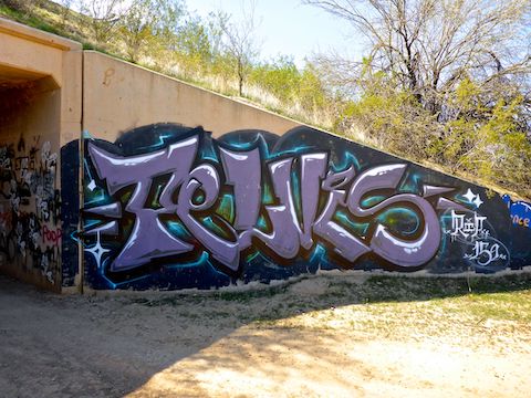
A mile from the end, Maricopa Trail reaches Sun Valley Pkwy. The trailhead is just across the road, but traffic is fast, so instead turn left, downhill a half mile to the graffiti-filled underpass. I spent 30 minutes taking photos, but there were only a few pieces. After the tunnel, turn right, heading west for a final ½ mile to Sun Valley Trailhead.
119th Ave. TH Directions: Anything is better than driving Bell Rd., especially through Sun City, so I took the Loop 303 to exit 125. I turned west on Happy Valley Pkwy., then the next left on 119th Ave., parking in the vacant lot on the corner.
Trilby TH Directions: Take Loop 303 exit 119, north onto Grand Ave. / US-60. In ~½ mile, turn right onto 163rd Ave., then a quick right onto Santa Fe Rd. The trailhead is on the left, just across Beardsley CSR canal.
Sun Valley TH Directions: Take Loop 303 exit 116, west onto Bell Rd., which by this point is well clear of Sun City. In 2½ miles, the road rises to cross a wash, becoming Sun Valley Pkwy. The trailhead is a ½ mile further, on the left.
GPS File: Maricopa_Trail_119th_Ave_to_Sun_Valley_Pkwy
Distance: 13.90 mi.
AEG: 150 ft.
Time: 1h 54m
Bike Video
Maricopa Trail: 119th Ave. to Sun Valley Pkwy. from Preston McMurry on Vimeo.